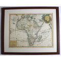
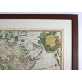
Framed Reproduction Print of Map L`Afrique by G. Delisle 1700
Secondhand
Shipping
Standard courier shipping from R30
R30 Standard shipping using one of our trusted couriers applies to most areas in South Africa. Some areas may attract a R30 surcharge. This will be calculated at checkout if applicable.
Check my rate
Check my rate
Free collection from
Somerset West, Cape Town
The seller allows collection for this item and will be in contact with the full collection address once the order is ready.
Ready for collection by Friday, 21 June.
Ready to ship in
The seller has indicated that they will usually have this item
ready to ship within 3 business days. Shipping time depends on your delivery address. The most
accurate delivery time will be calculated at checkout, but in
general, the following shipping times apply:
Standard Delivery
| Main centres: | 1-3 business days |
| Regional areas: | 3-4 business days |
| Remote areas: | 3-5 business days |
Returns
Get it now, pay later
Seller
Buyer Protection
Product details
Condition
Secondhand
Location
South Africa
Area
Africa
Time Period
Post-1950
Type
Physical Map
Bob Shop ID
615783878
Title: Framed Reproduction Print of Map L'Afrique by G. Delisle 1700.
Format: Reproduction Print newly framed.
Height: 59cm.
Width: 70cm.
Info: Originally published in Paris, 1700, this version of the L'Afrique Map was published by Renier & Joachim Ottens Amsterdam.
Cartographer: Guillaume de Lisle, 1675-1726.
Guillaume Delisle, also spelled Guillaume de l'Isle was a French cartographer known for his popular and accurate maps of Europe and the newly explored Americas.
At 27, Delisle was admitted into the French Académie Royale des Sciences, an institution financed by the French state. After that date, he signed his maps with the title of "Géographe de lAcadémie".
"L'Afrique Dressee sur les Observations de Mrs. de l'Academie Royal des Sciences et quelques autres & sur les Memoires les plus recens. Par G. De L'Isle Geographea a Amsterdam Chez R & J. Ottens Geographes dans le Kalberstraat au Carte du Monde."
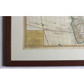
Cartouche top right with scenes from Africa; Elephant, Crocodile and exotic birds and a scale and "Avertissement" bottom left of map.
Joachim Ottens (1663-1719), was a copper-engraver and the founder of the print and mapsellers firm in Amsterdam. The Map was part of the Atlases that were produced by the company in the early 1700's.
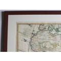
Condition: Good, a rescued map that has been newly framed, with some minor evidence of the age of the reproduction from 1977.
Inscription of "From I.M.A with all good wishes for 1977" on the bottom bottom left and "Van I.M.A met beste wense vir 1977" on the bottom right of map.
Price: R 695.00 Inc Vat.
