This item has closed with no items sold
View the relisted Item
View the relisted Item
View other items offered by CapeCollectables1055
Similar products
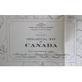
Dept of Mines and Technical Survey Geological Folded Map of Canada 1955
Secondhand
R245.00
Closed
20 May 24 15:01
Shipping
Standard courier shipping from R30
R30 Standard shipping using one of our trusted couriers applies to most areas in South Africa. Some areas may attract a R30 surcharge. This will be calculated at checkout if applicable.
Check my rate
Check my rate
Free collection from
Somerset West, Cape Town
The seller allows collection for this item and will be in contact with the full collection address once the order is ready.
Ready for collection by Wednesday, 12 June.
Ready to ship in
The seller has indicated that they will usually have this item
ready to ship within 3 business days. Shipping time depends on your delivery address. The most
accurate delivery time will be calculated at checkout, but in
general, the following shipping times apply:
Standard Delivery
| Main centres: | 1-3 business days |
| Regional areas: | 3-4 business days |
| Remote areas: | 3-5 business days |
Returns
Get it now, pay later
Seller
Buyer Protection
Product details
Condition
Secondhand
Location
South Africa
Area
The Americas
Time Period
Post-1950
Type
Political Map
Bob Shop ID
612851978
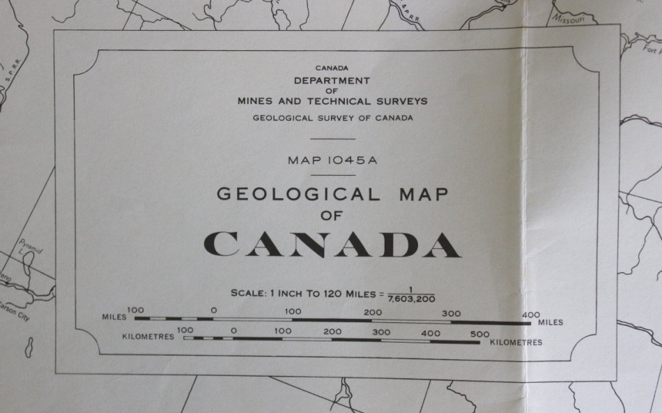
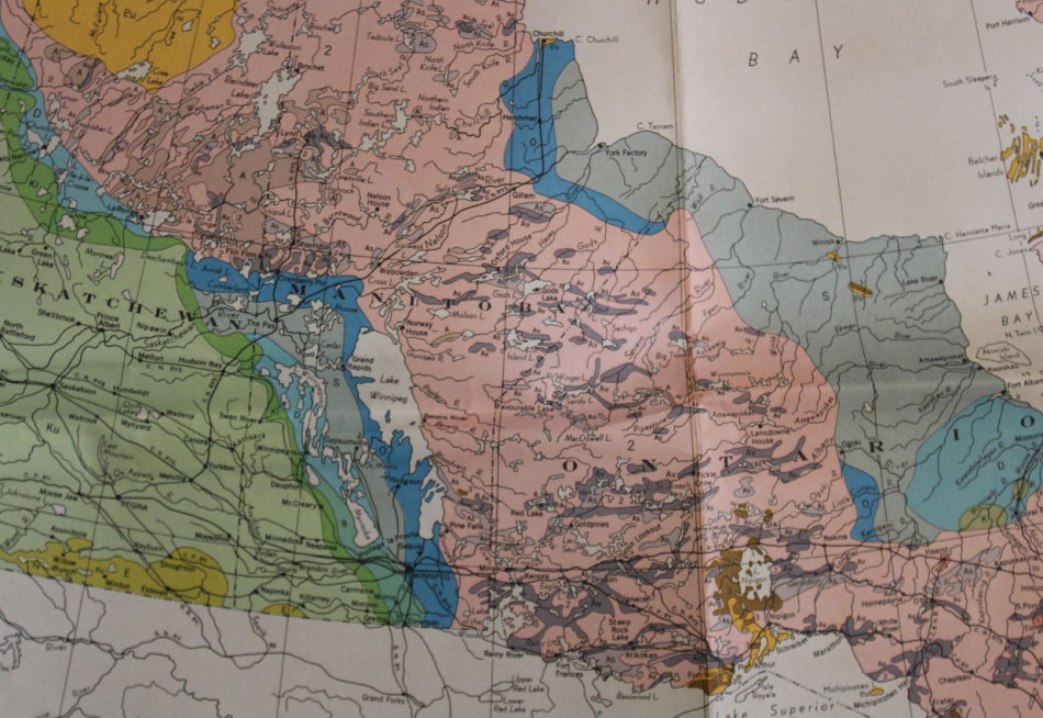
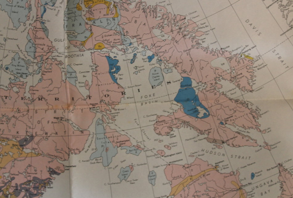
Title: Dept of Mines & Technical Survey Geological Folded Map of Canada 1955.
Publisher: Canada Department of Mines and Technical Surveys.
Format: Folded Map on poster paper.
Height: 79 cm.
Width: 81 cm.
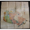
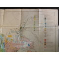
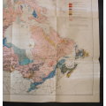
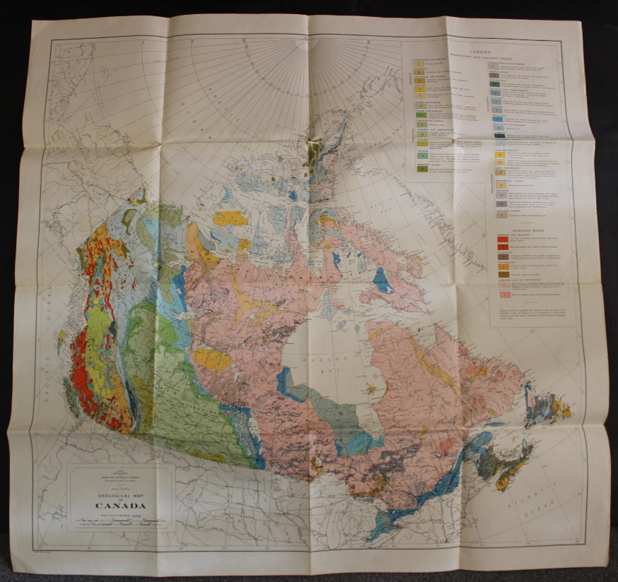
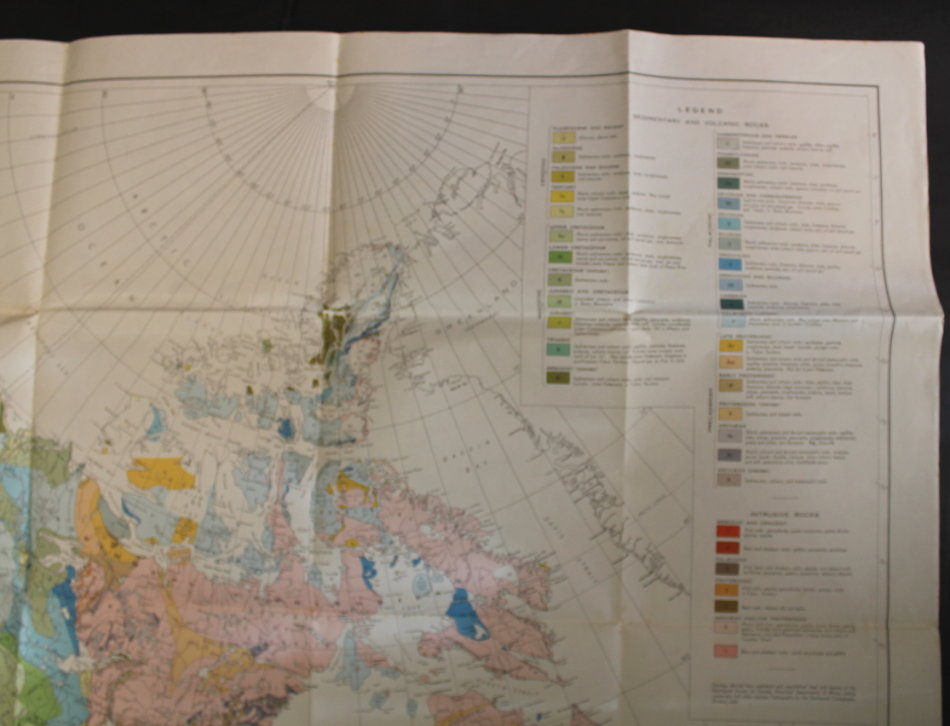
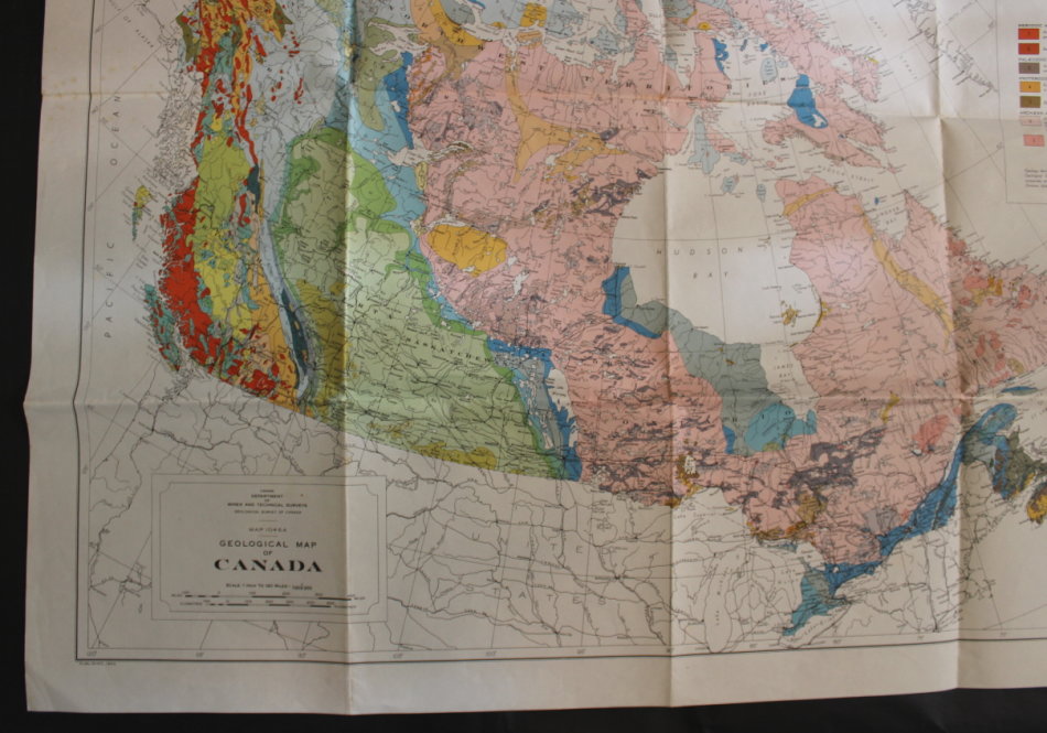
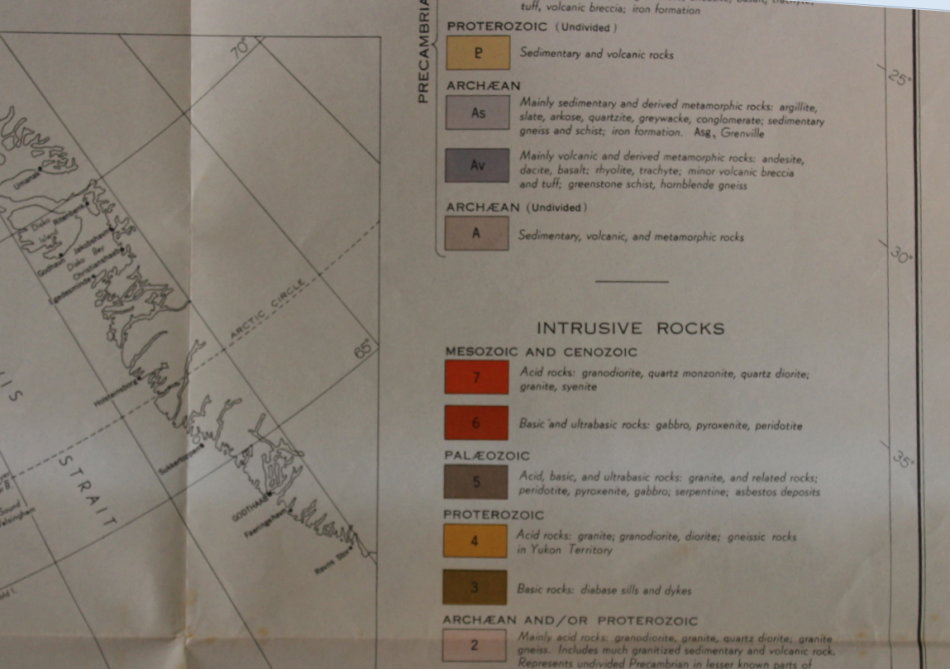
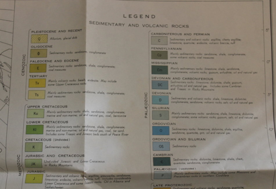
Info: A large detailed map of the Geology of Canada produced by the Canada Department of Mines and Technical Surveys. A Geological Survey of Canada, MAP 1045A, published in 1955.
A full legend according to the survey including Sedimentary and Volcanic Rocks as well as Intrusive Rocks. Seperated into ages and types.
Vintage Map.
Scale: 1 Inch to 120 Miles / 1: 7 603 200.
Condition: Very good condition, unmarked and unused, no tears or holes on the map. Some very slight foxing due to age.
Price: R 245.00 Inc Vat.
![]()