This item has closed with no items sold
View the relisted Item
View the relisted Item
View other items offered by gregsact1874
Similar products
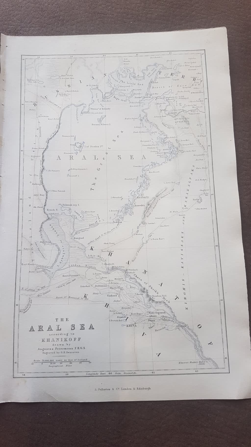
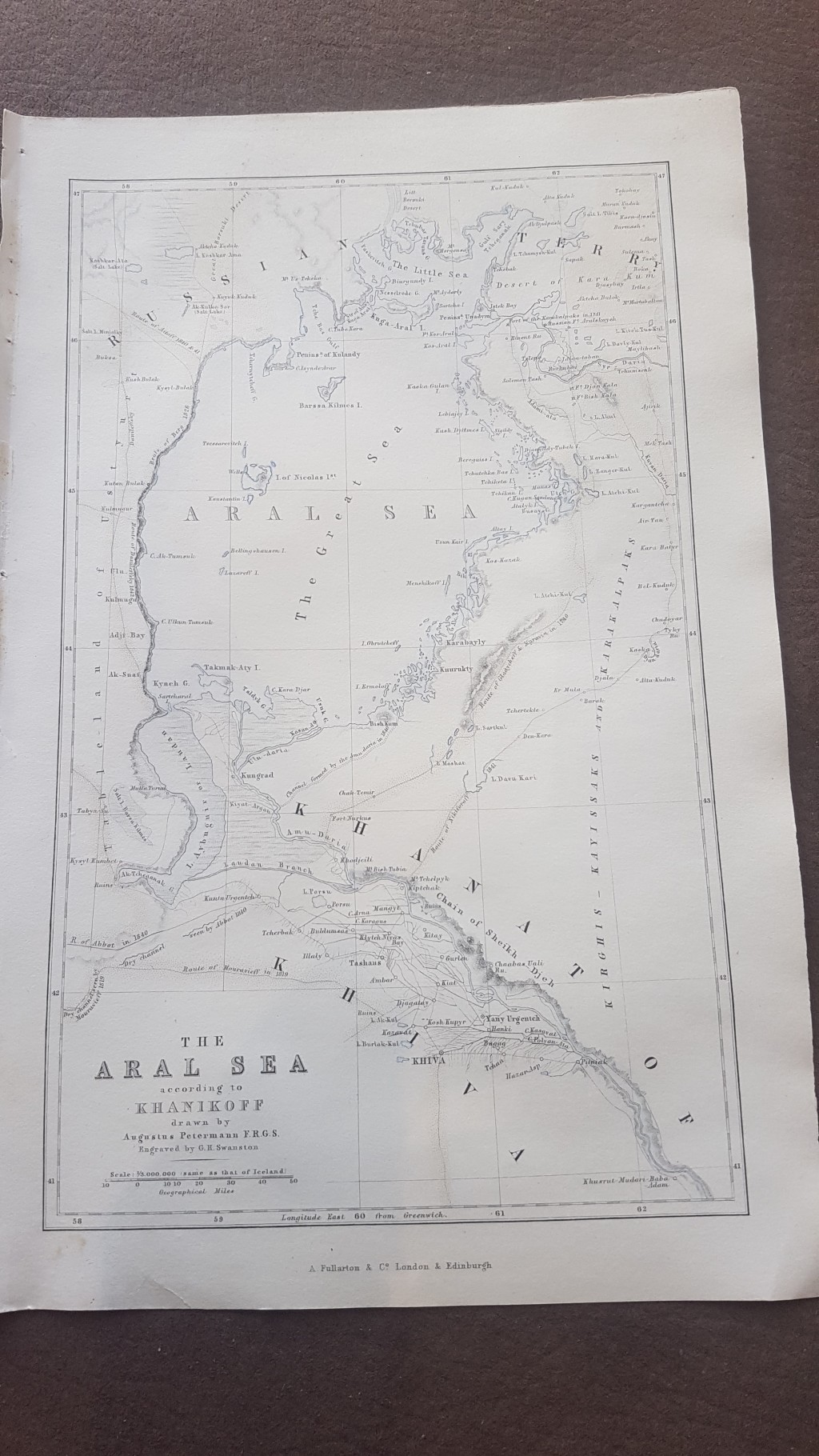
ORIGINAL 1856 MAP: The Aral Sea according to Khanikoff drawn by August Petermann engraved Swanston
Secondhand
R275.00
Closed
16 May 24 11:31
Shipping
Standard courier shipping from R30
R30 Standard shipping using one of our trusted couriers applies to most areas in South Africa. Some areas may attract a R30 surcharge. This will be calculated at checkout if applicable.
Check my rate
Check my rate
Free collection from
Newlands, Cape Town
The seller allows collection for this item and will be in contact with the full collection address once the order is ready.
Ready for collection by Tuesday, 11 June.
Ready to ship in
The seller has indicated that they will usually have this item
ready to ship within 3 business days. Shipping time depends on your delivery address. The most
accurate delivery time will be calculated at checkout, but in
general, the following shipping times apply:
Standard Delivery
| Main centres: | 1-3 business days |
| Regional areas: | 3-4 business days |
| Remote areas: | 3-5 business days |
Get it now, pay later
Seller
Buyer Protection
Product details
Condition
Secondhand
Location
South Africa
Area
Asia
Time Period
1800s
Type
Physical Map
Bob Shop ID
612640237
About this Item
The Aral Sea is a huge expanse between Kazakhstan and Uzbekistan, now almost completely dried up due to global warming, but in 1856, it's huge extent as an important sea was recorded in this historic map. Map is in very clean attractive condition. map was removed from a disbound Gazetteer of the World published in 1856 by Fullarton. Would frame well. The map itself is 23 cm x 14 cm withn the border, and sheet is 17 cm x 26 cm. Steel engraving, very fine work, with three lithographic colours: black outline, light blue, light brown. Looks to have been cleaned at some point. Would display beautifully. Seller Inventory # 71327