Fairest Cape Map of Cape Peninsula 2000 Printed Map Laminated
New
Shipping
Standard courier shipping from R30
R30 Standard shipping using one of our trusted couriers applies to most areas in South Africa. Some areas may attract a R30 surcharge. This will be calculated at checkout if applicable.
Check my rate
Check my rate
Free collection from
Somerset West, Cape Town
The seller allows collection for this item and will be in contact with the full collection address once the order is ready.
Ready for collection by Friday, 21 June.
Ready to ship in
The seller has indicated that they will usually have this item
ready to ship within 3 business days. Shipping time depends on your delivery address. The most
accurate delivery time will be calculated at checkout, but in
general, the following shipping times apply:
Standard Delivery
| Main centres: | 1-3 business days |
| Regional areas: | 3-4 business days |
| Remote areas: | 3-5 business days |
Returns
Get it now, pay later
Seller
Buyer Protection
Product details
Condition
New
Location
South Africa
Area
Africa
Time Period
Post-1950
Type
Political Map
Bob Shop ID
615722698
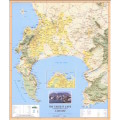
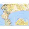
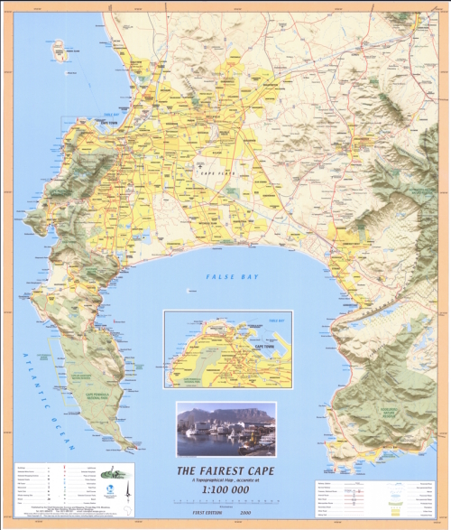
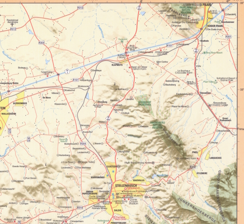
Title: Fairest Cape Map of Cape Peninsula 2000 Printed Map Laminated.
Publisher: NGI Topographical Map.
Height: 84cm.
Width: 70cm.
Format: Colour Printed on Poster Paper, and Laminated.
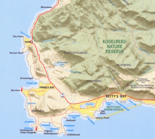
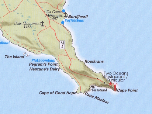
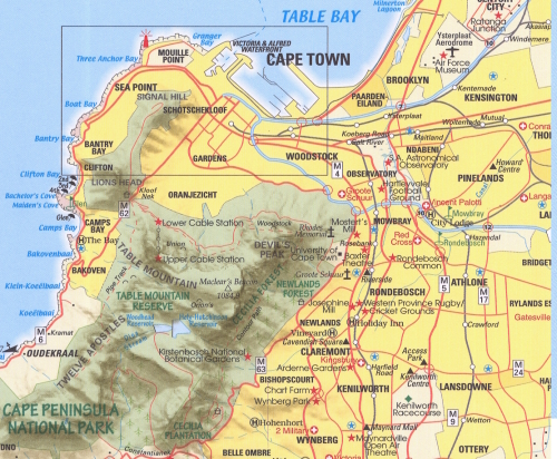
Info: Informative easy to read map of the Cape Peninsula, circa 2000.
Cape Peninsula, False Bay and Table Bay, Cape Town, Hangklip, Robben Island, Paarl South, Stellenbosch.
Edition: First Edition Topographical Map 2000.
Scale: 1: 100 000
Condition: Very Good - New.
Price: R 465.00 Inc Vat.
![]()