This item has closed with no items sold
View the relisted Item
View the relisted Item
View other items offered by CapeCollectables1049
Similar products
Witwatersrand Central, East and West, Topographical Map 1935, Set of 3 Maps, Reproduction Prints
New
R495.00
Closed
20 May 24 08:31
Shipping
Standard courier shipping from R30
R30 Standard shipping using one of our trusted couriers applies to most areas in South Africa. Some areas may attract a R30 surcharge. This will be calculated at checkout if applicable.
Check my rate
Check my rate
Free collection from
Somerset West, Cape Town
The seller allows collection for this item and will be in contact with the full collection address once the order is ready.
Ready for collection by Tuesday, 11 June.
Ready to ship in
The seller has indicated that they will usually have this item
ready to ship within 3 business days. Shipping time depends on your delivery address. The most
accurate delivery time will be calculated at checkout, but in
general, the following shipping times apply:
Standard Delivery
| Main centres: | 1-3 business days |
| Regional areas: | 3-4 business days |
| Remote areas: | 3-5 business days |
Returns
Get it now, pay later
Seller
Buyer Protection
Product details
Condition
New
Location
South Africa
Area
Africa
Time Period
1900-1950
Type
Political Map
Bob Shop ID
612830593
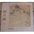
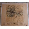
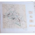
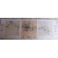
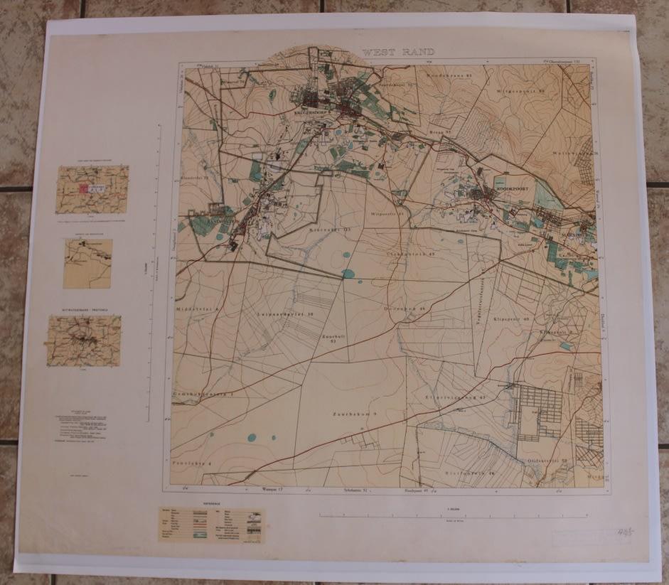
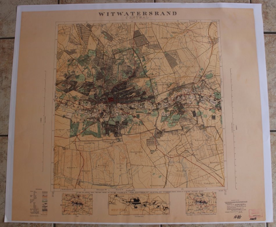
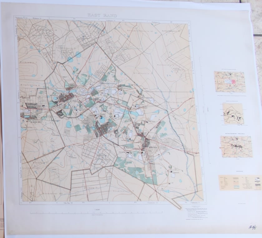
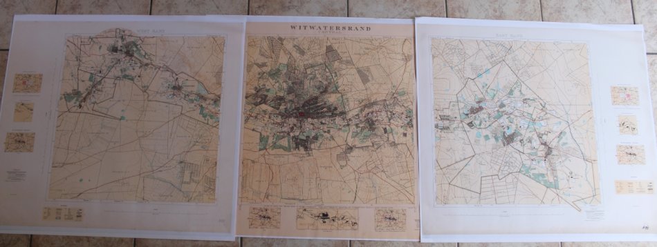
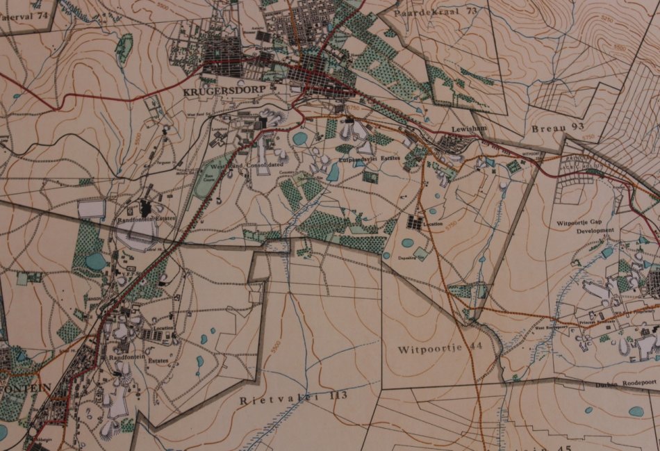
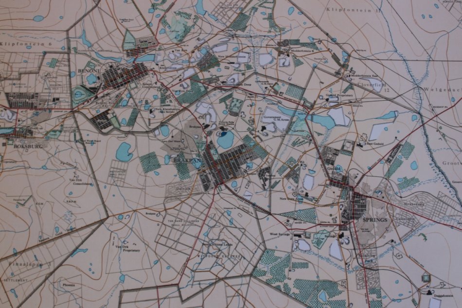
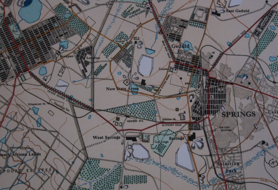
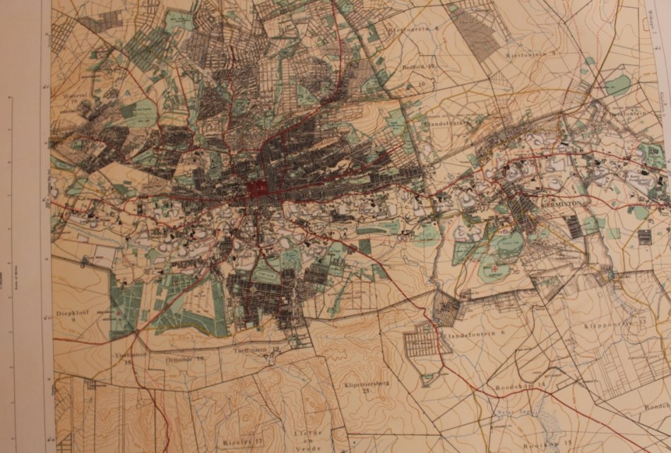
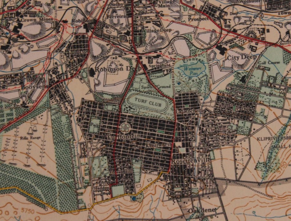
Title: Witwatersrand Central, East and West; Topographical Map 1935, Set of 3 Maps, Reproduction Prints.
Publisher: Surveyor General Office May 1935.
Each Map Height: 80cm.
Each Map Width: 87cm.
Info: Photolithographed by the Government Printer, May 1935.
Surveyor General Office, Pretoria 1934.
Set of 3 Maps showing the Witwatersrand and Suburbs @ mid 1930's, Gold Mine Properties and places of interest.
Scale: 1: 50 000
Format: Scanned and Printed on Poster Paper from the original, can be shipped in a Poster Tube.
A set of 3 Reproduction Prints.
Condition: Very Good, as new.
Price: R 495.00 Inc Vat for the Set Of Three Maps.
![]()