This item has closed with no items sold
View the relisted Item
View the relisted Item
View other items offered by cape restorer121
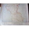
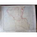
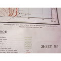
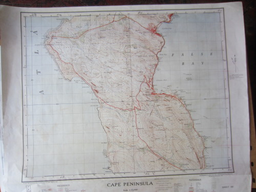
Trig Survey Map of Cape Peninsula - Scale 1:25 000 - 2000 Reprint of 1939 Map
Secondhand
R185.00
Closed
5 Jun 24 09:01
Shipping
Standard courier shipping from R30
R30 Standard shipping using one of our trusted couriers applies to most areas in South Africa. Some areas may attract a R30 surcharge. This will be calculated at checkout if applicable.
Check my rate
Check my rate
Free collection from
Plumstead, Cape Town
The seller allows collection for this item and will be in contact with the full collection address once the order is ready.
Ready for collection by Wednesday, 12 June.
Ready to ship in
The seller has indicated that they will usually have this item
ready to ship within 3 business days. Shipping time depends on your delivery address. The most
accurate delivery time will be calculated at checkout, but in
general, the following shipping times apply:
Standard Delivery
| Main centres: | 1-3 business days |
| Regional areas: | 3-4 business days |
| Remote areas: | 3-5 business days |
Get it now, pay later
Seller
Buyer Protection
Product details
Condition
Secondhand
Location
South Africa
Area
Africa
Time Period
Post-1950
Bob Shop ID
615373436
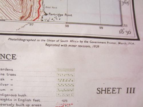
Trigonometric survey map of Cape Peninsula, South Africa. Scale 1:25 000. Sheet III. This is a 2000 commemorative reprint of first map series by Surveys and Mapping.
Originally photolithographed in the Union of South Africa by the Government Printer, March 1934. Then reprinted with minor revisions 1939.
Measurement: 76 x 91 cm
Condition: Some creasing and marks, otherwise the map is in very good condition.