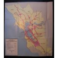
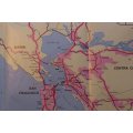
San Francisco Bay Area Transportation System Folded Map 1987
Secondhand
Shipping
Standard courier shipping from R30
R30 Standard shipping using one of our trusted couriers applies to most areas in South Africa. Some areas may attract a R30 surcharge. This will be calculated at checkout if applicable.
Check my rate
Check my rate
Free collection from
Somerset West, Cape Town
The seller allows collection for this item and will be in contact with the full collection address once the order is ready.
Ready for collection by Tuesday, 11 June.
Ready to ship in
The seller has indicated that they will usually have this item
ready to ship within 3 business days. Shipping time depends on your delivery address. The most
accurate delivery time will be calculated at checkout, but in
general, the following shipping times apply:
Standard Delivery
| Main centres: | 1-3 business days |
| Regional areas: | 3-4 business days |
| Remote areas: | 3-5 business days |
Returns
Get it now, pay later
Seller
Buyer Protection
Product details
Condition
Secondhand
Location
South Africa
Area
The Americas
Time Period
Post-1950
Bob Shop ID
615241809
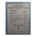
Title: San Francisco Bay Area Transportation System Folded Map 1987.
Publisher: Metropolitan Transportation Commission, San Francisco, California, 1987.
Format: Folded Map.
Height: 77 cm.
Width: 69 cm.
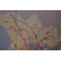
Info: Map showing 9 counties around San Francisco with the Road, Rail, and Ferry services around San Francisco.
With the Golden Gate Bridge and San Francisco Bay. Great for the railroad or transport collector.
Scale: 1 Inch = 5 Miles.
Condition: Very Good.
Price: R 125.00 Inc Vat.

