This item has closed with no items sold
View the relisted Item
View the relisted Item
View other items offered by CapeCollectables1041
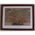
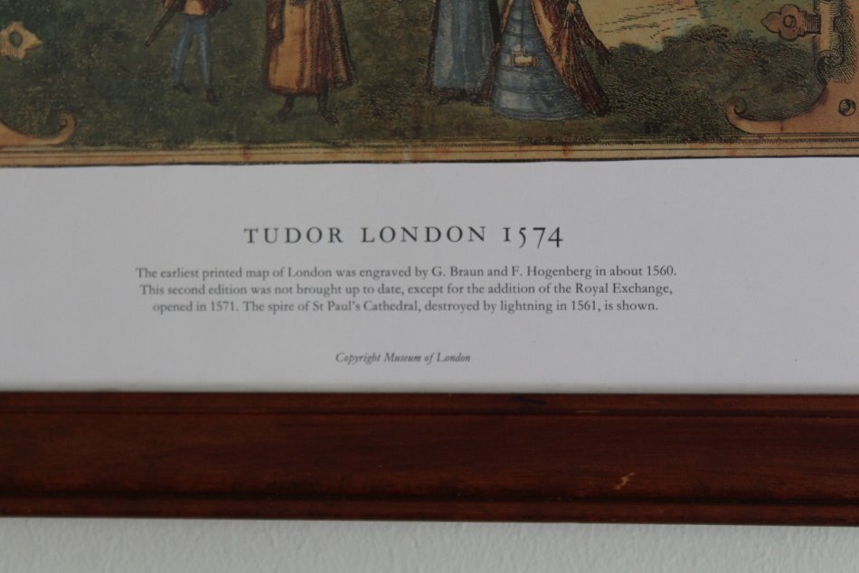
Tudor London 1574 Map Framed
Secondhand
R895.00
Closed
1 Jun 24 12:16
Shipping
Standard courier shipping from R30
R30 Standard shipping using one of our trusted couriers applies to most areas in South Africa. Some areas may attract a R30 surcharge. This will be calculated at checkout if applicable.
Check my rate
Check my rate
Free collection from
Kuils River, Cape Town
The seller allows collection for this item and will be in contact with the full collection address once the order is ready.
Ready for collection by Wednesday, 5 June.
Ready to ship in
The seller has indicated that they will usually have this item
ready to ship within 3 business days. Shipping time depends on your delivery address. The most
accurate delivery time will be calculated at checkout, but in
general, the following shipping times apply:
Standard Delivery
| Main centres: | 1-3 business days |
| Regional areas: | 3-4 business days |
| Remote areas: | 3-5 business days |
Returns
Get it now, pay later
Seller
Buyer Protection
Product details
Condition
Secondhand
Location
South Africa
Area
Europe
Bob Shop ID
614086935
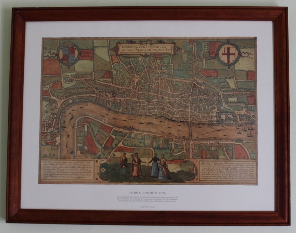
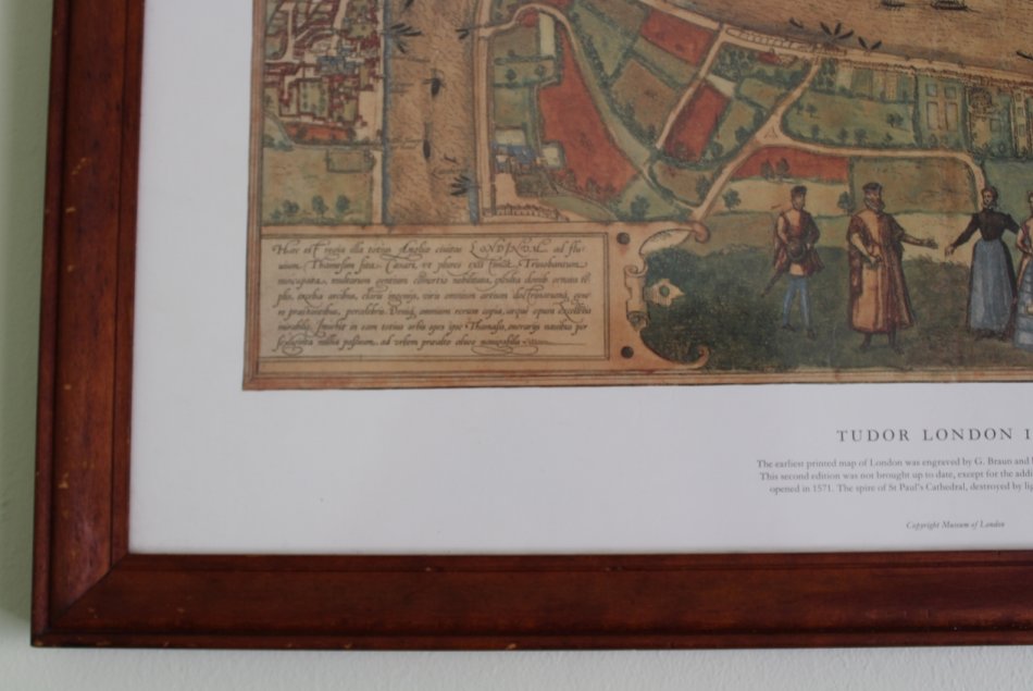
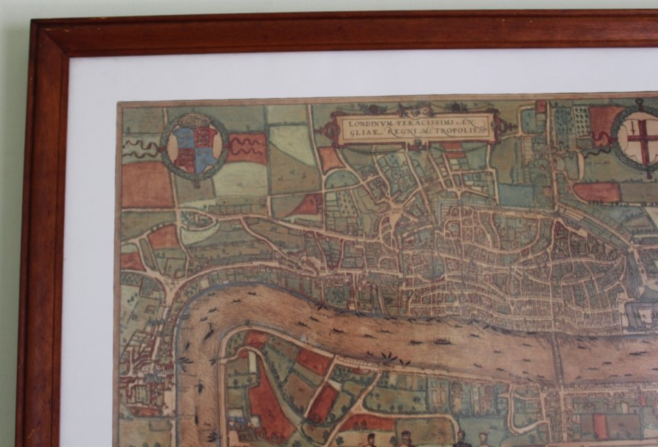
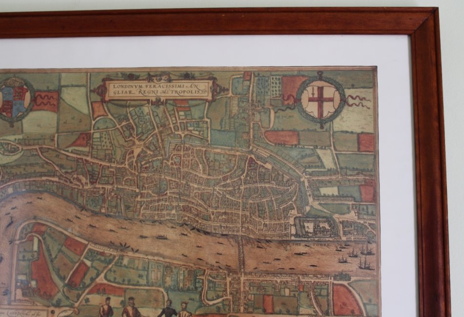
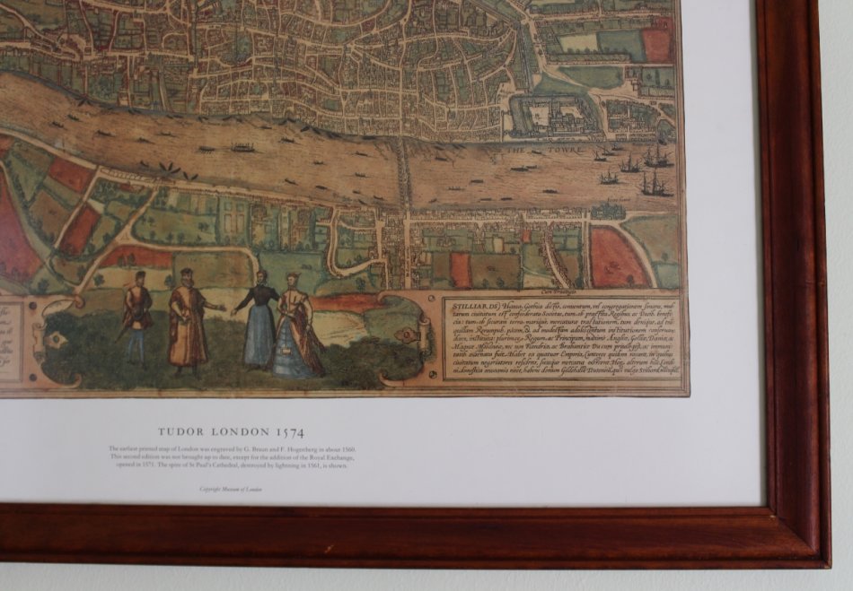
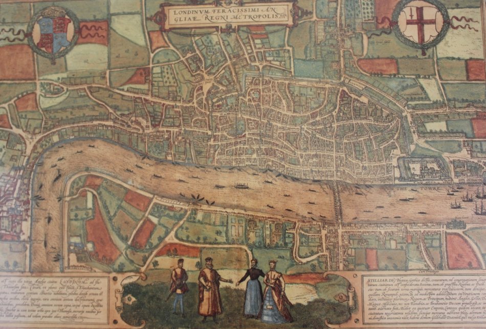
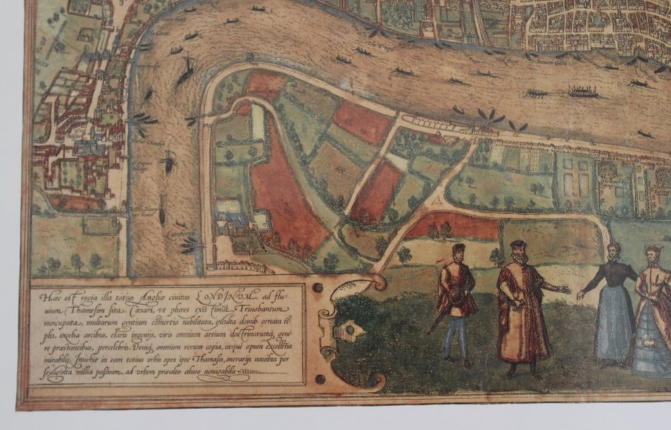
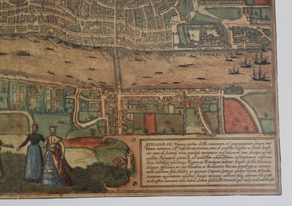
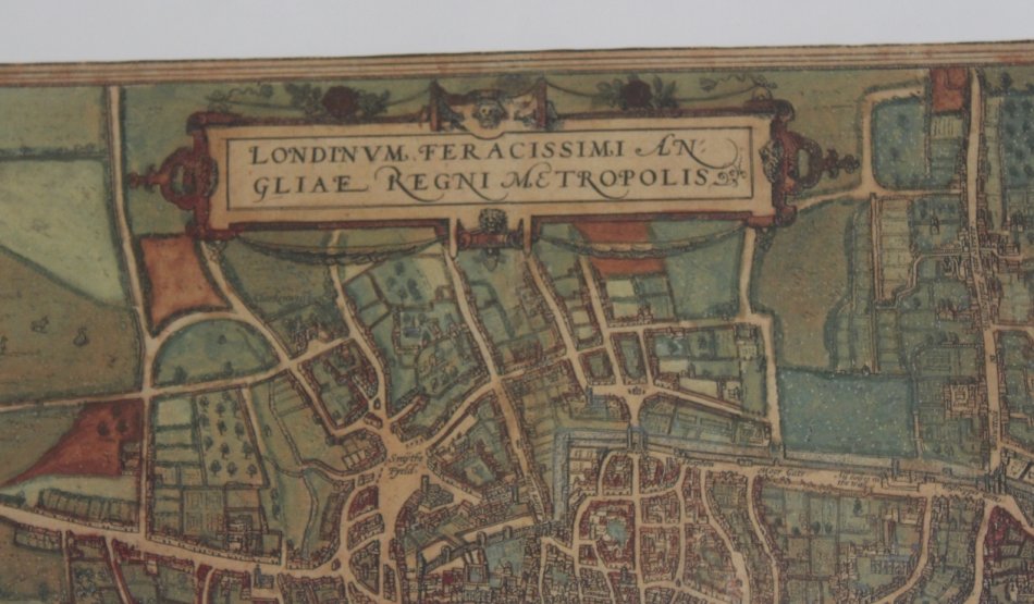
Title: Londinum Feracissimi Angliae Regni Metropolis: 1574 Map Framed.
Also Known as: Tudor London 1574.
Engraved By / drawn By:Georg Braun and Frans Hogenberg
Date: 1574
Description:
Second edition of the map view of London which was included in the first volume of the Civitates Orbis Terrarum, published in Cologne in 1572.
The sixth and final volume appeared in 1617.
Edited by Georg Braun, and eventually containing 546 prospects of cities from all over the world, the atlas was the first of its type.
The first volume concentrated on European cities, 79 in all. Braun, a cleric of Cologne, was the principal editor of the compendium, and was greatly assisted in his task by the close and continued interest of Abraham Ortelius, whose
Theatrum Orbis Terrarum of 1570 a systematic and comprehensive collection of maps produced to a
standard format was the first true atlas. To complete the series over a hundred artists and cartographers
were employed to produce the maps and the majority were engraved by Frans Hogenberg (1535-1590)
the son of a Munich engraver who settled in Malines. Although the London view was published in 1572
it shows the city at an earlier date, as St Paul's Cathedral is shown complete with its spire which was destroyed by lightning in 1561.
Condition: Excellent.
Size: Frame Size of 48cm H and 62cm W
Format: Printed Reproduction from the London Museum, Framed.
Price: R 895.00 Inc Vat.
![]()