This item has closed with no items sold
View the relisted Item
View the relisted Item
View other items offered by CapeCollectables1030
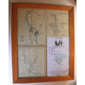
British Antarctic Terra Nova Expedition 1910-1913 Maps Of The Exploration Framed
Secondhand
R395.00
Closed
28 Apr 24 14:16
Shipping
Standard courier shipping from R30
R30 Standard shipping using one of our trusted couriers applies to most areas in South Africa. Some areas may attract a R30 surcharge. This will be calculated at checkout if applicable.
Check my rate
Check my rate
Free collection from
Kuils River, Cape Town
The seller allows collection for this item and will be in contact with the full collection address once the order is ready.
Ready for collection by Friday, 3 May.
Ready to ship in
The seller has indicated that they will usually have this item
ready to ship within 3 business days. Shipping time depends on your delivery address. The most
accurate delivery time will be calculated at checkout, but in
general, the following shipping times apply:
Standard Delivery
| Main centres: | 1-3 business days |
| Regional areas: | 3-4 business days |
| Remote areas: | 3-5 business days |
Buyer Protection
How you're covered
Get it now, pay later
Returns
Product information
Condition:
Secondhand
Location:
South Africa
Area:
Antartica
Time Period:
1900-1950
Type:
Other
Bob Shop ID:
611396006
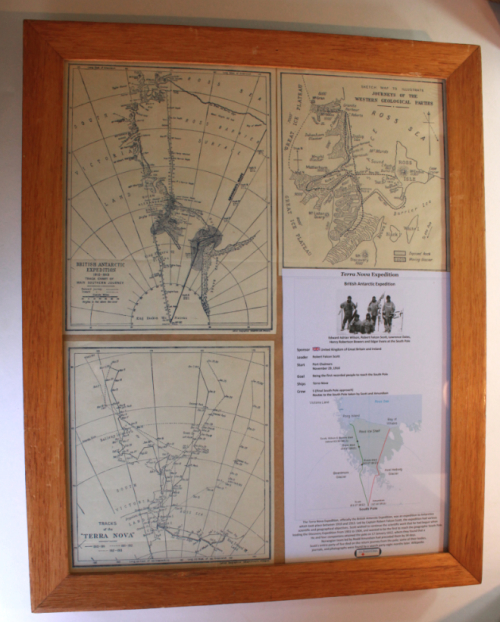
Title: British Antarctic Terra Nova Expedition 1910-1913 Maps Of The Exploration Framed
Publisher: Collins Geographical Establishment, Glasgow.
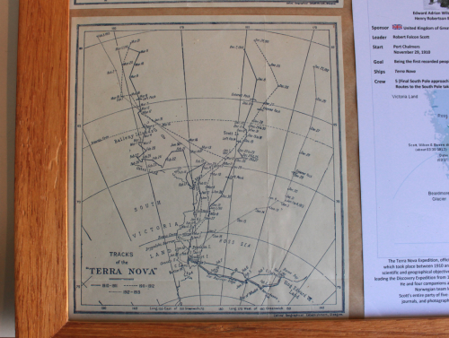
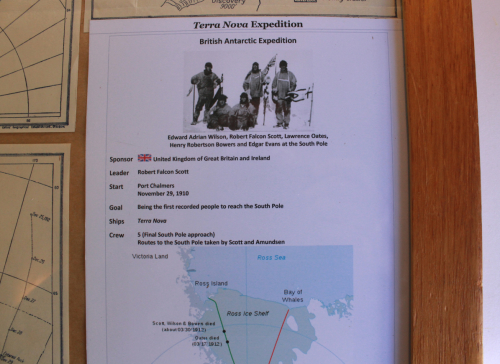
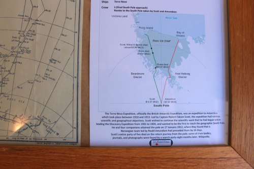
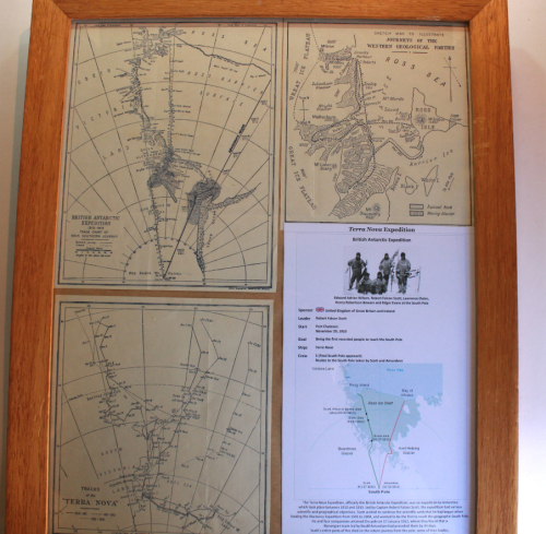
Format: Printed maps of the "British Antarctic Expedition 1910-1913".
Height: 46cm.
Width: 38cm.
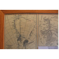
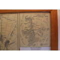
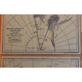
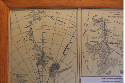
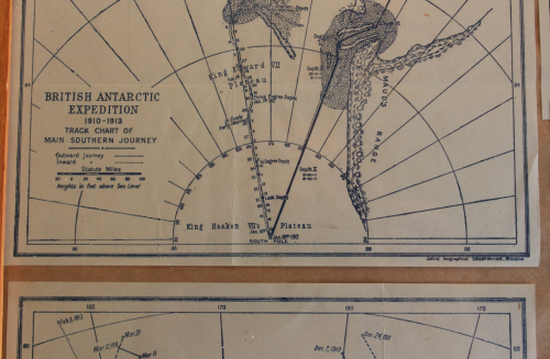
Info: The Maps include information of the British Antarctic Expedition of 1910-1913, with a Main Map of the "Track Chart Of Main Southern Journey" indicating the Outward and Inward tracks in Miles with comments of events.
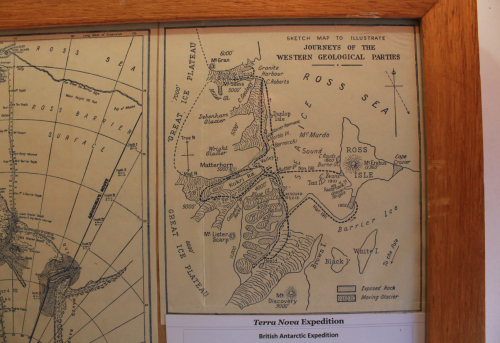
There are a further Two x Inset Maps that depict the Tracks of the "Terra Nova" as well as the Sketch Map to Illustrate the "Journeys Of The Western Geological Parties" on The Ice Shelf in the Ross Sea area.
Scale: 2 Inches = 100 Miles.
Condition: Good, old maps that have been mounted in a frame.
Price: R 395.00 Inc Vat.
![]()