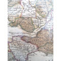
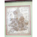
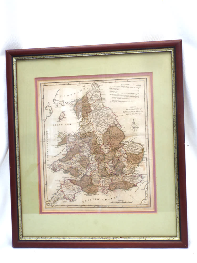
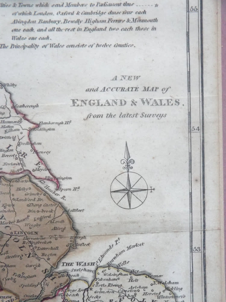
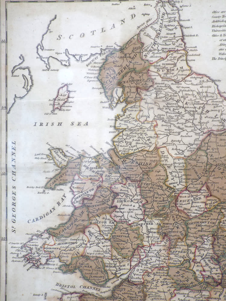
‘A New and Accurate Map of England and Wales’ G. Cooke. Circa 1807. Ref. No. MP/6

Secondhand
1 available
R550.00
Shipping
Standard courier shipping from R30
R30 Standard shipping using one of our trusted couriers applies to most areas in South Africa. Some areas may attract a R30 surcharge. This will be calculated at checkout if applicable.
Check my rate
Ready to ship in
The seller has indicated that they will usually have this item ready to ship within 3 business days. Shipping time depends on your delivery address. The most accurate delivery time will be calculated at checkout, but in general, the following shipping times apply:
 
Standard Delivery
Main centres:  1-3 business days
Regional areas: 3-4 business days
Remote areas: 3-5 business days
Get it now, pay later
Seller
Buyer Protection

Product details

Condition
Secondhand
Location
South Africa
Area
Europe
Time Period
1800s
Type
Physical Map
Bob Shop ID
615829205


Description:  A New and Accurate Map of England and Wales  G. Cooke. Circa 1807. Ref. No. MP/6
Maker/Cartographer: Unknown
Date: 1801-1807
History:  From The Modern and Authentic System of Universal Geography by George A. Cooke.
Description: A hand- coloured copper engraved map published by Macdonald and Son, London mounted in a wooden frame
Condition: Overall in good condition.
Dimensions: 43 cm x 37.5 cm.

Price: R550.00

Please note, I am NOT a qualified archaeologist/antiquarian and the description I have given is based on research of the subject.
This is a genuine antique. Please remember the classification of an 'antique' is that it should be 100 years old, OR MORE.

Terms: We offer a strict three-day approval period from the date the parcel reaches you. Refunds/credits are based on the cost of the article, NOT including delivery charges. Please advise us within this period whether you would like to return any article for a refund/credit. Although we pride ourselves in our packing, the buyer remains responsible for loss, non-arrival or damage to goods being sent to, or returned.

More from this seller

View all
R30 shipping
A very rare German (?) Kachelofen ceramic stove tile. Circa 1700 1750. Ref. CL-17
R2,000
R30 shipping
`Natures Gifts` Handmade Copper electroformed pendant with genuine `Snowflake` Obsidian. Ref. NG-4
R120
R30 shipping
Semi-Porcelain 1908 1911 Pheasant dinner plate Ref: P-87
R220
R30 shipping
A pair of Engraved Bucket-bowl Georgian Port Wine or Dram Glasses. Circa 1790-1820. Ref.GL5
R650
Add to cart

Recently viewed

Mini Grays Rabel Hockey Stick
R95

Similar products

R30 shipping
Vintage Folded Map Motorists` Map of Northern England, #4 First Edition 1977
R155
R30 shipping
1859 New South Wales And Victoria Map by J. Bartholomew- Has a slight tear in the top middle
R4,999.99
R30 shipping
1892 Map of England and Wales, Excellent condition, Original Chambers Map
R235
R30 shipping
The British Traveller map of Buckinghamshire Circa 1784. Ref. No. AR/18
R600