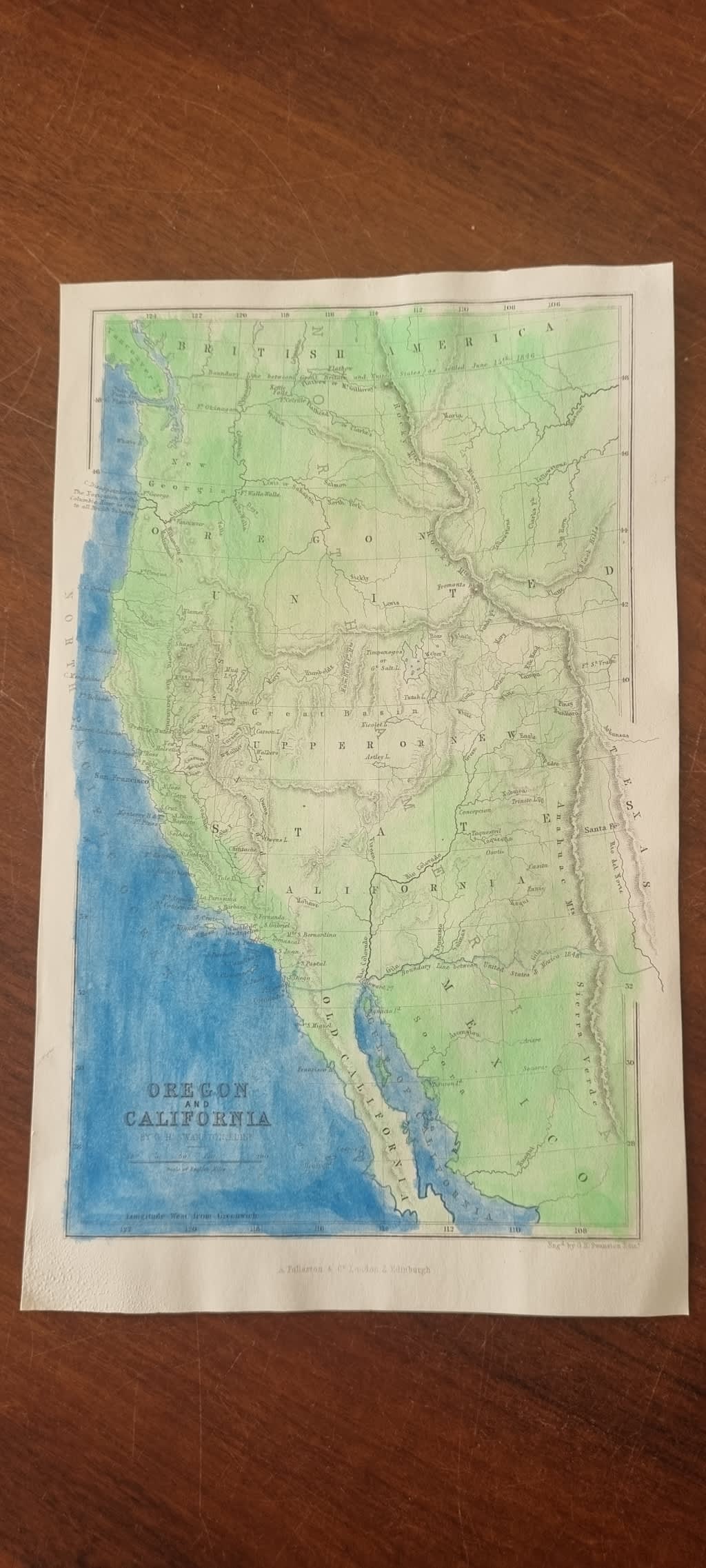
Oregon and California Map ( much later hand colour in light green and dark blue ) 1856 original map.
Secondhand
Shipping
Standard courier shipping from R30
R30 Standard shipping using one of our trusted couriers applies to most areas in South Africa. Some areas may attract a R30 surcharge. This will be calculated at checkout if applicable.
Check my rate
Check my rate
Free collection from
Newlands, Cape Town
The seller allows collection for this item and will be in contact with the full collection address once the order is ready.
Ready for collection by Thursday, 6 June.
Ready to ship in
The seller has indicated that they will usually have this item
ready to ship within 3 business days. Shipping time depends on your delivery address. The most
accurate delivery time will be calculated at checkout, but in
general, the following shipping times apply:
Standard Delivery
| Main centres: | 1-3 business days |
| Regional areas: | 3-4 business days |
| Remote areas: | 3-5 business days |
Get it now, pay later
Seller
Buyer Protection
Product details
Condition
Secondhand
Location
South Africa
Time Period
1800s
Bob Shop ID
615510918
About this Item
The ORIGINAL 1856 steel engraving, from a Gazetteer of the World pubilshed by Fullarton in 1856. Map is 14 cm x 23 cm. Sheet is 26 x 17 cm. Much later hand colour in watercolour with entire land portion in light green and entire sea portion in dark blue ( a little uneven). Sheet is very clean with no foxing or tears.