View the relisted Item
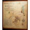
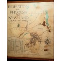
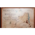
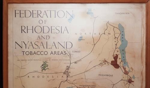
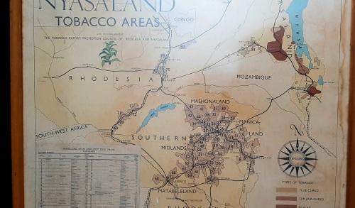
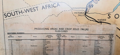
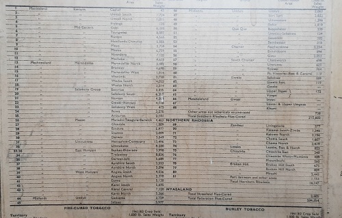
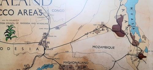
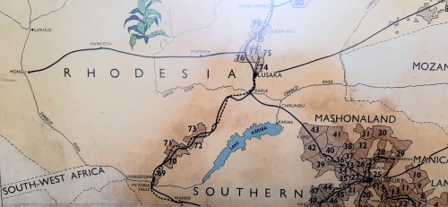
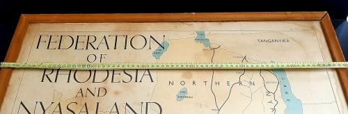
** 1950-1962 Federation of Rhodesia and Nyasaland Tobacco Areas Large Framed Map (77cm x 71cm).**
Check my rate
| Main centres: | 1-3 business days |
| Regional areas: | 3-4 business days |
| Remote areas: | 3-5 business days |
Product details
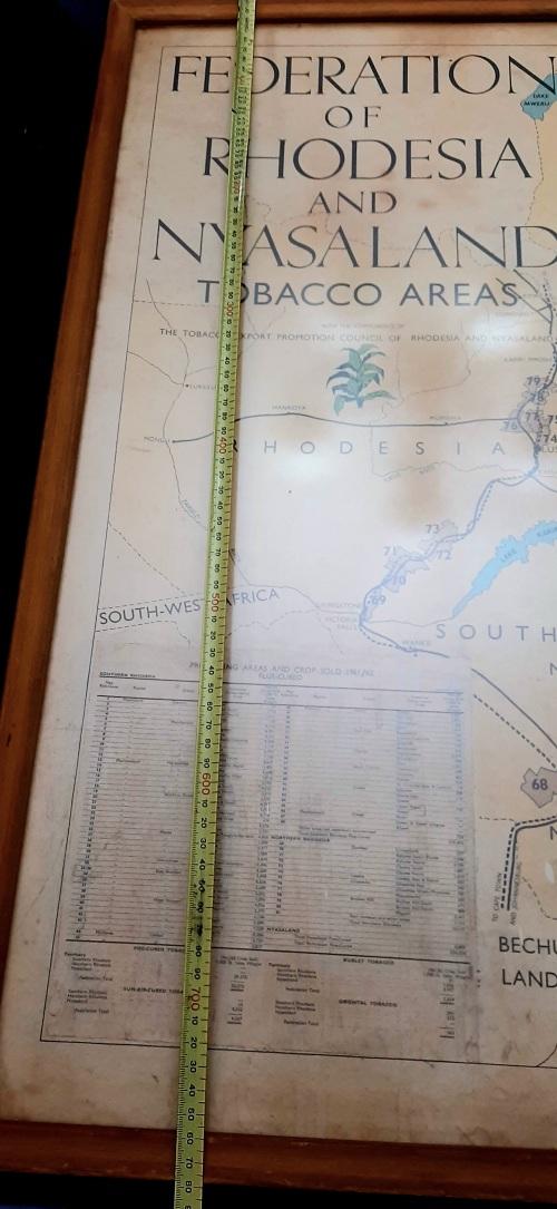
** 1950-1962 Federation of Rhodesia & Nyasaland Tobacco Areas Large Framed Map (77cm x 71cm).**
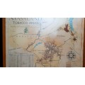
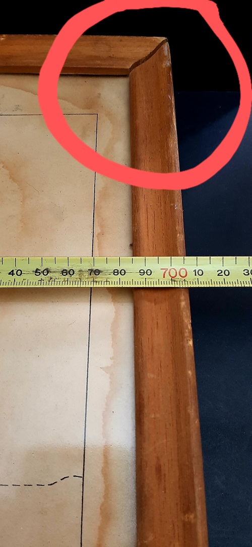
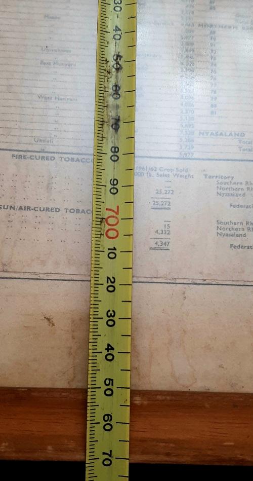
This piece remains in a GOOD, USED CONDITION- Map is complete , but clearly displays signs of Age-related wear. Graphic Relief is detailed and includes a Crop Yield & Sales Sheet for the Year 1961/62. ** Note : Frame has come partially loose on Top Right-hand corner. **
INSPECT PICTURES CAREFULLY AS THEY FORM AN IMPORTANT PART OF THE DESCRIPTION.
ORIGIN : Federation of Rhodesia & Nyasaland
YEAR : 1950 - 1962
SUBJECT : Tobacco Producing Areas & Crop Sold
DIMENSIONS: 77cm x 71cm
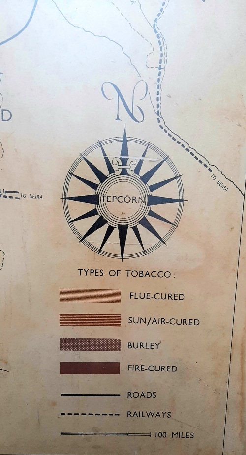
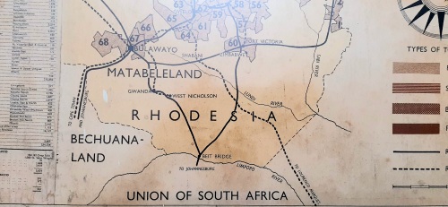
An EXCELLENT example of a 1950-1962 Federation of Rhodesia & Nyasaland Tobacco Areas Large Framed Map behind Glass. This piece details the prominent Tobacco Producing regions of Northern Rhodesia, Southern Rhodesia & Nyasaland Colonies - including a Yield Sheet for the Production Year 1961/62. A Key is provided on the bottom Right-hand corner of the Map - indicating the various Types of Tobacco & Road/ Rail Networks throughout the Three Colonies. This piece had been produced by The Tobacco Export Promotion Council of Rhodesia & Nyasaland.
Please Take Note : The Frame has come slightly loose on the Top Right-hand Panel Corner. The Paper upon which the Map has been printed displays visible wear.
The ideal addition to any Vintage 1950s/60s Rhodesia & Nyasaland Agricultural Map collection or display - detailing Political and Physical Boundaries for the History or Cartographic enthusiast.
FOREIGN BIDDERS TO PAY USING BOB BUCKS- QUOTED SHIPPING
NO COLLECTION
PAYMENT IN 7 DAYS OR SNC
SEE SHIPPING