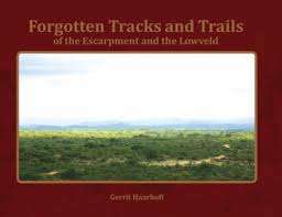
"FORGOTTEN TRACKS AND TRAILS OF THE ESCARPMENT AND THE LOWVELD" BY GERRIT HAARHOFF
Check my rate
| Main centres: | 1-3 business days |
| Regional areas: | 3-4 business days |
| Remote areas: | 3-5 business days |

| Main centres: | 1-3 business days |
| Regional areas: | 3-4 business days |
| Remote areas: | 3-5 business days |
"FORGOTTEN TRACKS AND TRAILS OF THE ESCARPMENT AND THE LOWVELD" BY GERRIT HAARHOFF, HARDCOVER, 2018 FIRST EDITION, 314 PAGES, NO NAMES OR INSCRIPTIONS. IN EXCELLENT CONDITION.
Researched from archival sources and contemporaneous literature, Forgotten Tracks and Trails documents the origin and development of towns and their roads in the Nineteenth Century. The wheel was late to arrive in the Lowveld, as it was only in the 1830s that the first explorers and immigrants ventured far inland in their ubiquitous ox wagon. Describing the events as they unfolded and the people involved, this book gives an accurate and concise history of the period leading up to the establishment of Eastern Railway line. Exploring the time-lines and narratives of the time, the author debunks previously held myths by meticulous reasoning and proof. Among the startling conclusions is the contention that Pretoriuskop has been incorrectly named after the Anglo-Boer War and the mistake has been repeated ever since. Lavishly illustrated, the reader is taken on a journey through time and guided to the places where history is still visible on the face of the landscape of this beautiful province, Mpumalanga.
Old maps and Charts - Using the latest drone technology, forgotten roads can again be identified as they cross mountain passes and ford drifts. The aerial photography series of 1935 was used extensively to identify and accurately pinpoint the old highways. The overlay technology of Google Earth made it possible, for the first time, to create accurate maps of the original wagon tracks. Cutting-edge Lidar technology was used to determine the old roads where forestry had destroyed the marks and gouges through cycles of replanting.
