+5


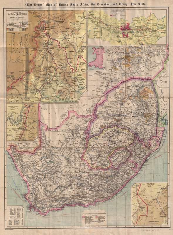
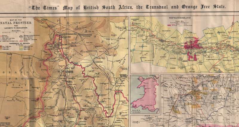
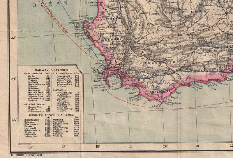
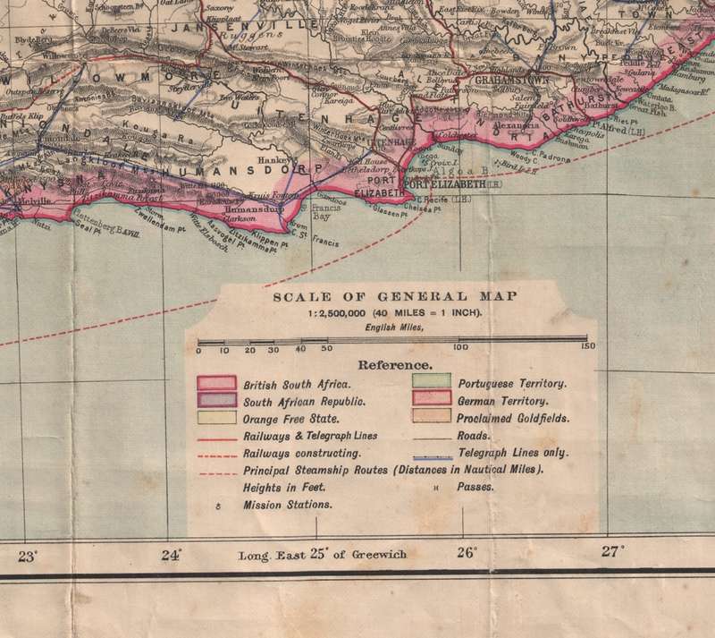
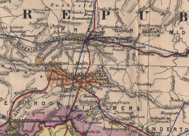
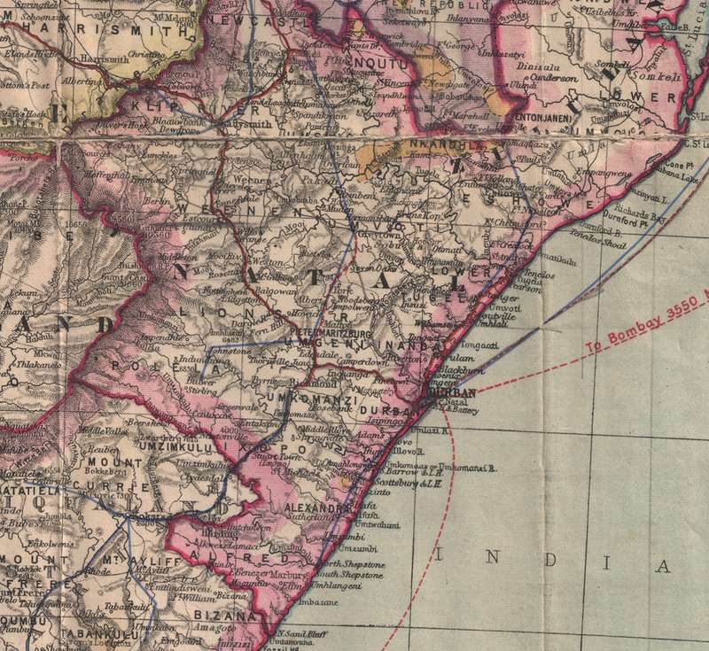
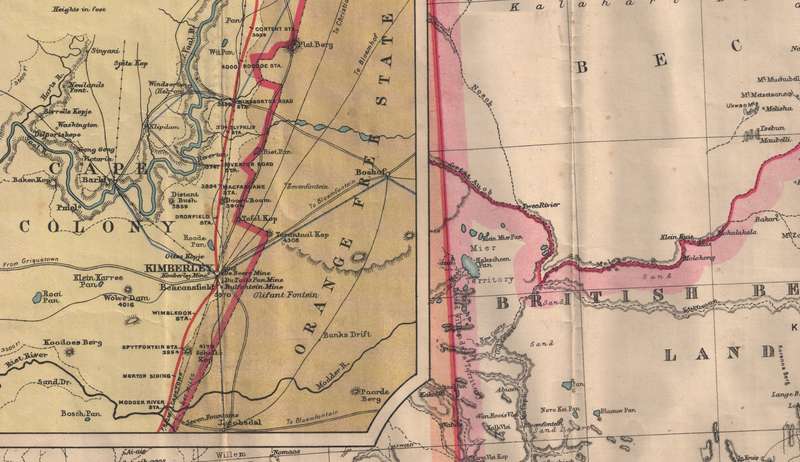
"The Times" Map of British South Africa Transvaal and Orange Free State Digital Map.
Digital product
Shipping
The seller has indicated that they will usually have this item
ready to ship within 3 business days.
Shipping time depends on your delivery address.
The most accurate delivery time will be calculated at checkout,
but in general, the following shipping times apply:
Standard Delivery
| Main centres: | 1-3 business days |
| Regional areas: | 3-4 business days |
| Remote areas: | 3-5 business days |
Seller
Buyer protection
Get it now, pay later