


| Main centres: | 1-3 business days |
| Regional areas: | 3-4 business days |
| Remote areas: | 3-5 business days |
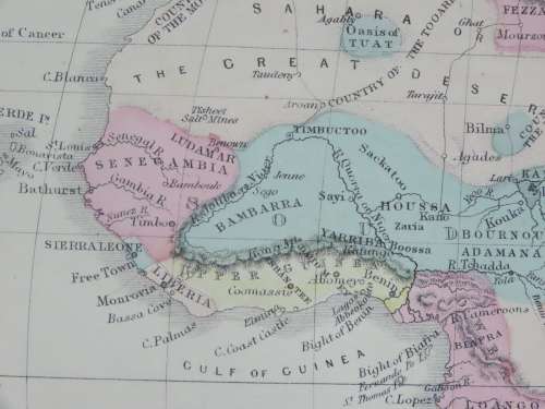
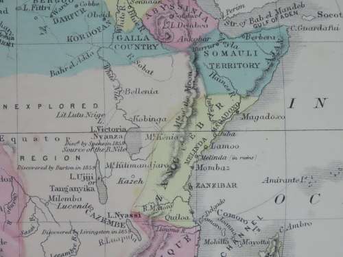
Africa
1855 Original Map
Excellent Condition
The map is an original 1855 issue and NOT a reproduction.
It measures 345mm x 280mm in total
The paper is crisp and responsive to handling but shows some age related discolouration, but no foxing is seen. Hand coloured regions with all colours still strong with only slight signs of fading. No tears or folding though the top right corner is dogeared. Engraved by SS Cornell for publication in Cornell's High School Geography in 1855 and published by D Appleton & Co, New York. Maps of Greece with Turkey and Persia as well as India on the back.