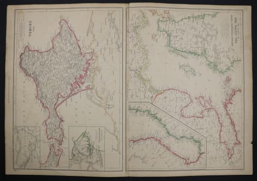
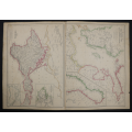
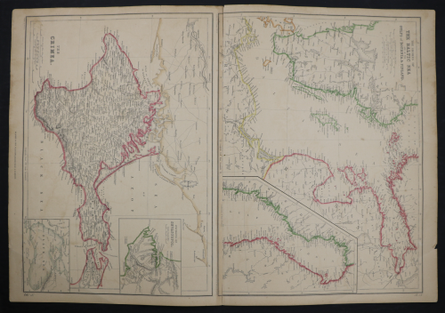
1859 The Shores Of The Baltic Sea And Of The Gulfs Of Bothnia And Finland and The Crimea Map by J. B
Secondhand
Shipping
Standard courier shipping from R30
R30 Standard shipping using one of our trusted couriers applies to most areas in South Africa. Some areas may attract a R30 surcharge. This will be calculated at checkout if applicable.
Check my rate
Check my rate
Free collection from
Century City, Cape Town
The seller allows collection for this item and will be in contact with the full collection address once the order is ready.
Ready for collection by Thursday, 16 May.
Ready to ship in
The seller has indicated that they will usually have this item
ready to ship within 4 business days. Shipping time depends on your delivery address. The most
accurate delivery time will be calculated at checkout, but in
general, the following shipping times apply:
Standard Delivery
| Main centres: | 1-3 business days |
| Regional areas: | 3-4 business days |
| Remote areas: | 3-5 business days |
Buyer Protection
How you're covered
Get it now, pay later
Returns
Money-Back 7 Days
Guarantee
Money-Back Guarantee:
7 Days: Dealer Guarantee: If you are not satisfied with your item(s), you may return the item(s) within 7 days of receiving them for a full refund of the sales price (return postage costs for buyers account) without leaving neutral or negative feedback.
Product information
Condition:
Secondhand
Location:
South Africa
Time Period:
1800s
Type:
Physical Map
Product code:
Map045
Bob Shop ID:
613038238
1859 The Shores Of The Baltic Sea And Of The Gulfs Of Bothnia And Finland and The Crimea Map by J. Bartholomew- Has a tear in the top middle
Size: 54,5cm x 37cm
Photos are of the actual item you will receive, please judge condition for yourself.
Please note that the photos were taken with a high qualify camera, the photos are 15mb each, unfortunately the website compresses the size of them thus reducing the quality.
All maps have been photographed on a black canvas backing to allow for any defects to be visible