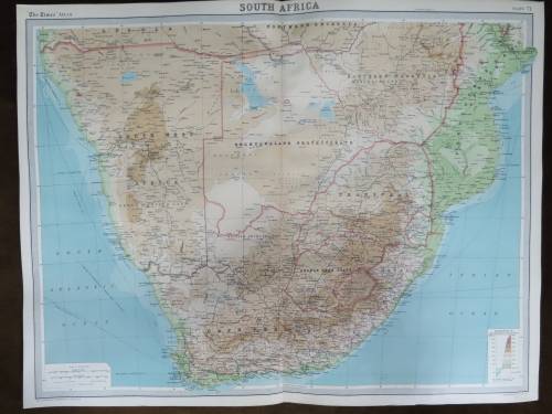
1880's ORIGINAL ANTIQUE MAP OF SOUTH AFRICA (in German) (ALSO SEE MY OTHER MAPS)
Secondhand
1 was available
R5.00
minimum increment
R250.00
Shipping
R35.00 Standard shipping using one of our trusted couriers applies to most areas in South Africa. Some areas may attract a R30.00 surcharge. This will be calculated at checkout if applicable. Check my rate
The seller has indicated that they will usually have this item
ready to ship within 3 business days.
Shipping time depends on your delivery address.
The most accurate delivery time will be calculated at checkout,
but in general, the following shipping times apply:
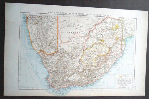
The map is in a very good condition suitable for framing. It shows the Cape colony, Natal, the Boer Republics and Luderitzland.
This an original German lithograph map book plate.
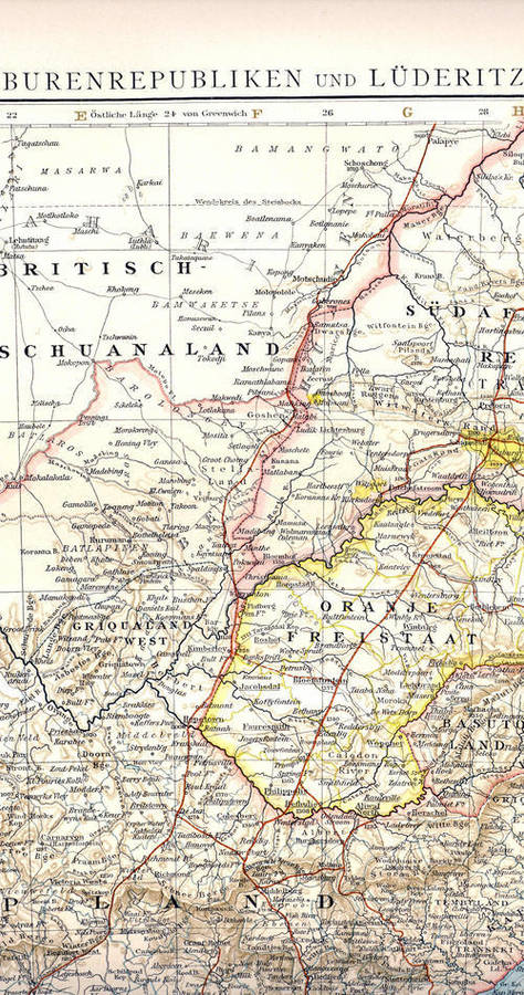
The map is very detailed & produced in Germany in the 1880's by the mapmaker Justus Perthes according to the person who I bought it from. The map is mainly in German, printed on thick paper with no folds or printing on the reverse. Two small tears in the margins.
Size approx. 34cm x 28cm (the reverse is blank).
map detail (actual map much more sharper than the scan)