Similar products


| Main centres: | 1-3 business days |
| Regional areas: | 3-4 business days |
| Remote areas: | 3-5 business days |
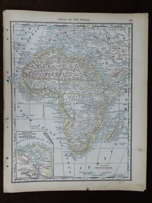
Africa
1882 Original Map
Excellent Condition

The map is an original 1882 issue and NOT a reproduction.
It measures 380mm x 560mm in total
The map is partially hand coloured with no fading present to the print, the parer is still crisp and responsive to handling although it has been aged to a pleasing off cream shade. Original 1882 map of Africa Published by Blackie & Son. There are insets of Natal , Bourbon and Mauritius. There is no foxing but a small diagonal tear, about 2cm , is found in the upper left hand corner that does not extend to or even come near the printed area. There is also a small cut, less than 1cm, just into the printed area of the map. This is at the 40 degree longitude mark just above Arabia. Cartographer and engraver is Edward Weller FRGS(Royal Geographical Society)


