
| Main centres: | 1-3 business days |
| Regional areas: | 3-4 business days |
| Remote areas: | 3-5 business days |
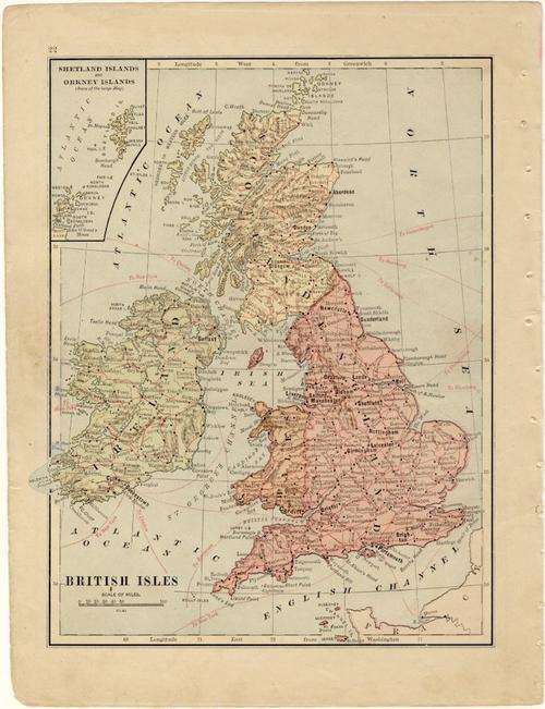
Great Britain
1893 Original Map
Fair Condition


The map is an original 1893 issue and NOT a reproduction.
It measures 197mm x 260mm in total
The map is in full color with only minimal fading, there is some age related discolorasion of the paper. Original 1893 map of the british isles eith a map of europe on the reverse. The map is from "The Handy Atlas" published in 1893. There is some minor water related damage on the top and bottom margins and a tear on the lesft most middle side has been mended with translucent tape.


 INTERNATIONAL CUSTOMERS WELCOME