
| Main centres: | 1-3 business days |
| Regional areas: | 3-4 business days |
| Remote areas: | 3-5 business days |
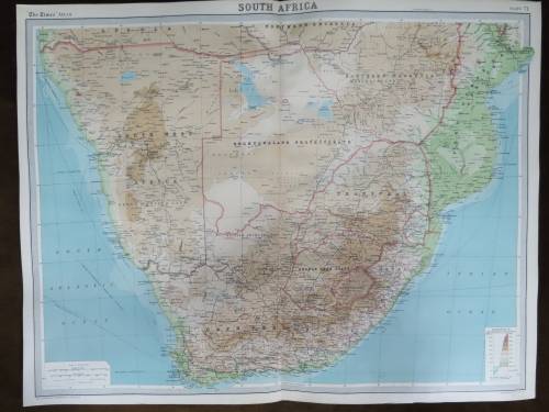
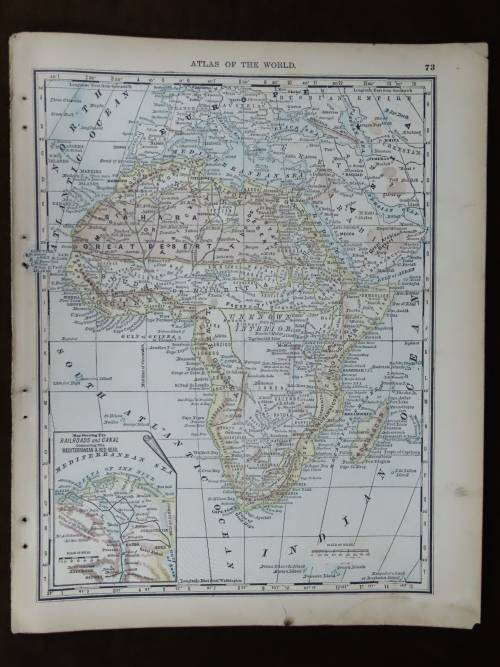
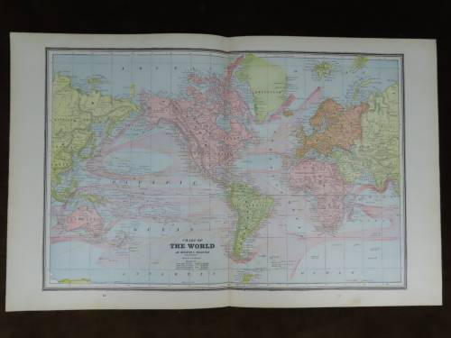
Colonial Boundaries of Africa
1895 Original Two Page Map
Excellent Condition


The map is significantly larger than my scanner so the pages had to be scanned separately for the closer up images.


The map is an original 1895 issue and NOT a reproduction.
It measures 372mm x 595mm in total.Two page map showing the colonial division of Africa at the time with an indexed section at the bottom of the second page of place names and countries along with political status, total area, population and chief cities. The map is in full color with NO fading whatsoever and colours are still sharp, crisp and vivid, there is some minor age related discoloration of the paper at the very out most edges of the parer but this is hardly noticeable.Original Cram's map.
Some of the place names indicated are :
Cape of Good Hope Colony (British Colony), South African Republic(Z.A.R. aka Transvaal), Orange Free State, Bechuanaland (British Protectorate)German South West Africa (German Protectorate)Portuguese East Africa(modern Mozambique) (Pertugese Colony)Niger Territories (British Protectorate), Basuto Land (British Colony), Zulu Land (British Colony), Abbissinia, Egypt (Turkish Province), Togo Land (German Colony)and so on


 INTERNATIONAL CUSTOMERS WELCOME