This item has closed with no items sold
View other items offered by gregsact1901

Similar products

Vintage Folded Map Motorists` Map of South East & East Midlands, #2 First Edition 1977
R155.00
56% OFF
1795 original antique map of the Cape of Good Hope
R7,500.00 R17,200.00
1905 Map of South Africa Anglo-Boer War, Siege of Ladysmith, Original German Mayer Map
R615.00
1596 hand coloured original: Striking map of South Africa, West Africa, Atlantic.
R64,795.00
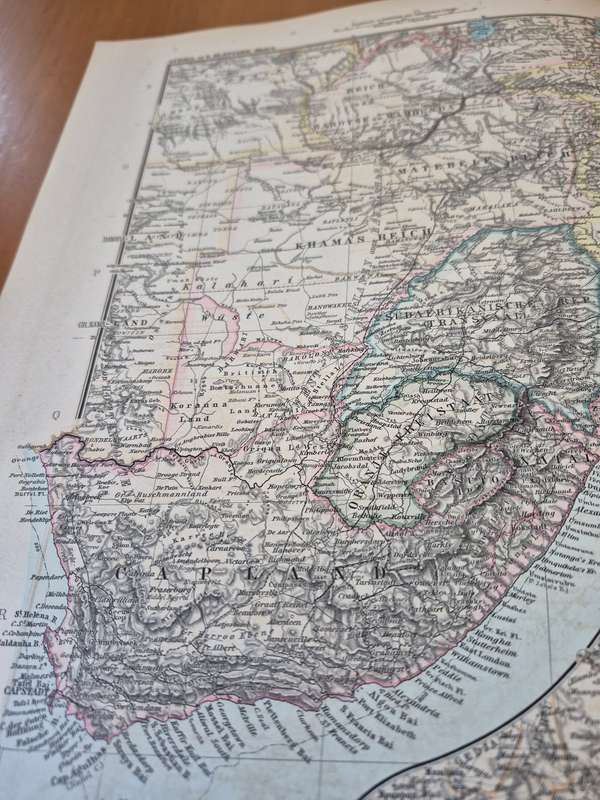
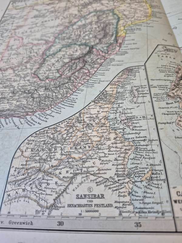
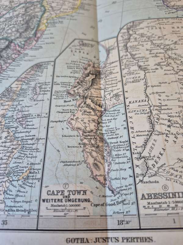
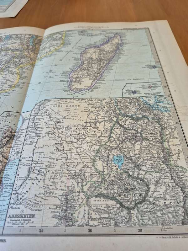
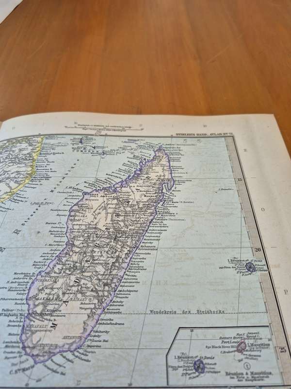
1898 Original Map of South East Africa, Zanzibar, Cape Town, Ethiopia, Reunion Mauritius, Madagascar 1898 Original Map of South East Africa, Zanzibar, Cape Town, Ethiopia, Reunion Mauritius, Madagascar 1898 Original Map of South East Africa, Zanzibar, Cape Town, Ethiopia, Reunion Mauritius, Madagascar 1898 Original Map of South East Africa, Zanzibar, Cape Town, Ethiopia, Reunion Mauritius, Madagascar 1898 Original Map of South East Africa, Zanzibar, Cape Town, Ethiopia, Reunion Mauritius, Madagascar 1898 Original Map of South East Africa, Zanzibar, Cape Town, Ethiopia, Reunion Mauritius, Madagascar 1898 Original Map of South East Africa, Zanzibar, Cape Town, Ethiopia, Reunion Mauritius, Madagascar
1898 Original Map of South East Africa, Zanzibar, Cape Town, Ethiopia, Reunion Mauritius, Madagascar 1898 Original Map of South East Africa, Zanzibar, Cape Town, Ethiopia, Reunion Mauritius, Madagascar 1898 Original Map of South East Africa, Zanzibar, Cape Town, Ethiopia, Reunion Mauritius, Madagascar 1898 Original Map of South East Africa, Zanzibar, Cape Town, Ethiopia, Reunion Mauritius, Madagascar
1898 Original Map of South East Africa, Zanzibar, Cape Town, Ethiopia, Reunion Mauritius, Madagascar
+3
Closed

1898 Original Map of South East Africa, Zanzibar, Cape Town, Ethiopia, Reunion Mauritius, Madagascar

1 was available / secondhand
R990.00
Shipping
R35.00 Standard shipping using one of our trusted couriers applies to most areas in South Africa. Some areas may attract a R30.00 surcharge. This will be calculated at checkout if applicable.
Check my rate
The seller allows collection for this item. Buyers will receive the collection address and time once the order is ready.
The seller has indicated that they will usually have this item ready to ship within 3 business days. Shipping time depends on your delivery address. The most accurate delivery time will be calculated at checkout, but in general, the following shipping times apply:
 
Standard Delivery
Main centres:  1-3 business days
Regional areas: 3-4 business days
Remote areas: 3-5 business days
Buyer protection
Get it now, pay later

Product details

Condition
Secondhand
Location
South Africa
Area
Africa
Time Period
1800s
Type
Physical Map
Bob Shop ID
637982070

48 cm x 38 cm. Excellent condition. 1898 original. Ready to frame. 

Cape Colony, ZAR, OFS, Mocambique, and later Rhodesia and Botswana and Madagascar shown in detail.

Interesting insets showing Cape Town ( Cape Town und Weitere Umgebung), Zanzibar and Tanganyika coast ( Sansibar und Benachartes Festland ) , Ethiopia ( Abessinien), Reunion and Mauritius.

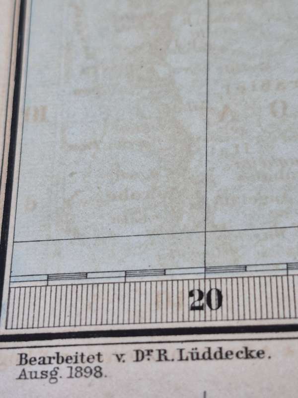
Published in 1898 by Justus Perthes of Gotha. The maps are the works of Dr. R. Luddecke.

Recently viewed

See more
Big & Beautiful, Sterling Silver Marcasite Ring
R595.00 No bids
Womens Willy G Skull Dealer Tee
R1,299.00
Queen - Sheer Heart Attack (Half-Speed Vinyl) (Vinyl)
R929.00
1964 Greece silver 30 Drachmai - Royal wedding of Constantine II
R250.00 No bids