Similar products


| Main centres: | 1-3 business days |
| Regional areas: | 3-4 business days |
| Remote areas: | 3-5 business days |
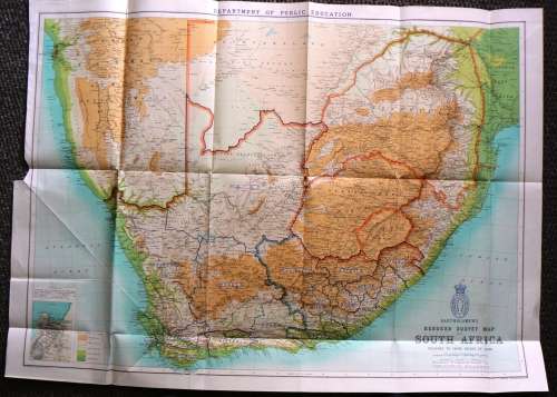
1899 - BARTHOLOMEW'S Reduced Survey Map of South Africa
Showing Boundaries of Inspection circuits and names of inspectors shewn in dark blue.
Inspector names are those of the Dept of public education Cape of Good Hope.
The Map were salvage from a 1899 Cape government book
The Map were folded but are sharp and in a very good condition. The reverse are blank.
One tear at the top and bottom left
Size: 87 x 63.5 cm
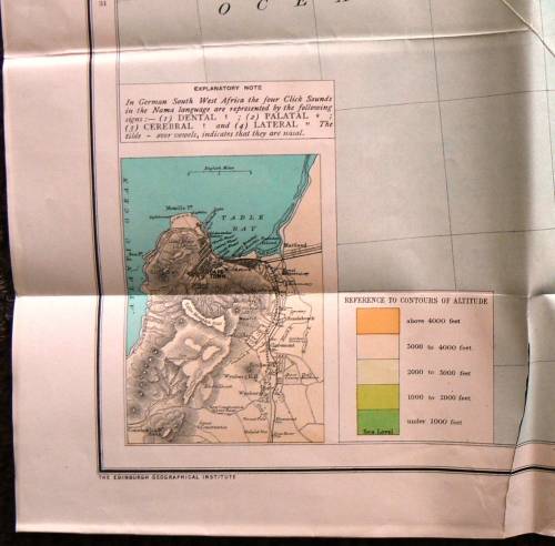
Please see the photo's as part of the description.


Same Postage apply if you order one or more Maps
International Bidders Welcome (Please enquire about shipping costs)
Postage and Packaging:
Post Office: R55, --- Courier R110 up to 5kg
We do combine items to save shipping cost. (Please enquire about the cost if you buy more than 1 item)