Similar products


.jpg)
| Main centres: | 1-3 business days |
| Regional areas: | 3-4 business days |
| Remote areas: | 3-5 business days |
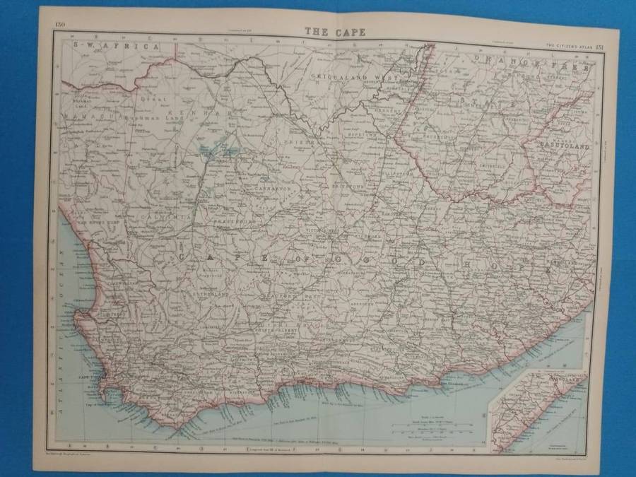
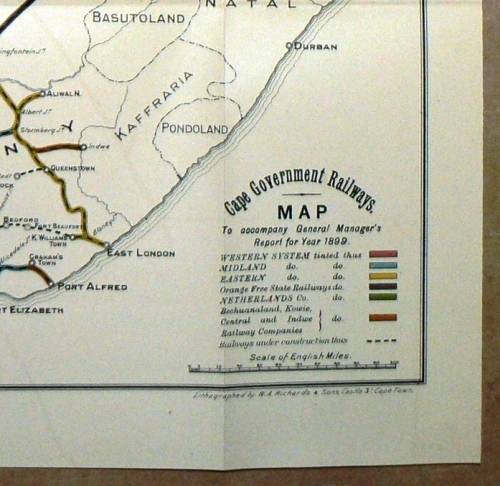
1899 Lithographed Cape Government Railways Map
by WA Richards & Sons , Castle S, Cape town - Compiled by The Office of the Engineer in Chief
Map showing the existing Railway lines and the ones that were under construction in 1899
The Map were salvage from a 1899 Cape government book
The Map were folded but are sharp and in a very good condition. The reverse are blank
Size: 48 x 43.5 cm
Please see the photo's as part of the description.
Same Postage apply if you order one or more Maps
International Bidders Welcome (Please enquire about shipping costs)
Postage and Packaging:
Post Office: R55, --- Courier R110 up to 5kg
We do combine items to save shipping cost. (Please enquire about the cost if you buy more than 1 item)
.jpg)