

| Main centres: | 1-3 business days |
| Regional areas: | 3-4 business days |
| Remote areas: | 3-5 business days |
Africa
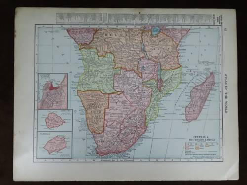
1899 Original Map
Excellent Condition


The map is an original 1890 issue and NOT a reproduction.
It measures 366mm x 540mm in total
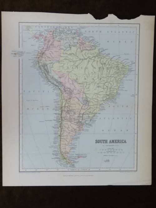
The map is in full color with NO fading whatsoever and colours are still sharp and bright.Original 1899 George F Cram map of Africa depicting the colonial division of Africa at the time. There is also a detailed index of countries, political status, main Cities, Population and area at the bottom. There is also a map of South Africa on the back.
Some of the place names indicated are :
Cape Colony
Orange Free State
South African Republic(Z.A.R.)
German South West Africa
Bechuana
British Central Africa
Italian Somali
French Congo
Congo Free State
Royal Niger
Abyssinia
Exct


 INTERNATIONAL CUSTOMERS WELCOME