

| Main centres: | 1-3 business days |
| Regional areas: | 3-4 business days |
| Remote areas: | 3-5 business days |
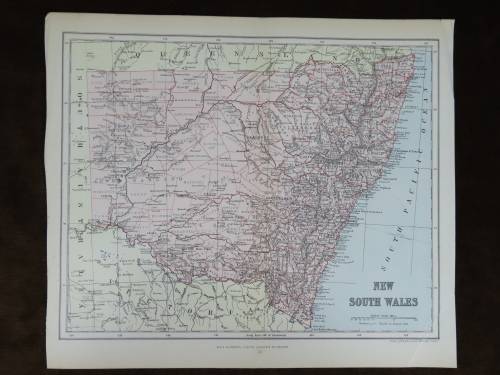
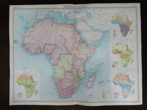
South Africa
1899 Original Map
Excellent Condition


The map is an original 1899 issue and NOT a reproduction.
It measures 272mm x 370mm in total
The map is in full color with NO fading whatsoever and colours are still sharp, crisp and vivid, there is however some minor water damage at the left hand margin, but this does not extend into the map itself.Original 1899 map, appears to be a Leo F. Cram map.
Some of the place names indicated are :
Cape Colony
South African Republic(Z.A.R. aka Transvaal)
Orange Free State
Bechuanaland
German South West Africa
Portuguese East Africa(modern Mozambique)
Khamas Country
Basuto Land
Zulu Land(as a British Colony)
Tonga
Exct


 INTERNATIONAL CUSTOMERS WELCOME