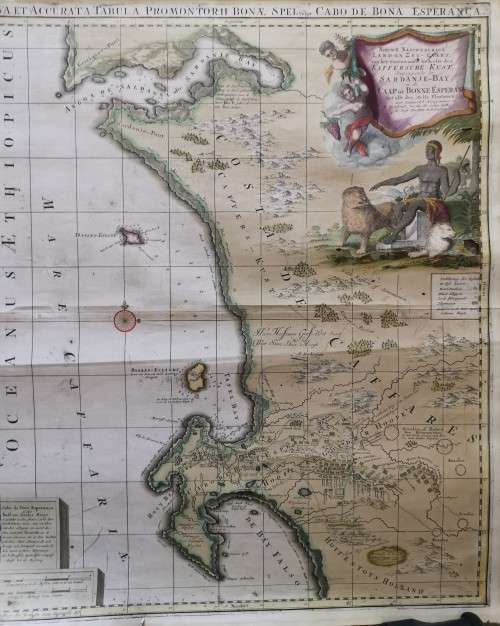
18th CENTURY DUTCH MAP OF THE CAPE AND ITS ENVIRONS
Secondhand
1 was available
Indicative market price:
R6,000.00
R20.00
minimum increment
R1,500.00
Shipping
R35.00 Standard shipping using one of our trusted couriers applies to most areas in South Africa. Some areas may attract a R30.00 surcharge. This will be calculated at checkout if applicable. Check my rate
The seller has indicated that they will usually have this item
ready to ship within 3 business days.
Shipping time depends on your delivery address.
The most accurate delivery time will be calculated at checkout,
but in general, the following shipping times apply:
18th CENTURY DUTCH MAP OF THE CAPE AND ITS ENVIRONS
480 X 560mm
Condition as per images
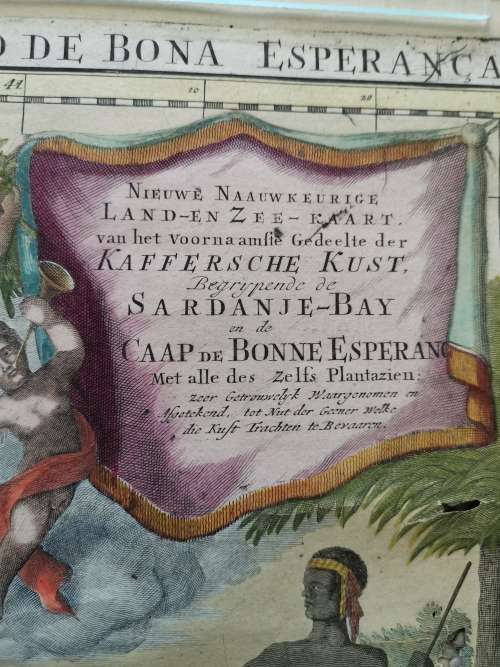
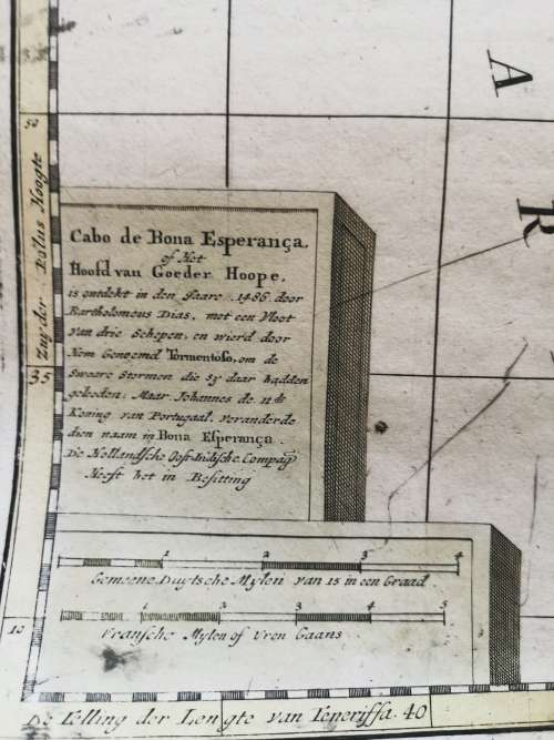
Nederlands: Titel in catalogus Leupe (Nationaal Archief): Nova et accurata tabula promontorii Bonae Spei vulgo Cabo de Bona Esperanca. Nieuwe naauwkeurige land en zeekaart van het voornaamste gedeelte der Kaffersche kust, begrijpende de Sardanje-Baij en de Caap de Bonne Esperance met alle deszelfs plantaziën. Schaalaanduiding: Schaal van 4 Duitse mijlen = 85 strepen; omgerekende schaal [1: 359.952]; Schaal van 5 Franse [zee ?] mijlen = 80 strepen; omgerekende schaal [1: 347.293].
English: Title in the Leupe Catalogue (National Archives): Nova et accurata tabula promontorii Bonae Spei vulgo Cabo de Bona Esperanca. Nieuwe naauwkeurige land en zeekaart van het voornaamste gedeelte der Kaffersche kust, begrijpende de Sardanje-Baij en de Caap de Bonne Esperance met alle deszelfs plantaziën. Scale: Scale of 4 German miles = 85 lines; converted scale [1: 359.952]; Scale of 5 French [sea?] miles = 80 lines; converted scale [1: 347.293].