

| Main centres: | 1-3 business days |
| Regional areas: | 3-4 business days |
| Remote areas: | 3-5 business days |
The World
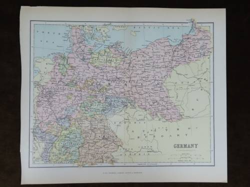
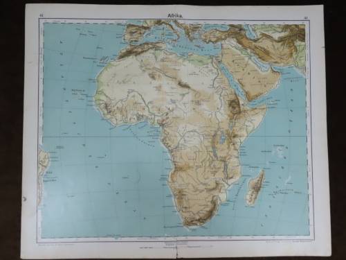
1910 Original Map
Good Condition


The map is an original 1910 issue and NOT a reproduction.
It measures 145mm x 203mm in total
The map is in full color with no clear fading visable, there is some age related discolorasion of the paper. Original 1910 map of the world which indicates the shipping routes and colour keyed to indicate the colonial possession of the world at that time. The map is from "Hammond's Handy Atlas of the World" published in 1910. There is also an equivalent projection map of the world on the reverse.


 INTERNATIONAL CUSTOMERS WELCOME