

| Main centres: | 1-3 business days |
| Regional areas: | 3-4 business days |
| Remote areas: | 3-5 business days |
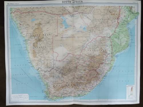
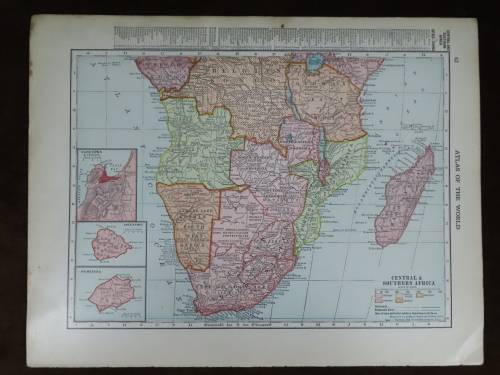
Africa
1940 Original Map
Excellent Condition


The map is an original 1940 issue and NOT a reproduction.
It measures 277mm x 358mm in total
The map is in full color with NO fading whatsoever and colours are still sharp and bright.Original 1940 McNally map of Africa. There is also a index of countries, and population counts at the right hand side. The map was originally published in the World Atlas and Gazetteer of 1940. The bottom right corner is dogeared.
Some of the place names indicated are :
Cape of Good Hope
Orange Free State
Transvaal
South West Africa(Mandate of the Union of S.A.)
BechuanaLand
Southern Rhodesia
Italian East Africa
French Equatorial Africa
Belgian Congo
Tabganyika Territory
Anglo Egyptian Sudan
Exct


 INTERNATIONAL CUSTOMERS WELCOME