View the relisted Item


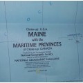
1975 Folded Wall Map of MAINE U.S.A Published By National Geographic 57x89cm
Check my rate
| Main centres: | 1-3 business days |
| Regional areas: | 3-4 business days |
| Remote areas: | 3-5 business days |
Product details

Shipping Can be combined please discuss with me
POSTAGE: See Shipping Tab for Postage Fees. |
ITEM Description
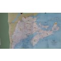
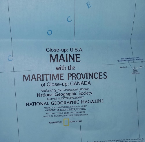
POSTAGE will be Combined 1975 Folded Map of MAINE U.S.A Published By National Geographic 57x89cm Great Condition unfolded for the 1st time to take the photos. This map details Maine, the most northeastern state in the United States, as well as the surrounding Canadian maritime provinces of New Brunswick, Nova Scotia, and Prince Edward Island. Includes a wealth of notes about the festivals, events, and historical sites one can visit in this scenic region. Published in March 1975 as part of the Close-up: U.S.A. series, with a companion travel poster and an article on Nova Scotia. Size: 35.25 x 22.75 in. Publication Date: 1975. Publisher: National Geographic CONDITION: SOLD as FOUND - No Damage -Please see ALL IMAGES |