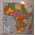
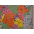
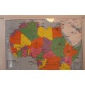
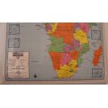
2009 Africa Political Wall Map, Laminated, with Battens
New
Shipping
Standard courier shipping from R30
R30 Standard shipping using one of our trusted couriers applies to most areas in South Africa. Some areas may attract a R30 surcharge. This will be calculated at checkout if applicable.
Check my rate
Check my rate
Free collection from
Kuils River, Cape Town
The seller allows collection for this item and will be in contact with the full collection address once the order is ready.
Ready for collection by Monday, 20 May.
Ready to ship in
The seller has indicated that they will usually have this item
ready to ship within 3 business days. Shipping time depends on your delivery address. The most
accurate delivery time will be calculated at checkout, but in
general, the following shipping times apply:
Standard Delivery
| Main centres: | 1-3 business days |
| Regional areas: | 3-4 business days |
| Remote areas: | 3-5 business days |
Returns
Replacement 10 Days
guarantee
Replacement Guarantee:
10 Days: Refund if returned, excluding Postage.
Get it now, pay later
Seller
Buyer Protection
Product details
Condition
New
Location
South Africa
Bob Shop ID
612591011
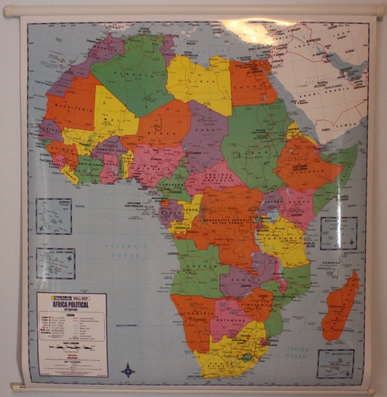
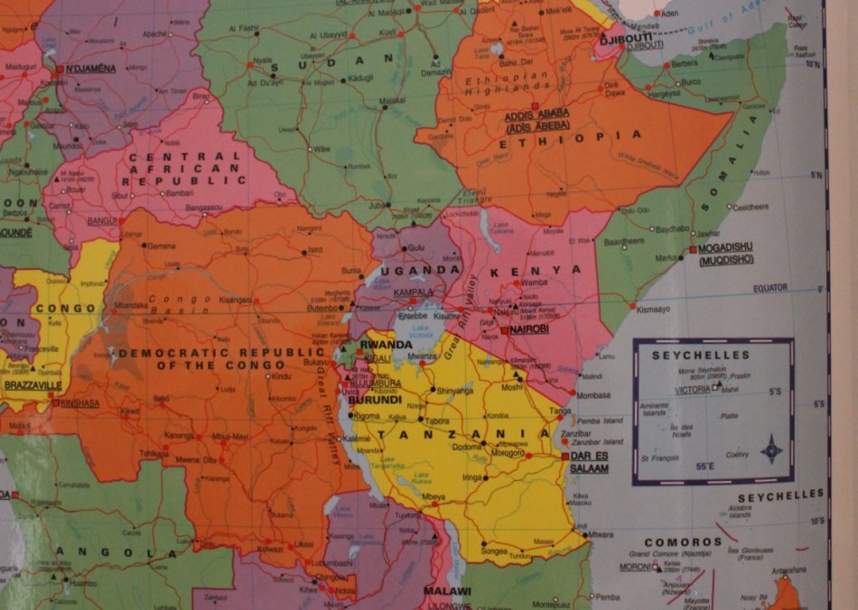
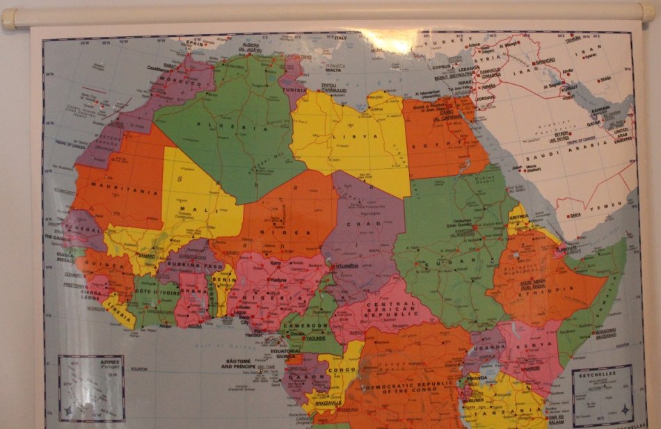
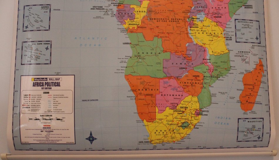
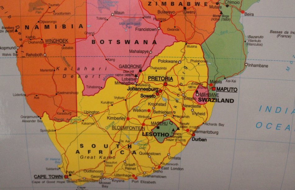
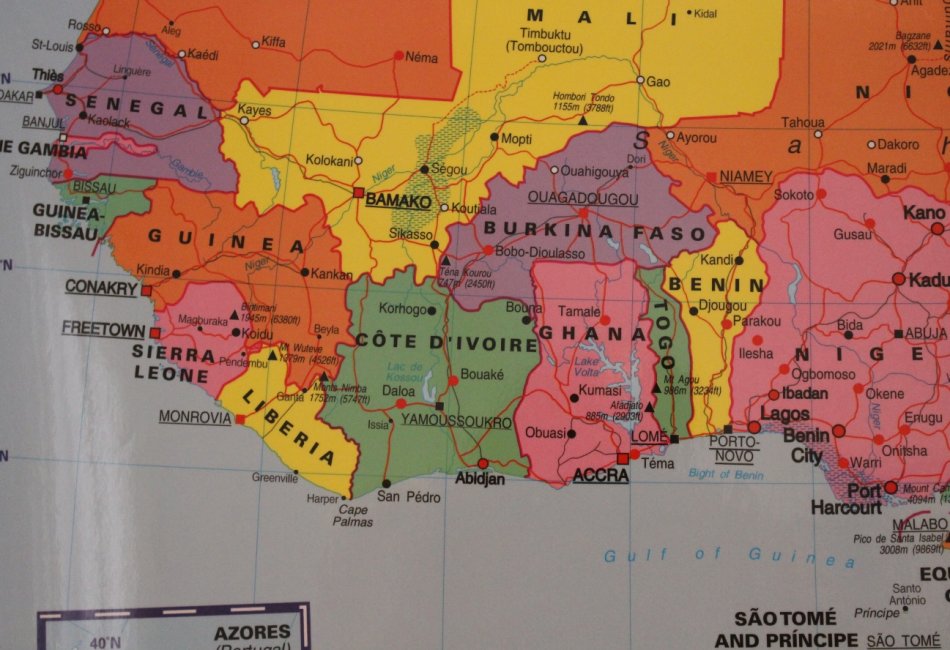
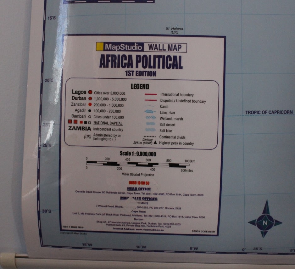
Title: 2009 Africa Political Wall Map, Laminated, with Battens.
This detailed map of Africa at a 1:9 000 000 scale shows colour coded countries with international, disputed and undefined country boundries. The map indicates capital cities, major cities, towns, major roads, minor roads, seasonal roads, international and national airports, rivers and lakes with names, latitude, longitude, tropic and equator lines, the highest peak in each country.
Coverage also includes Seychelles, Mauritius and Madagascar.
Scale: 1:9 000 000.
Laminated and Battened, ready to hang on the wall.
Edition: 1st Edition @ 2009.
Size: 0.87m Wide x 0.98m High.
Condition: New, never used.
Price: R 475.00 Inc Vat.
![]()