This item has closed 1 buyer bought 1 item

Similar products

In search of Western Europe
R35
R30 shipping
Columbus World Travel Atlas 11th Edition
R100
Exit into History: A Journey into the New Eastern Europe | Eva Hoffman
R57
R30 shipping
Heinemann New Zealand Atlas 1993 Edition.
R275

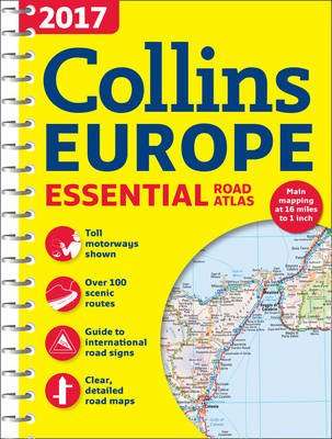
2017 Collins Essential Road Atlas Europe (Spiral bound, New edition)

New
Indicative market price: R318
R260.00 18% OFF
Closed 11 Jan 17 00:22
Shipping
Standard courier shipping from R30
R30 Standard shipping using one of our trusted couriers applies to most areas in South Africa. Some areas may attract a R30 surcharge. This will be calculated at checkout if applicable.
Check my rate
Ready to ship in
The seller has indicated that they will usually have this item ready to ship within 3 business days. Shipping time depends on your delivery address. The most accurate delivery time will be calculated at checkout, but in general, the following shipping times apply:
 
Standard Delivery
Main centres:  1-3 business days
Regional areas: 3-4 business days
Remote areas: 3-5 business days
Get it now, pay later
Seller
Buyer Protection

Product details

Condition
New
Location
South Africa
Customer ratings:
Product code
LPTX-3633-G140
Bob Shop ID
256930065
2017 Collins Essential Road Atlas Europe (Spiral bound, New edition) picture

This item is sold brand new. It is ordered on demand from our supplier and is usually dispatched within 6 - 13 working days


Up-to-date A4 spiral bound road atlas of Europe. Contains clear, detailed road mapping, perfect for touring the Mediterranean, Iberian peninsula, Scandinavia and many other European tourist destinations. Scale of main maps 1:1,000,000 (1 cm to 10 km / 1 inch to 16 miles). MAIN FEATURES Clear, easy to follow road maps at a scale of 1:1,000,000. Euroroutes and motorways are easily distinguished on the mapping. The maps also show international road classifications, road distances in kilometres and relief is shown by attractive layer tints. INCLUDES * Route planning maps. * Over 100 scenic routes shown. * Toll motorways shown. * Guide to international road signs, driving advice and useful internet links. * Route maps of 64 major cities. * Street plans of 16 major cities. * Locator diagrams on each page to help you navigate. * More detailed road maps extending from Amsterdam to Munich, making route following easier through this densely populated area. * Top 25 European destinations as recommended on Tripadvisor(R) AREA OF COVERAGE The mapping extends from the North Cape (Norway) to Gibraltar and from Ireland to east of Moscow. Also includes Iceland and Cyprus.

Features

SummaryUp-to-date A4 spiral bound road atlas of Europe. Contains clear, detailed road mapping, perfect for touring the Mediterranean, Iberian peninsula, Scandinavia and many other European tourist destinations.
AuthorCollins Maps
PublisherCollins
Release date20161201
Pages272
ISBN0-00-820358-X
ISBN 13978-0-00-820358-0

Customer ratings: 1 ratings

Great service! Thank you very much!
23 Dec 2016