This auction has been won.
View other items offered by Blue Stone Antiques526
Leading
Diedericks Inc8 1 × R364.00
8 Oct 22:00
Runners-up
greg77735 1 × R315.00
8 Oct 15:57
Jeavan5960324 1 × R200.00
7 Oct 19:03
zte2147 1 × R164.00
7 Oct 21:58
jocolri173989 1 × R66.00
7 Oct 12:41

Similar products

219 Years Old!!! Antique Map Of THE CAPE OF GOOD HOPE to SALDANHA BAY (1806) Size: 70cm x 26.5cm 219 Years Old!!! Antique Map Of THE CAPE OF GOOD HOPE to SALDANHA BAY (1806) Size: 70cm x 26.5cm 219 Years Old!!! Antique Map Of THE CAPE OF GOOD HOPE to SALDANHA BAY (1806) Size: 70cm x 26.5cm 219 Years Old!!! Antique Map Of THE CAPE OF GOOD HOPE to SALDANHA BAY (1806) Size: 70cm x 26.5cm
Sold

219 Years Old!!! Antique Map Of THE CAPE OF GOOD HOPE to SALDANHA BAY (1806) Size: 70cm x 26.5cm

Secondhand 1 was available
R49.00 minimum increment
R364.00
R9,000.00
Shipping
R35.00 Standard shipping using one of our trusted couriers applies to most areas in South Africa. Some areas may attract a R30.00 surcharge. This will be calculated at checkout if applicable.
Check my rate
The seller allows collection for this item. Buyers will receive the collection address and time once the order is ready.
The seller has indicated that they will usually have this item ready to ship within 3 business days. Shipping time depends on your delivery address. The most accurate delivery time will be calculated at checkout, but in general, the following shipping times apply:
 
Standard Delivery
Main centres:  1-3 business days
Regional areas: 3-4 business days
Remote areas: 3-5 business days
Buyer protection
Get it now, pay later

Product details

Condition
Secondhand
Location
South Africa
Area
Africa
Time Period
1800s
Bob Shop ID
656951757

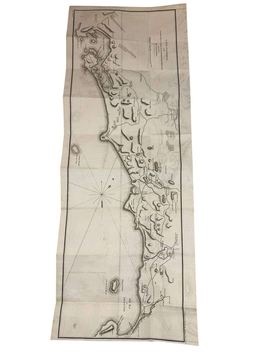
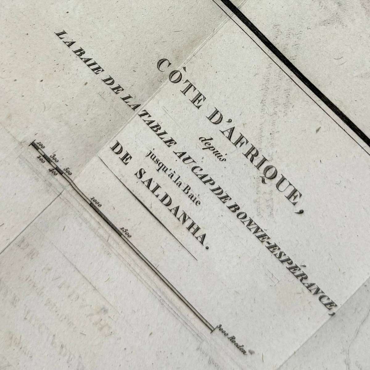
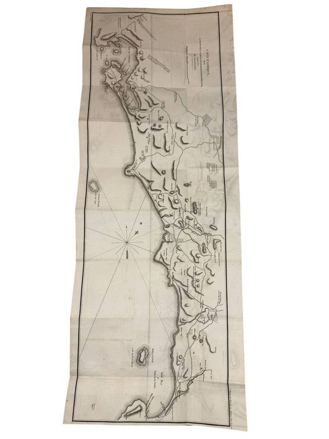
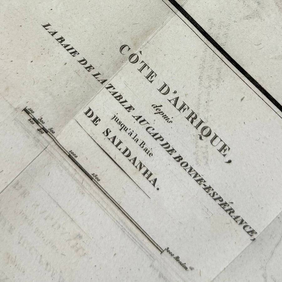
An original copperplate engraved map showing the coastline from the Cape of Good Hope northwards to Saldanha Bay. This large and detailed chart was published in John Barrows important account of the Cape of Good Hope, the first French edition of 1806.

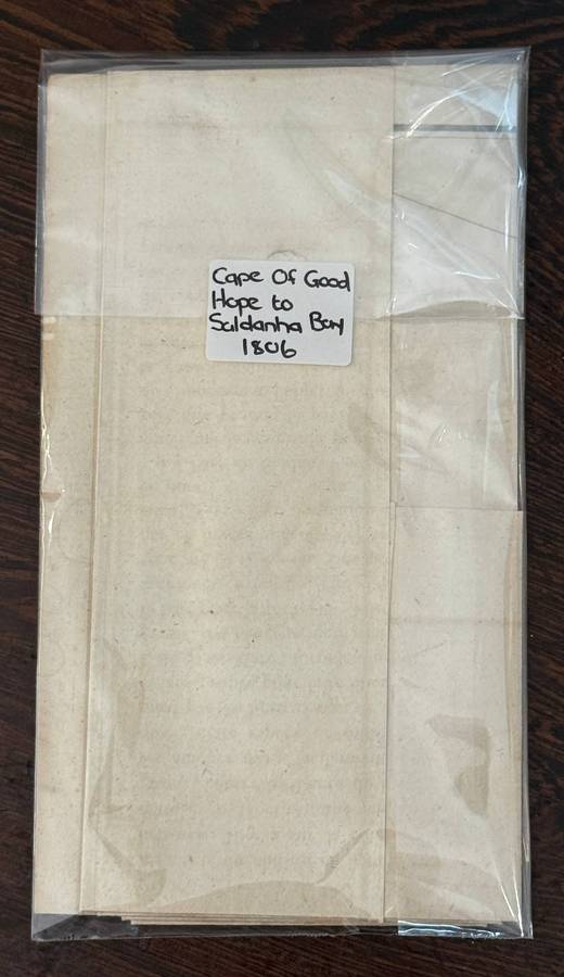
         Original antique map (not a reproduction)

         Date: 1806

         Size: 70 × 26.5 cm


Scarce and highly desirable for collectors of Cape cartography and naval history.


Terms and Conditions:

The provided photographs form an integral part of the item description.

Buyers are expected to assess the item's condition based on the images supplied.

All items are sold strictly "as is". Descriptions reflect our best efforts, but no guarantees are implied.

No returns or refunds will be accepted once the auction or Buy-Now option has concluded.

Payment is required within 24 hours of the listing's conclusion. Multiple payment methods are accepted.

Please use the Q&A section for any enquiries prior to purchase.

We encourage all buyers to conduct their own research and bid responsibly.

We wish you every success in acquiring this item.