Cape Government Railways Royal Mail Route 1903 1 x Map Digital Download Cape Government Railways Royal Mail Route 1903 1 x Map Digital Download Cape Government Railways Royal Mail Route 1903 1 x Map Digital Download Cape Government Railways Royal Mail Route 1903 1 x Map Digital Download Cape Government Railways Royal Mail Route 1903 1 x Map Digital Download Cape Government Railways Royal Mail Route 1903 1 x Map Digital Download
Cape Government Railways Royal Mail Route 1903 1 x Map Digital Download Cape Government Railways Royal Mail Route 1903 1 x Map Digital Download Cape Government Railways Royal Mail Route 1903 1 x Map Digital Download Cape Government Railways Royal Mail Route 1903 1 x Map Digital Download
Cape Government Railways Royal Mail Route 1903 1 x Map Digital Download
+2

Cape Government Railways Royal Mail Route 1903 1 x Map Digital Download

Digital product
New 1 available
Only 1 left – grab it before it’s gone!
R245.00
Shipping
This is a digital product (eg. voucher, product license, service, etc.) and does not require shipping. The seller will be in contact to deliver this product to you electronically.
The seller has indicated that they will usually have this item ready to ship within 3 business days. Shipping time depends on your delivery address. The most accurate delivery time will be calculated at checkout, but in general, the following shipping times apply:
 
Standard Delivery
Main centres:  1-3 business days
Regional areas: 3-4 business days
Remote areas: 3-5 business days
Seller
Buyer protection
Get it now, pay later

Product details

Condition
New
Location
South Africa
Area
Africa
Time Period
1900-1950
Product code
8327119
Bob Shop ID
650767257

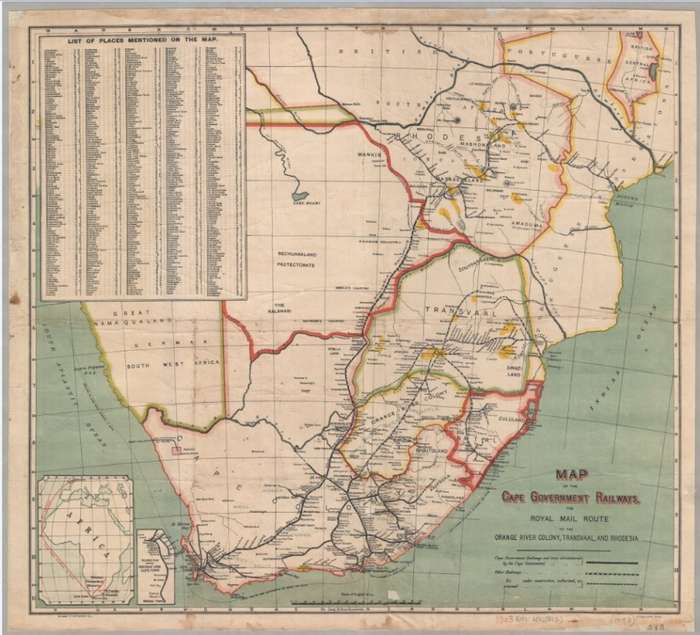
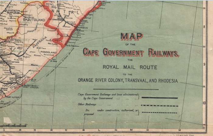
 Title: Cape Government Railways Royal Mail Route 1903 1 x Map Digital Download.
Publisher: Cape Government railways. T.T. & S. Cape Town.
Format: Vintage Printed Map that has been scanned and saved as a JPEG image.
Printed Size on a large format printer would be as follows:-
Height: @ 90cm.
Width: 75cm.
Total Number of Files: 1 x JPEG images @ 11.3MB.
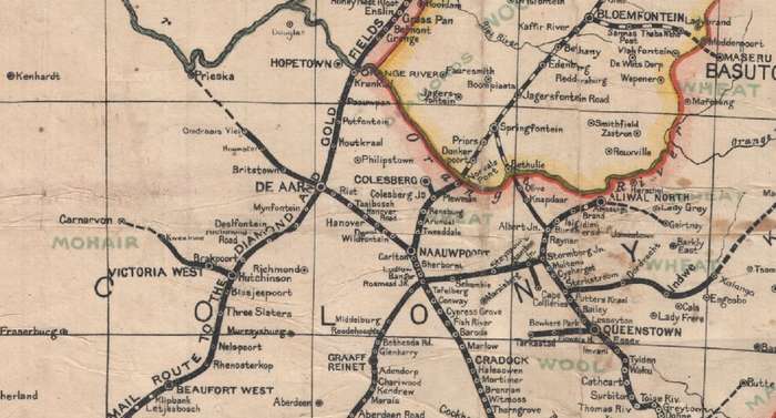
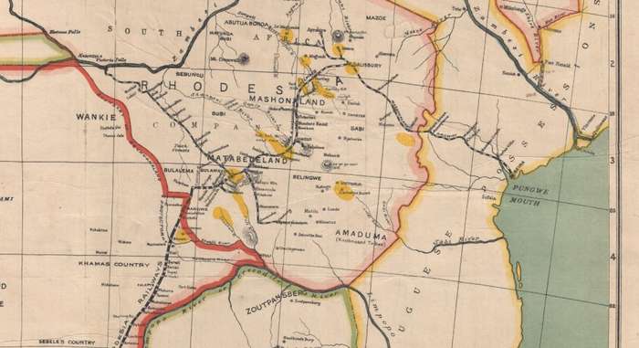
Info: 1903 Map of the Mail route from England to the Union and into the interior via Rail. With Shipping Routes and durations. Rail lines and stations from Cape Town to Rhodesia and Portuguese East Africa.
Scale: 1 Inch to 20 miles. 
Format: Digital files transferred via WeTransfer - A download Link will be forwarded on completion of order.
Price: R 245.00 Inc Vat.


Add to cart

Recently viewed

See more
Free shipping
74% OFF
Bulget Eyewear Women's Eyeglasses (BG6499 51P04)
New
R709.33 R2,742.61
Cabin Air Filter Fit for Bmw E38 728i 730i 735i 740i 95-01 2 Pcs
New
R544.00
Zipper Black Short Skinny Sleeveless Romper
New
R972.00
45% OFF
1Pc 19.69x31.50inch 50x80cm Floor Mat
New
R347.00 R630.00

Similar products

Cape Southern Districts @ 1880/1900 Set of 14 Digital Maps Digital Download
New
R350.00
Northern Cape Provincial Map - Digital Download
New
R120.00
Vintage Railways Map of South Africa 1946 1 x Map Digital Download
New
R195.00
British Empire Colonies, Dependencies and Trade Routes Digital Map Digital Download
New
R195.00