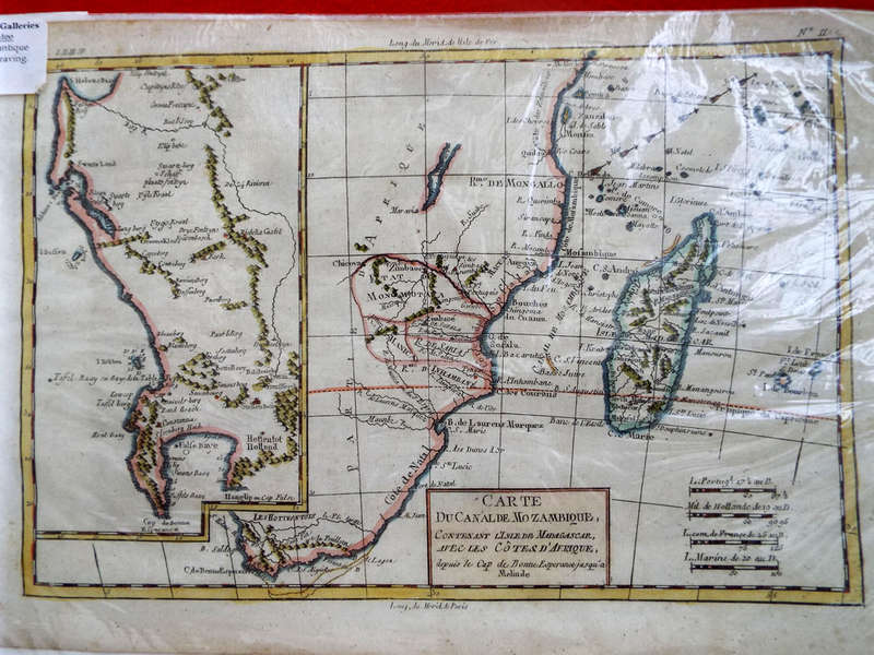
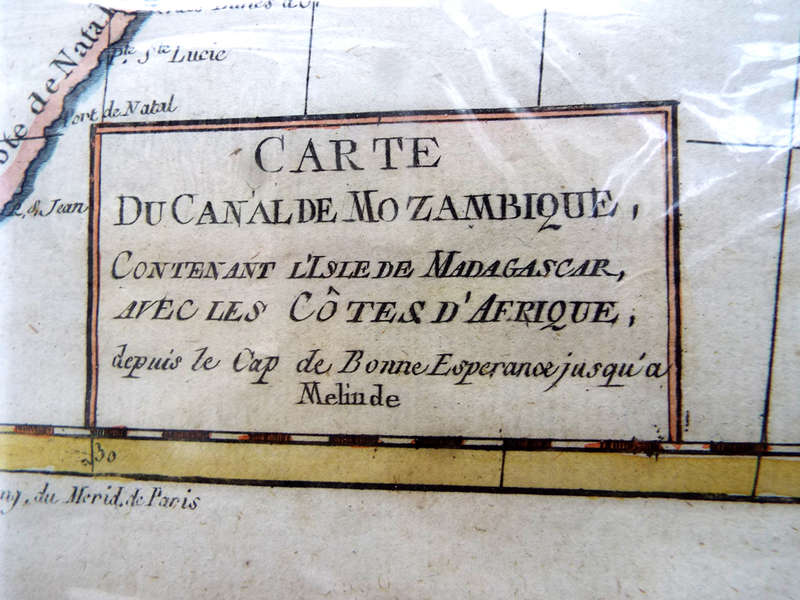
Description: Antique 1768 map Carte Du Canal De Mozambique. Ref. MP-12
Cartographer: Rigobert Bonne
Date: Estimated 1768
History: Bonne, 1727-1794, was one of the finest cartographers of the day, succeeding Bellin as the Royal Cartographer to France. Famous for his detailed and very accurate maps for the time. At an early age, Bonne taught himself mathematics and engineering and became one of Frances most distinguished mathematicians.
The map was drawn for G. Raynals Atlas de Toutes les Parties Connues du Globe Terrestre published in 1780 with many editions, apparently some being pirated copies.
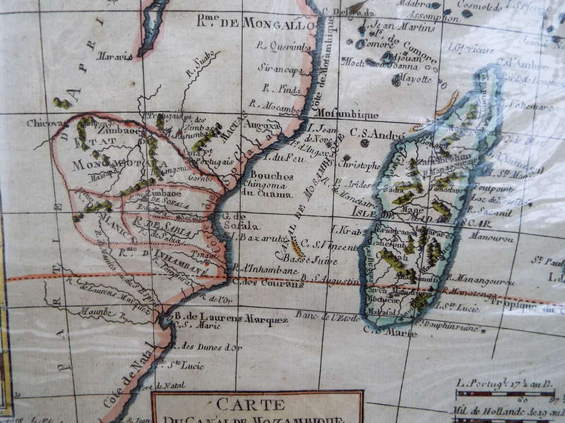
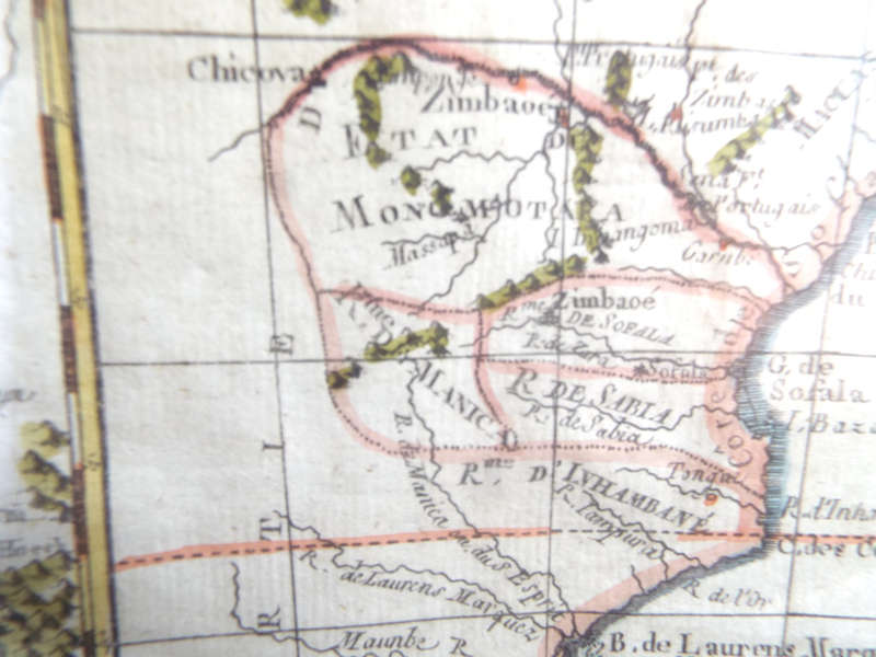
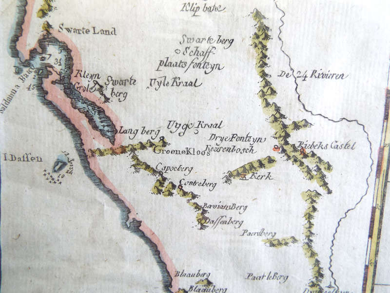
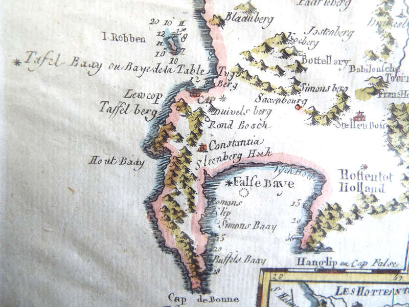
Description: An extremely interesting copper engraving, the title of which is Carte Du Canal De Mozambique. The larger, right side of the map covers the area from Cape of Good Hope right up to Mombasa in what is now Kenya including Mozambique and Madagascar and inwards towards Monomotapa. This area was important, as it was often associated with the Biblical Kingdom of Ophir, renowned for its gold deposits.
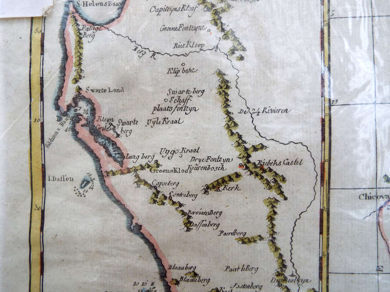
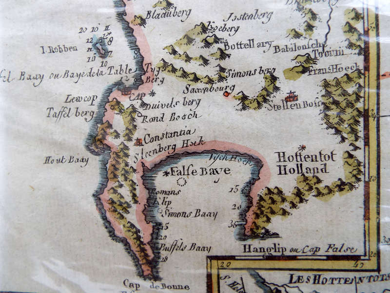
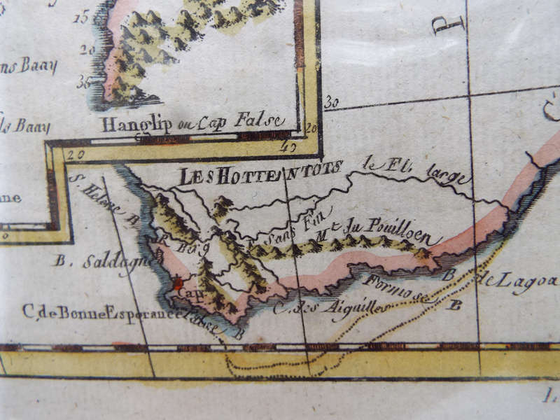
A series of arrows at the top of the map indicates the Trade Winds, crucial for early trade routes to India and the Middle East. Offshore reefs and part of present day Lake Malawi are also shown. The smaller section of the map to the left shows the area from Cape of Good Hope up to St Helens Bay. Robben Island and Dassen Island show depth soundings. Indigenous African groups are depicted as well as early Dutch farming districts and mountain ridges.
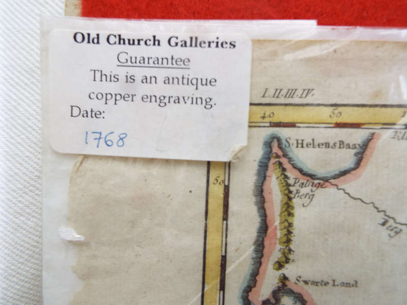
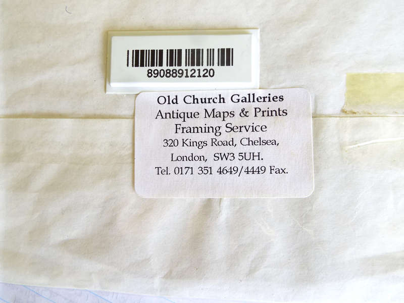
Condition: In very good condition for its age. The map is hand-coloured and shows NO centre fold. It is encased in an old envelope with clear plastic front (and was photographed through the plastic) and originally was purchased from Old Church Galleries in Chelsea. Two labels from Old Church Galleries are found, the one on the front with the date 1768 and Guarantee printed on it and on the reverse we find a similar label with address as well as a Bar Code. It appears that the map has NOT been removed from the envelope since purchase. Please take note of the old script shown on this map and compare it to the script on other similar maps for sale on Google. You will be sure to spot the difference, many of the maps I have seen advertised show the script in a more modern text.
Dimensions: The page measures 39cm x 25cm
For comparison Please check prices on Google, you will see these maps are priced at around R9,600 upwards.
Price: R3,750.00
Please note, I am NOT a qualified archaeologist/antiquarian and the description I have given is based on research of the subject.
This is a genuine antique. Please remember the classification of an 'antique' is that it should be 100 years old, OR MORE.
Terms: We offer a strict three-day approval period from the date the parcel reaches you. Refunds/credits are based on the cost of the article, NOT including delivery charges. Please advise us within this period whether you would like to return any article for a refund/credit. Although we pride ourselves in our packing, the buyer remains responsible for loss, non-arrival or damage to goods being sent to, or returned.