Similar products


| Main centres: | 1-3 business days |
| Regional areas: | 3-4 business days |
| Remote areas: | 3-5 business days |
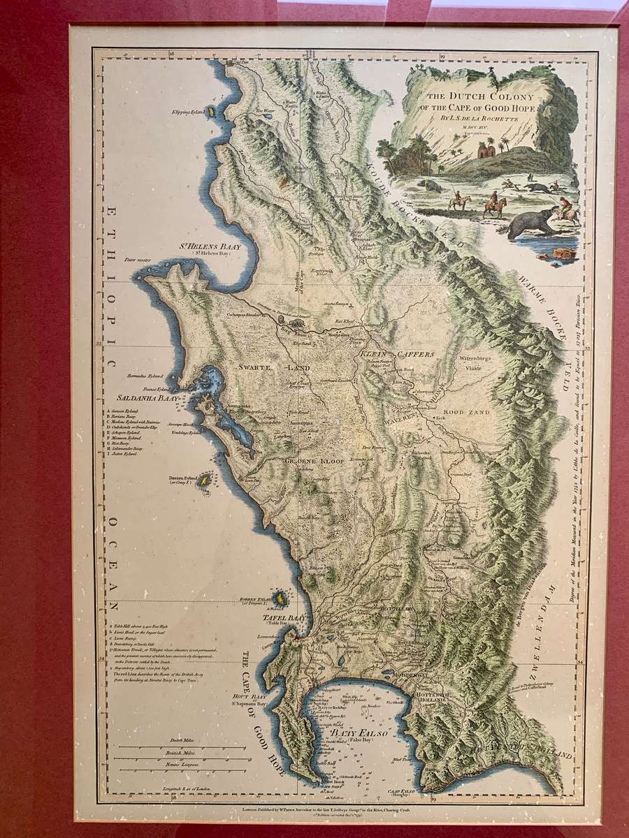
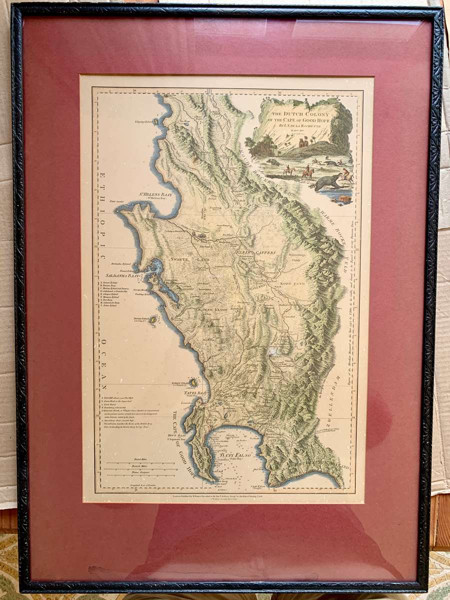
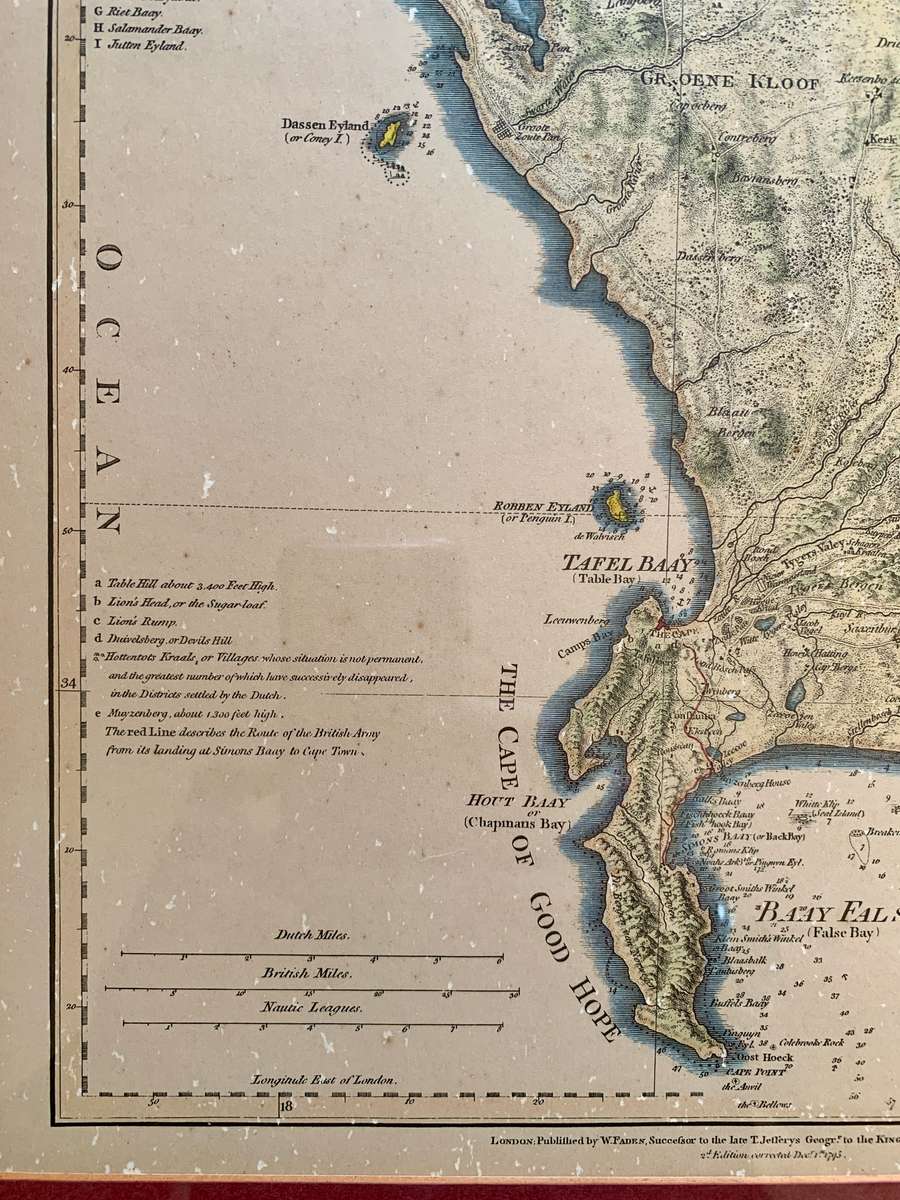
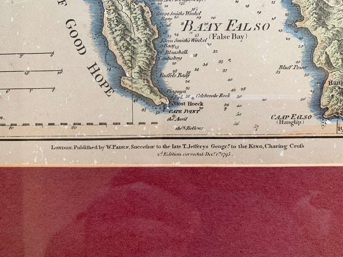
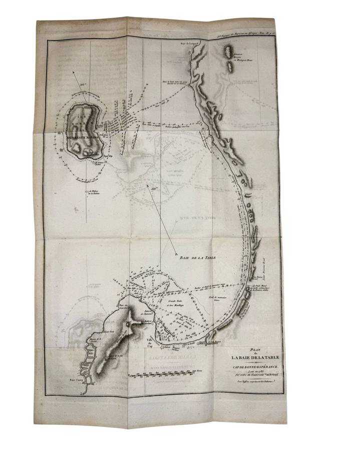
Second edition of this highly detailed map of the Dutch Colony on the Cape of Good Hope, first published in 1782.
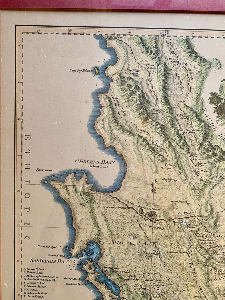
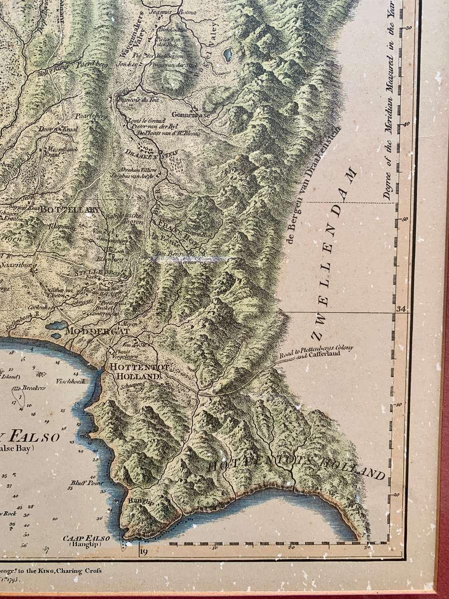
The map is particularly rich in detail and scope, stretching from "Klipping Eyland" to "Cape Falso". The addition of "Muyzenberg about 1300 feet high" in the second edition suggests an ongoing exploration and more profound knowledge of the region's topography during that period. The map labels approximately twenty farms and settlements, some of which were significant like Constantia and Stellenbosch. The geographical boundary of the Dutch colony is indicated by the imposing Drakenstein mountains to the east of the Cape.
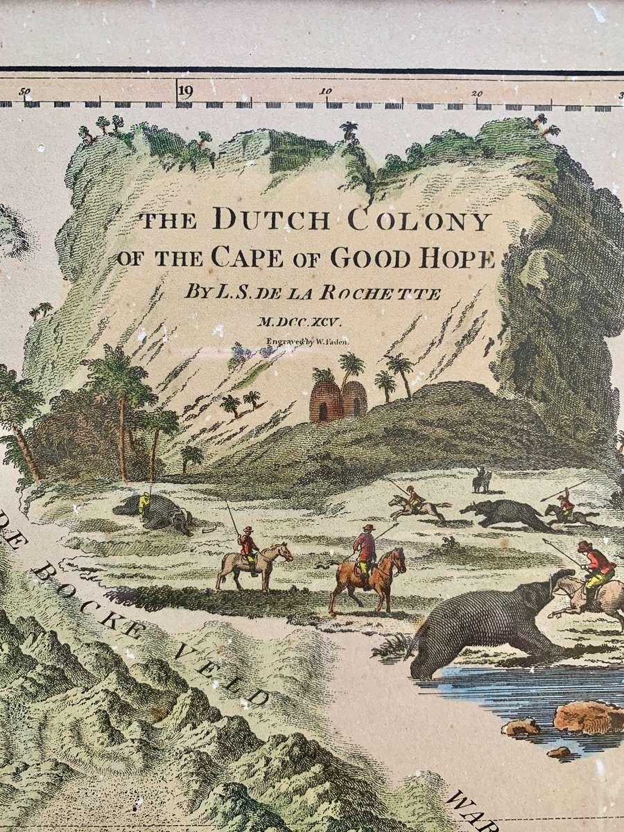
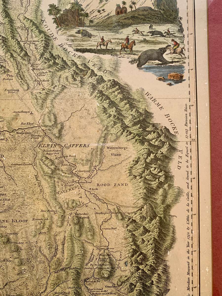
The cartouchea cliff bearing the titlefeatures picturesque palms, thatched huts, and a majestic elephant, indicative of the local fauna, in the foreground. Its purpose is not merely decorative, as it provides a glimpse into the life and environment of the indigenous people during the colonial period.
A five point key identifies important areas on the map.
In the 17th and 18th centuries, the Cape of Good Hope was a crucial way station for the Dutch East India Company (VOC) en route from Europe to the East Indies. Established in 1652 by Jan van Riebeeck, the colony was initially intended to provide fresh produce to prevent scurvy among sailors during their long voyages. The settlement at the Cape quickly evolved, growing to include a more permanent population and becoming a vital trading post for the VOC.
By the late 18th century, the time of the map's publication, the Cape Colony was a well-established, if not somewhat isolated, outpost of the Dutch Empire. The local population was a mixture of Dutch settlers, indigenous Khoisan people, slaves from Southeast Asia and East Africa, and a growing community of freed slaves and mixed-race individuals known as the Cape Coloureds.
The map, therefore, is more than a geographical representation; it is a historical artifact, providing a window into a pivotal moment in the Cape Colony's development, as it transitioned from a small provisioning station to a diverse, multicultural settlement on the brink of major geopolitical shifts.