This item has closed with no items sold
View other items offered by Heritage Trades1500

Similar products

Antique Map of the Fort at Capo Corso, Corsica, 18th Century
Closed

Antique Map of the Fort at Capo Corso, Corsica, 18th Century

Secondhand 1 was available
R550.00
Shipping
This product qualifies for free shipping in South Africa, using one of our trusted couriers. Offers below R350.00 do not qualify for free shipping.
Check my rate
Free collection is available from various lockers and counter collection points across South Africa. Offers below R350.00 do not qualify for free shipping.
View locations
The seller allows collection for this item. Buyers will receive the collection address and time once the order is ready.
The seller has indicated that they will usually have this item ready to ship within 2 business days. Shipping time depends on your delivery address. The most accurate delivery time will be calculated at checkout, but in general, the following shipping times apply:
 
Standard Delivery
Main centres:  1-3 business days
Regional areas: 3-4 business days
Remote areas: 3-5 business days
Buyer protection
Get it now, pay later

Product details

Condition
Secondhand
Location
South Africa
Area
Europe
Time Period
Pre-1800s
Type
Physical Map
Product code
ms
Bob Shop ID
657478718

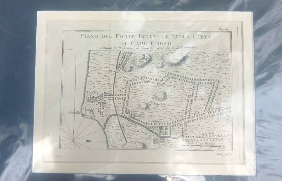
Antique Map of the Fort at Capo Corso, Corsica, 18th Century, copperplate engraving, original, Italian with mount suitable for framing, 36.7 cms x 30.2 cms, condition: very good.

Image photographed under protective plastic.

Cap Corse is a 40 kilometres (25 mi) long peninsula located at the northern tip of the island.