Atlas de Moçambique Rare 1st Ed, numbered 2046/2500, 1960
Check my rate
| Main centres: | 1-3 business days |
| Regional areas: | 3-4 business days |
| Remote areas: | 3-5 business days |
Product information
Atlas de Moçambique (numbered 2046/2500)
Number 2046 of 2500 numbered copies, with publisher's oleographic stamp, of the first impression of the first edition of this fascinating record of Moçambique at the end of the colonial era.
Cream coloured board covers are bound with a brown canvas spine. The binding is tight and the book is internally clean and without markings other than those mentioned above. The copy is in very good condition. There is no dust jacket and the cover shows some edge wear and staining.
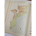
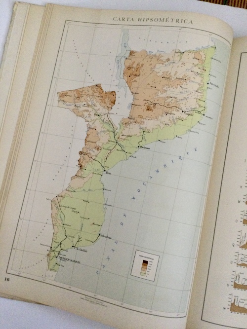
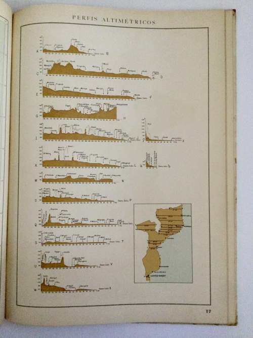
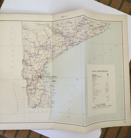
The Atlas was published as part of the commemorations of the 5th Centenary of the Death of Infante D. Henrique, and intended to contribute to a better understanding of the Portuguese Province of Mozambique. The main geographical features, main urban centers and road and rail systems of the former Portuguese colony are shown on a scale of 1:1,000,000. Also contained are a series of 21 colour maps/sketches (some of which are foldable) at a scale of 1:6,000,000. Statistical data is given on the geography (geological, mineralogical, climatic, rainfall), and population (linguistic groups, ethnic groups, location and number of missions) for the period immediately preceding the war of independence, starting in 1964. It shows 11 provinces, with main cities: Niassa - Lichinga, Cabo Delgado - Pemba, Napula (formerly district of Mozambique) - Nampula, Zambézia - Quelimane, Tete - Tete, Manica - Chimoio, Sofala - Beira, Inhambane - Inhambane, Gaza - Xai-Xai, Maputo Province - Matola City, Maputo City. Note: Sofala and Manica were still considered separate provinces at the time of printing, but has since been united.
Publisher: Empressa Moderna, Mozambique
1st Edition, 1st Printing, 1960
Language: Portuguese
Hardcover: 45 pages
Dimensions: 385 x 285 x 12 mm (L x W x T)
Item Mass: 0.85 kg
Condition: Used