Introduction
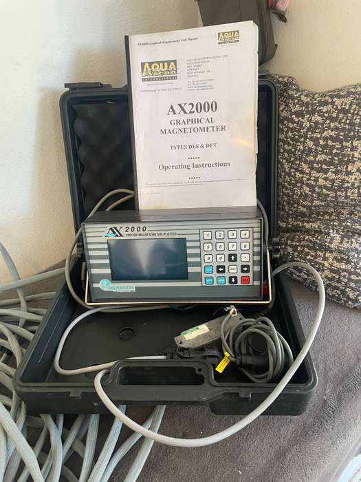
The main feature of the AX2000 Proton Magnetometer is the very high contrast graphical display set behind an attractive front panel, plus an integral membrane key pad with a tactile response. Of the 20 keys 10 are numeric, 4 are arrowed and the remainder are dedicated function keys. The electronics are housed in an ABS plastic enclosure from the same family as the AQUASCAN MC5 Proton Magnetometer, thus providing a high level of environmental protection, and a gimbal mount for ease of removal or adjustment of the display angle. Selecting the operating mode and individual settings, is by a sequence of menus that are easily accessed and selected via the keypad. A high degree of automatic selection through the software routines is also incorporated, particularly for initial input tuning optimisation - at the local ambient magnetic field strength, additionally the scales can be set in either linear or logarithmic modes to enhance the presentation of information.
Survey
Fullest range of professional and commercial applications are served by the variety of options available in the AX2000 Proton Magnetometer system :- including all types of archaeological and marine survey for anchors, cannon, cables, pipeline and general ferrous material.
Salvage
An essential tool for the professional salvor, providing an effective tool for the pinpointing of items for recovery - even when they have become deeply buried in silt and mud etc.
Diving
Offers a positive means of wreck location and in particular provides a powerful means to survey an extensive area of seabed when only an approximate position of a wreck is known . The magnetometer is the most successful tool in modern times for locating "virgin" wrecks.
System Description
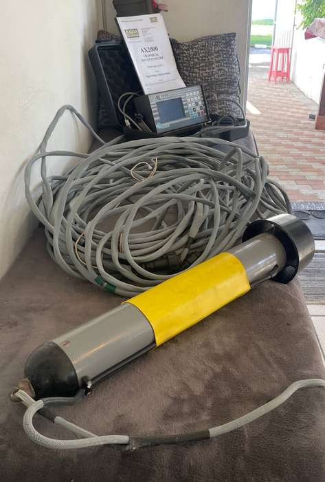
The standard AX2000 Proton Magnetometer is a microprocessor controlled instrument consisting of an electronic module together with a solenoid type sensor (towfish), 40M (130ft) of cable and a light weight storage drum.
The AX2000 functions as a graphical display magnetometer with continuous data recording by means of internal memory storage, digital printer or direct PC interface (baud rates are selectable). Positional information derived from accurate navigation source can also be correlated with the magnetometer readings to provide a comprehensive survey log. The system is intended to be offered as a standard or professional version with optional features such as monitoring towfish depth, increased datalogging facilities and on screen position plotting.
COLLECTION OR COURIER FOR BUYERS ACCOUNT.