This item has closed with no items sold
View the relisted Item
View other items offered by CapeCollectables1289

Similar products

Northern and Southern Rhodesia 1913 British South Africa Company Digital Map Digital Download
New
R195.00
Antique Map Lithograph Nova Totius Germaniae Descriptio Vintage Map
Secondhand
R2,850.00
Transvaal, Welverdiend Map- Geographical Section, General Staff, 1913
Secondhand
R350.00
1905 Map of Africa, Excellent condition, Original German Mayer Map Showing Expeditions
Secondhand
R395.00
British Antarctic Terra Nova Expedition 1910-1913 Maps Of The Exploration Framed British Antarctic Terra Nova Expedition 1910-1913 Maps Of The Exploration Framed British Antarctic Terra Nova Expedition 1910-1913 Maps Of The Exploration Framed British Antarctic Terra Nova Expedition 1910-1913 Maps Of The Exploration Framed British Antarctic Terra Nova Expedition 1910-1913 Maps Of The Exploration Framed British Antarctic Terra Nova Expedition 1910-1913 Maps Of The Exploration Framed British Antarctic Terra Nova Expedition 1910-1913 Maps Of The Exploration Framed British Antarctic Terra Nova Expedition 1910-1913 Maps Of The Exploration Framed British Antarctic Terra Nova Expedition 1910-1913 Maps Of The Exploration Framed British Antarctic Terra Nova Expedition 1910-1913 Maps Of The Exploration Framed
British Antarctic Terra Nova Expedition 1910-1913 Maps Of The Exploration Framed British Antarctic Terra Nova Expedition 1910-1913 Maps Of The Exploration Framed British Antarctic Terra Nova Expedition 1910-1913 Maps Of The Exploration Framed British Antarctic Terra Nova Expedition 1910-1913 Maps Of The Exploration Framed
British Antarctic Terra Nova Expedition 1910-1913 Maps Of The Exploration Framed
+6
Closed

British Antarctic Terra Nova Expedition 1910-1913 Maps Of The Exploration Framed

Secondhand 1 was available
R395.00
Shipping
Free shipping is available from CapeCollectables for all orders above R1,500.00, using one of our trusted couriers.
Check my rate
The seller allows collection for this item. Buyers will receive the collection address and time once the order is ready.
The seller has indicated that they will usually have this item ready to ship within 3 business days. Shipping time depends on your delivery address. The most accurate delivery time will be calculated at checkout, but in general, the following shipping times apply:
 
Standard Delivery
Main centres:  1-3 business days
Regional areas: 3-4 business days
Remote areas: 3-5 business days
Buyer protection
Returns
Money-Back Guarantee: 7 Days: Excludes Cost Of Shipping
Get it now, pay later

Product details

Condition
Secondhand
Location
South Africa
Area
Antartica
Time Period
1900-1950
Type
Other
Bob Shop ID
619672167

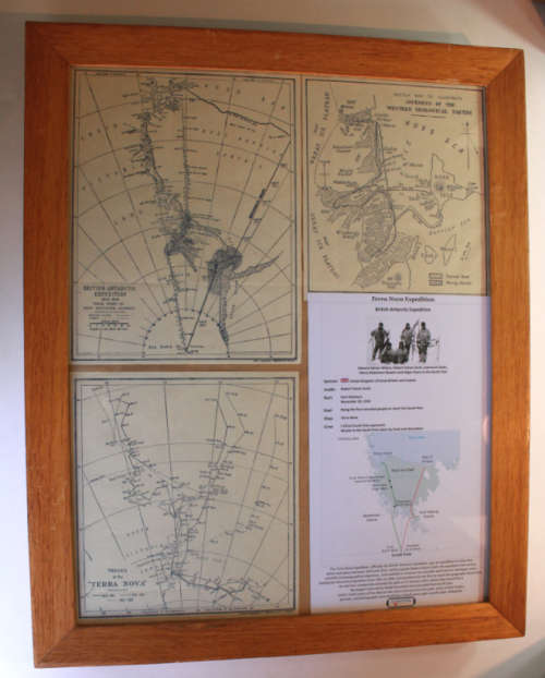
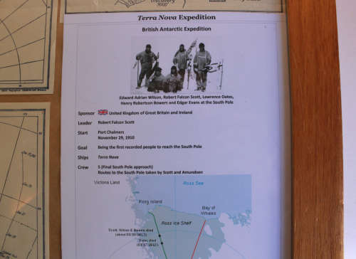
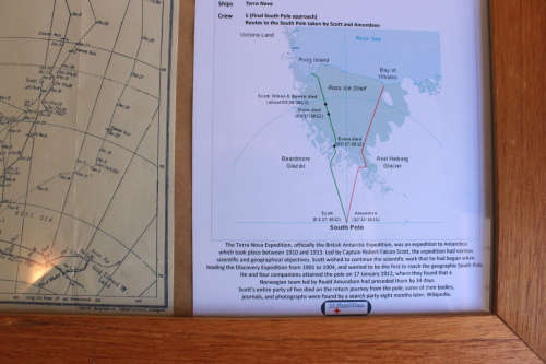
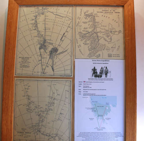
Title: British Antarctic Terra Nova Expedition 1910-1913 Maps Of The Exploration Framed
Publisher: Collins Geographical Establishment, Glasgow.
Format: Printed maps of the "British Antarctic Expedition 1910-1913". 
Height: 46cm.
Width: 38cm.
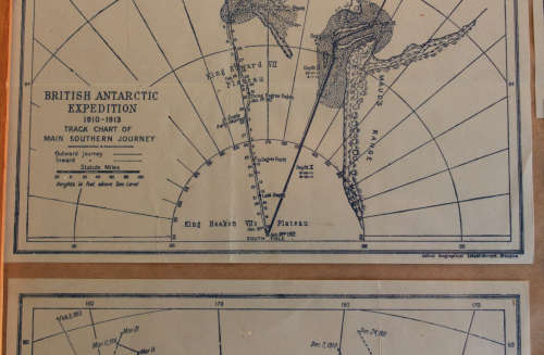
Info: The Maps include information of the British Antarctic Expedition of 1910-1913, with a Main Map of the "Track Chart Of Main Southern Journey" indicating the Outward and Inward tracks in Miles with comments of events.
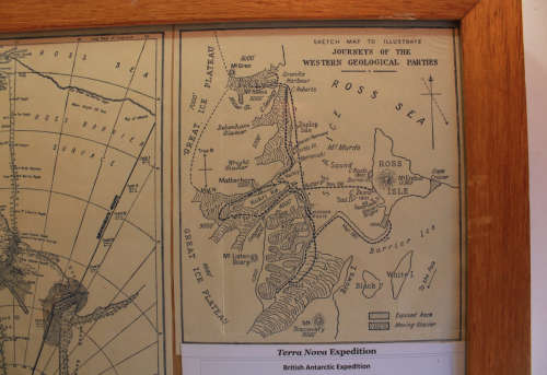
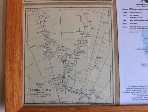
There are a further Two x Inset Maps that depict the Tracks of the "Terra Nova" as well as the Sketch Map to Illustrate the "Journeys Of The Western Geological Parties" on The Ice Shelf in the Ross Sea area.
Scale: 2 Inches = 100 Miles.
Condition: Good, old maps that have been mounted in a frame.
Price: R 395.00 Inc Vat.


Recently viewed

See more
Grand Maitre Drop Forged Chef's Knife, 20cm
New
R3,749.00
Hoppity the softest, cutest Bunny ever! Beautiful plush toy! 40cm.
Secondhand
R59.00
48% OFF
Tunnel Racing
New
R103.48 R199.00
The Passion Of The Western Mind: Understanding The Ideas That Have Shaped Our World View
Secondhand
R130.00