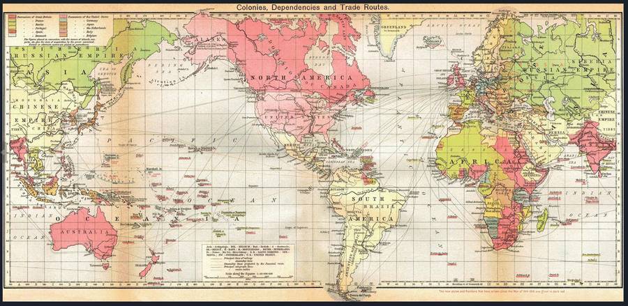
British Empire Colonies, Dependencies and Trade Routes Digital Map Digital Download
Digital product
New
1 was available
R195.00
0% off
Shipping
This is a digital product (eg. voucher, product license, service, etc.) and does not require shipping.
The seller will be in contact to deliver this product to you electronically.
The seller has indicated that they will usually have this item
ready to ship within 3 business days.
Shipping time depends on your delivery address.
The most accurate delivery time will be calculated at checkout,
but in general, the following shipping times apply:
Title: British Empire Colonies, Dependencies and Trade Routes Digital Map Digital Download. Publisher: Unknown. Format: Vintage Printed Maps that have been scanned and saved as Tiff images. File Size: Total of 1.3MB. Total Number of Files: One. Scale 1: 80 000 000. Print To A3 / A2 Size. Info: Circa 1920's map of the British Empire and other Empires of the time after WW1. Format: Digital files transferred via WeTransfer - A download Link will be forwarded on completion of order. Price: R 195.00 Inc Vat.