This item has closed 1 buyer bought 1 item
View other items offered by CapeCollectables1035

Similar products

R30 shipping
Map of Somersetshire by Robert Morden Framed Reproduction Print
R445
R30 shipping
Caap De Goede Hoop Oostelijken Oever 1785 - 1794 Reproduction Print Map
R245
R30 shipping
Vintage Africa / Afrika Wall Map 1951 Reproduction print.
R195
R30 shipping
Reproduction Printed Map of the Cape Peninsula - Issued by The War Office 1909.
R295

Caap De Goede Hoop Oostelijken Oever 1785 - 1794 Reproduction Print Map

Secondhand
R495.00
Closed 17 Jun 19 21:15
Shipping
Standard courier shipping from R30
R30 Standard shipping using one of our trusted couriers applies to most areas in South Africa. Some areas may attract a R30 surcharge. This will be calculated at checkout if applicable.
Check my rate
Free collection from Kuils River, Cape Town
The seller allows collection for this item and will be in contact with the full collection address once the order is ready. Ready for collection by Wednesday, 22 May.
Ready to ship in
The seller has indicated that they will usually have this item ready to ship within 3 business days. Shipping time depends on your delivery address. The most accurate delivery time will be calculated at checkout, but in general, the following shipping times apply:
 
Standard Delivery
Main centres:  1-3 business days
Regional areas: 3-4 business days
Remote areas: 3-5 business days
Returns
Money-Back 7 Days
Money-Back Guarantee: 7 Days: Refund if returned, excluding Postage.
Get it now, pay later
Buyer Protection

Product details

Condition
Secondhand
Location
South Africa
Area
Africa
Time Period
Pre-1800s
Type
Political Map
Customer ratings:
Bob Shop ID
417862898

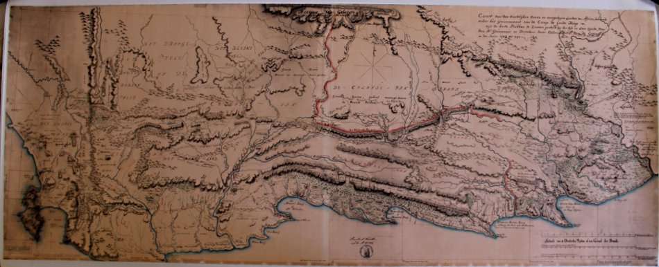
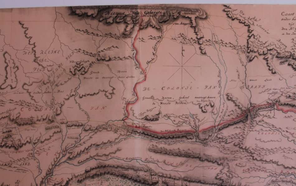
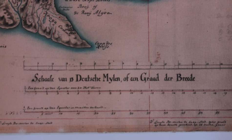
Title: Caap De Goede Hoop Oostelijken Oever 1785 - 1794 Reproduction Print Map.
Publisher: Gouvernment Van De Caap De Goede Hoop.
Height: 67cm.
Width: 150cm.
Info: Map of the South Western Cape from the Cape Peninsula to the Fish River from information compiled between 1785 to 1794.
Details of Towns and Wagon Trails from the time, as well as place names in Dutch. Mountain Ranges names and comments on the map in Dutch.

"Caart van den Oostelijken oever en aangelegen landen van Africa, behorende onder het Gouvernement Van De Caap De Goede Hoop uyt de beste Stukken te Zamen gesteld in der tijd in Loco Zynde, voor den Hr Gouverneur en Directeur deser Colonien G.J. Van De Graaf in den Jaare 1785 tot 1794."
It is interesting to note the shape of the coastline and rivers from the map makers of the time.
A very interseting and rare map that would suit a library or office / study in a good frame.
Format: Scanned from a Copy of the original and printed on Poster Paper.
Condition: Very Good, Scanned and Printed Reproduction Map.
Price: R 595.00 Inc Vat.

More from this seller

View all
South Africa 1/2 Penny 1934 Coin XF40 Circulated
R60
R30 shipping
And Furthermore by Judi Dench (With John Miller) by Stiffcover Book
R145
`Scrabble Board Words: Retirement Funds` Original Digital Download Stock Photo
R195
R30 shipping
Robinson Crusoe by Daniel Defoe, A Norton Critical Edition Softcover Book
R145

Recently viewed

See more
SHEER CLARET/GOLD 10mmx20m
R90
PATONS 6351 A PRETTY PAIR OF MATINEE COATS TO FIT 18 - 19 INCH
R10
R30 shipping
Hybrid 12H200S
R499
Various Artists - 20 Sokkie Jol Danstreffers (CD)
R15

Customer ratings: 1 ratings

why
01 Jul 2019