
Caap De Goede Hoop Oostelijken Oever 1785 - 1794 Reproduction Print Map
Secondhand
Shipping
Standard courier shipping from R30
R30 Standard shipping using one of our trusted couriers applies to most areas in South Africa. Some areas may attract a R30 surcharge. This will be calculated at checkout if applicable.
Check my rate
Check my rate
Free collection from
Kuils River, Cape Town
The seller allows collection for this item and will be in contact with the full collection address once the order is ready.
Ready for collection by Friday, 31 May.
Ready to ship in
The seller has indicated that they will usually have this item
ready to ship within 3 business days. Shipping time depends on your delivery address. The most
accurate delivery time will be calculated at checkout, but in
general, the following shipping times apply:
Standard Delivery
| Main centres: | 1-3 business days |
| Regional areas: | 3-4 business days |
| Remote areas: | 3-5 business days |
Returns
Get it now, pay later
Seller
Buyer Protection
Product details
Condition
Secondhand
Location
South Africa
Area
Africa
Time Period
Pre-1800s
Type
Political Map
Bob Shop ID
614086923
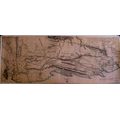
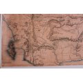
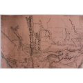
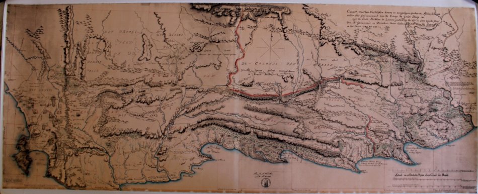
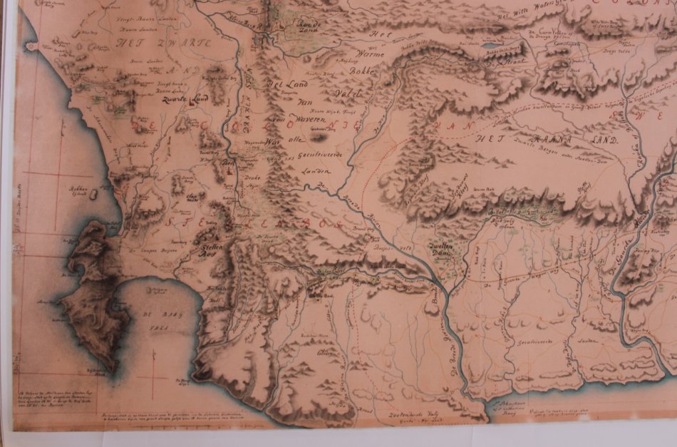
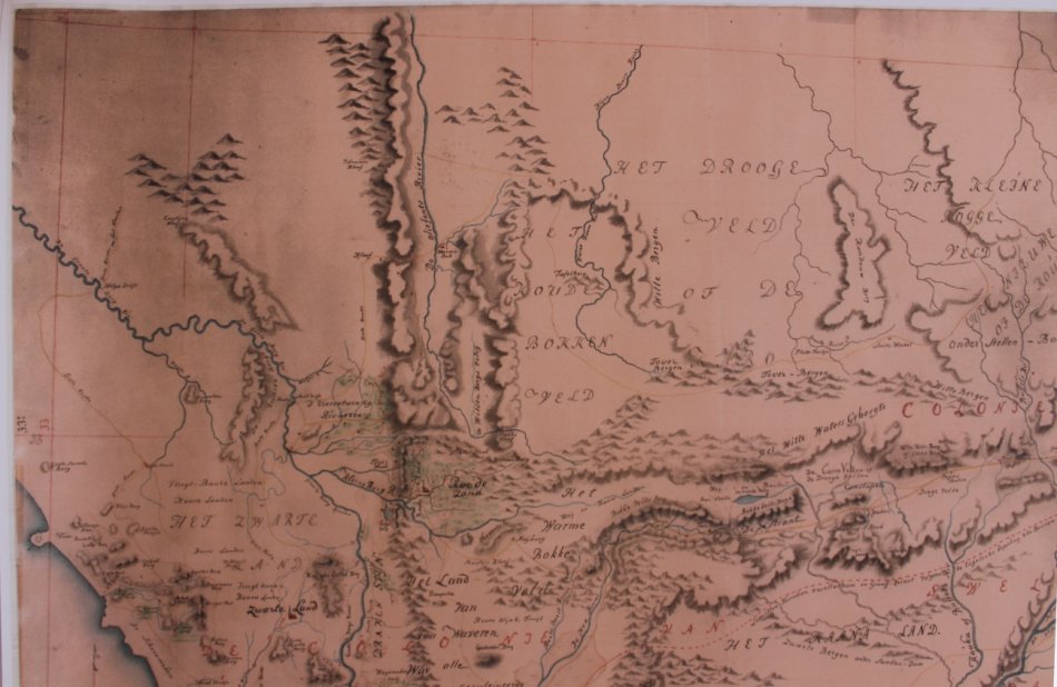
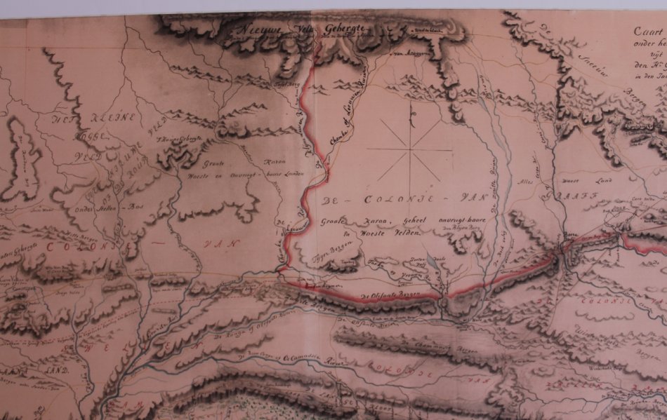
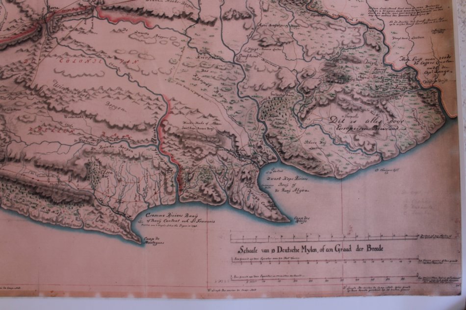
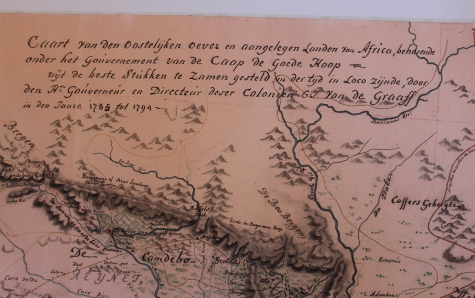
Title: Caap De Goede Hoop Oostelijken Oever 1785 - 1794 Reproduction Print Map.
Publisher: Gouvernment Van De Caap De Goede Hoop.
Height: 67cm.
Width: 150cm.
Info: Map of the South Western Cape from the Cape Peninsula to the Fish River from information compiled between 1785 to 1794.
Details of Towns and Wagon Trails from the time, as well as place names in Dutch. Mountain Ranges names and comments on the map in Dutch.
"Caart van den Oostelijken oever en aangelegen landen van Africa, behorende onder het Gouvernement Van De Caap De Goede Hoop uyt de beste Stukken te Zamen gesteld in der tijd in Loco Zynde, voor den Hr Gouverneur en Directeur deser Colonien G.J. Van De Graaf in den Jaare 1785 tot 1794."
It is interesting to note the shape of the coastline and rivers from the map makers of the time.
A very interseting and rare map that would suit a library or office / study in a good frame.
Format: Scanned from a Copy of the original and printed on Poster Paper.
Condition: Very Good, Scanned and Printed Reproduction Map.
Price: R 245.00 Inc Vat.
![]()