Cape of Good Hope Eastern Frontier 1836 Poster Map Digital Download Cape of Good Hope Eastern Frontier 1836 Poster Map Digital Download Cape of Good Hope Eastern Frontier 1836 Poster Map Digital Download Cape of Good Hope Eastern Frontier 1836 Poster Map Digital Download Cape of Good Hope Eastern Frontier 1836 Poster Map Digital Download Cape of Good Hope Eastern Frontier 1836 Poster Map Digital Download Cape of Good Hope Eastern Frontier 1836 Poster Map Digital Download
Cape of Good Hope Eastern Frontier 1836 Poster Map Digital Download Cape of Good Hope Eastern Frontier 1836 Poster Map Digital Download Cape of Good Hope Eastern Frontier 1836 Poster Map Digital Download Cape of Good Hope Eastern Frontier 1836 Poster Map Digital Download
Cape of Good Hope Eastern Frontier 1836 Poster Map Digital Download
+3

Cape of Good Hope Eastern Frontier 1836 Poster Map Digital Download

Digital product
New 1 available
Only 1 left – grab it before it’s gone!
R295.00
Shipping
This is a digital product (eg. voucher, product license, service, etc.) and does not require shipping. The seller will be in contact to deliver this product to you electronically.
The seller has indicated that they will usually have this item ready to ship within 3 business days. Shipping time depends on your delivery address. The most accurate delivery time will be calculated at checkout, but in general, the following shipping times apply:
 
Standard Delivery
Main centres:  1-3 business days
Regional areas: 3-4 business days
Remote areas: 3-5 business days
Seller
Buyer protection
Get it now, pay later

Product details

Condition
New
Location
South Africa
Area
Africa
Time Period
1800s
Type
Political Map
Product code
8326133
Bob Shop ID
630336201

Title: Cape of Good Hope Eastern Frontier 1836 Poster Map Digital Download.
Year: 1836.
Scale: Imperial / 1:25 / 1 Inch = 25 Miles.
File Type: Tif File Image.
File Size: 27 MB.
Printed Size when printed up to: About 58cm x 72cm.
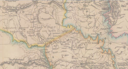
Info: Map of the Eastern Frontier of the Colony of the Cape of Good Hope.
Includes some detail of the Frontier Wars of the time post 1820 Settlers. 
The Cape Colony Governor in 1836 was Sir Benjamin D'Urban K.C.B.
Most Respectfully Inscribed to His Excellency by John Centlivres Chace (Chase), Secretary to the Cape of Good Hope Association for exploring Central africa, Joint Secretary to the South African Literary & Scientific Institution 1836.
Published by John Arrowsmith 36 Essex Street, Strand, London 10th October 1836.
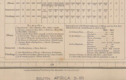
The map includes details on towns and villages with regards to houses and population and businesses in the area at the time.
Condition: Digital Download.
Price: R 295.00 Inc Vat.
On completion of the order and receipt of payment a WeTransfer link will be forwarded to your e-mail address for downloading of the file.


Add to cart

Recently viewed

Samsung s21 fe
Secondhand
R3,000.00 1 bid
9% OFF
TEKNOSA FRONT LEFT - RIGHT RACK END For VOLVO S70 2.4 (B5244S)(20V 125KW) 97-00
New
R299.00 R329.00
Splodgenessabounds - Simon Templar Vinyl 7 single
Secondhand
R150.00 No bids
10% OFF
ATE Front Brake Pads For Ford Laser Laser 1.3 1994-1999
New
R529.00 R589.00

Similar products

National Geographic Africa 1909 Poster Map Digital Download
New
R295.00
Fairest Cape Map of Cape Peninsula 2000 Digital Download
New
R195.00
Cape Peninsula 1909 War Office Map Digital Download
New
R195.00
Eastern Frontier of the Colony Of the Cape of Good Hope Wall Map 1853, Reproduction Print
Secondhand
R295.00