This item has closed 1 buyer bought 1 item
View other items offered by christinas5680

Similar products

Where to Climb in the British Isles | Edward C. Pyatt
Secondhand
R60.00
Vintage Folded Map Motorists` Map of South East & East Midlands, #2 First Edition 1977
Secondhand
R155.00
vintage road map of South Africa, published by the Vacuum Oil Company of South Africa, Limited.
Secondhand
R200.00
Antique 1768 map Carte Du Canal De Mozambique. Ref. MP-12
Secondhand
R3,750.00
Carte des Isles Maldives. Carte des Isles Maldives. Carte des Isles Maldives. Carte des Isles Maldives. Carte des Isles Maldives.
Sold

Carte des Isles Maldives.

Secondhand 1 was available
R1,250.00
Shipping
R35.00 Standard shipping using one of our trusted couriers applies to most areas in South Africa. Some areas may attract a R30.00 surcharge. This will be calculated at checkout if applicable.
Check my rate
The seller has indicated that they will usually have this item ready to ship within 5 business days. Shipping time depends on your delivery address. The most accurate delivery time will be calculated at checkout, but in general, the following shipping times apply:
 
Standard Delivery
Main centres:  1-3 business days
Regional areas: 3-4 business days
Remote areas: 3-5 business days
Buyer protection
Get it now, pay later

Product details

Condition
Secondhand
Location
South Africa
Time Period
1800s
Product code
office
Bob Shop ID
641655914

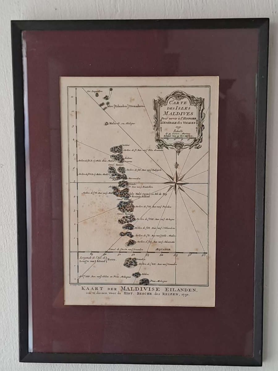
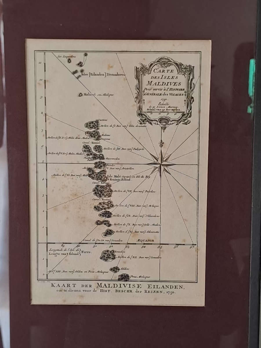
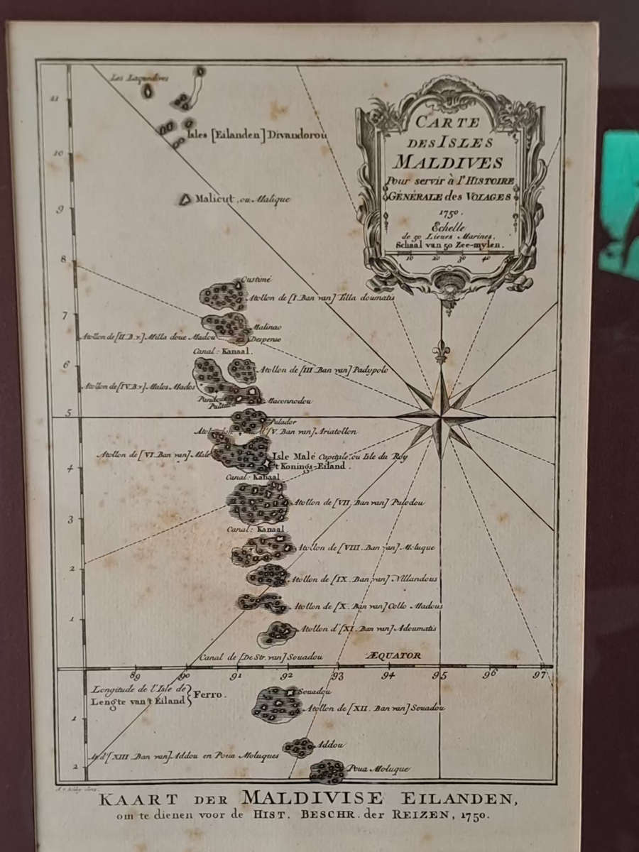
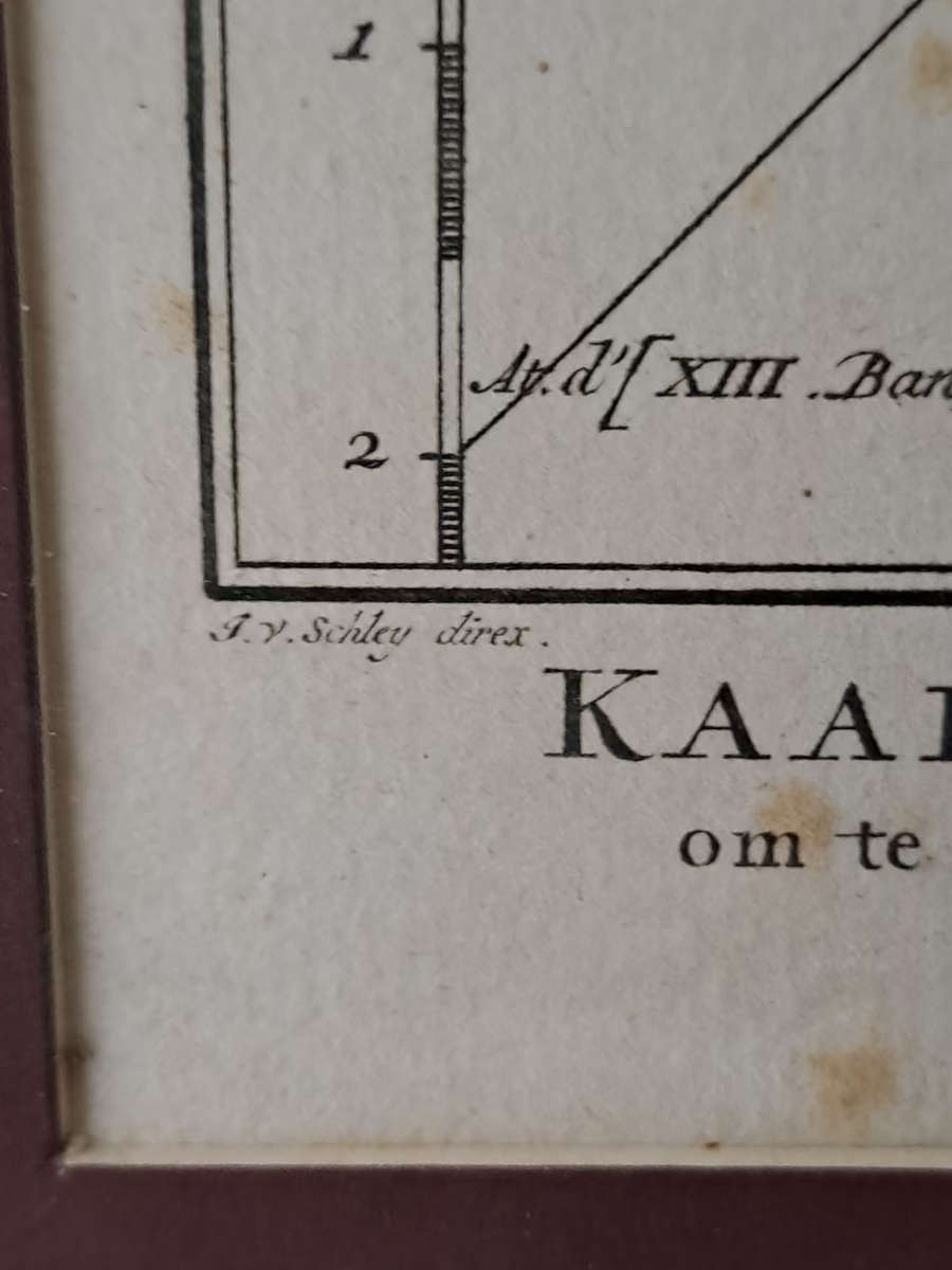
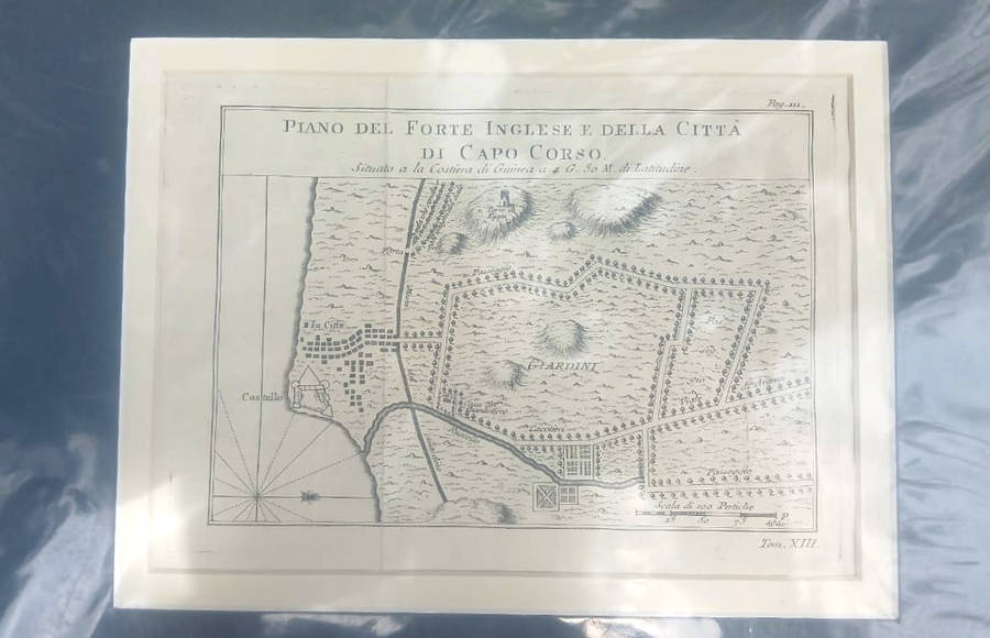
.A very nice map of the Maldives Islands from Atlas Portatif pour servir a l'intelligence de l'Histoire Philosophique et Politique des etablissements et du commerce des Européens dans les deux Indes.

After Jacques Nicolas Bellin (1703-1772) who was one of the most important and proficient French cartographers of the mid-eighteenth century. He was appointed the first Ingenieur Hydrographe de la Marine, and also Official Hydrographer to the French King.
Bellin produced a substantial number of important separately issued maps, particularly reflecting continuing discoveries and political events in the Americas.
With French text in title cartouche and an additional title in Dutch underneath the map.
RARE.  map drawing size 215 x 152 mm

some blemishes on paper

Recently viewed

See more
170gsm Matte Photo Paper (20 sheets)
New
R135.00
Free shipping
Guess Men's Watch (i30005g1)
New
R6,963.29
For Beetle 06-10 Left+right Front Bumper Lower Grille Honeycomb Grill
New
R730.00
Yes! Energy by Loral Langemeier
New
R252.00