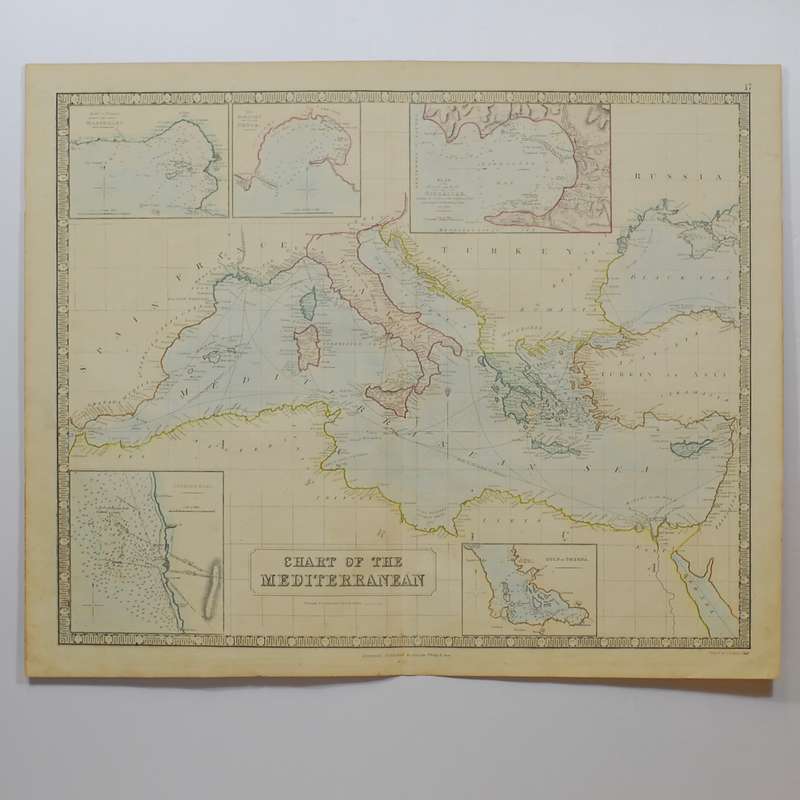
Chart of the Mediterranean showing Steam Communication Lines -

Chart of the Mediterranean showing Steam Communication Lines -

1 available / new
Only 1 left – grab it before it’s gone!
R2,030.00
Shipping
R35.00 Standard shipping using one of our trusted couriers applies to most areas in South Africa. Some areas may attract a R30.00 surcharge. This will be calculated at checkout if applicable.
Check my rate
The seller has indicated that they will usually have this item ready to ship within 3 business days. Shipping time depends on your delivery address. The most accurate delivery time will be calculated at checkout, but in general, the following shipping times apply:
 
Standard Delivery
Main centres:  1-3 business days
Regional areas: 3-4 business days
Remote areas: 3-5 business days
Seller
Buyer protection
Get it now, pay later

Product details

Condition
New
Location
South Africa
Product code
301542
Bob Shop ID
591470686

Large hand-coloured steel engraved map. Good condition with clear unfaded colour. With insets of Bay and Roads of Marseilles, the Harbour of Genoa, Plan of the Rock and Bay of Gilbratar, Lechorn Road and Gulf of Smyrna. Margins frayed, some age toning and a central fold. Engraved by Gellatly, Edinburgh. Sheet size: 45.4cm x 66.5cm

Publisher: George Philip & Son
Date Published: 1851
Publication Place: Liverpool
First Edition: Yes

Condition: Good

Dimensions: Sheet size: 454cm x 665cm

Add to cart

Recently viewed

See more
OFBN RANGE LED FLOODLIGHTS
R99.00
AUTOGRAPHED SIGNED IVAN MAUGER MOTOR CYCLE CHAMPION HALF SIZE OF A4
R880.00
Seagate One Touch Hub 4TB USB-A External Desktop HDD
R3,262.00
Apatite - Faceted Round Shape - 0.13cts
R131.00 No bids

Similar products

An introduction to communication studies - Sheila Steinberg
R618.00
The Nautical Chart
R105.00
Corporate communication (Paperback, 2nd Edition)
R495.00
MESSAGES FROM THE STARS - COMMUNICATION & CONTACT WITH EXTRA-TERRESTRIAL LIFE - A SCIENTIFIC VIEW -
R30.00