This auction has been won.
View other items offered by JeannineD1031
Leading
ivanych45 1 × R72.00
27 Oct 20:29
Runners-up
Net791335 1 × R65.00
27 Oct 20:27
CWP69106 1 × R52.00
27 Oct 12:45
garth b511 1 × R51.00
27 Oct 11:14
bellezze630 1 × R22.00
26 Oct 22:10

Similar products

56% OFF
1795 original antique map of the Cape of Good Hope
R7,500.00 R17,200.00
Antique Map of West Canada by John Tallis 1851
R795.00
ANTIQUE MAPS OF EUROPE, THE AMERICAS, WEST INDIES, AUSTRALASIA, AFRICA, THE ORIENT BY DOUGLAS GOHM
R250.00
Antique Map Lithograph Nova Totius Germaniae Descriptio Vintage Map
R2,850.00
Collecting Antique Maps by Jonathan Potter
Sold

Collecting Antique Maps by Jonathan Potter

1 was available / secondhand
R10.00 minimum increment
R72.00
Shipping
R65.00 Standard shipping applies to orders under R100.00, in most areas in South Africa. R35.00 Standard shipping applies to orders over R100.00. Some areas may attract a surcharge surcharge. This will be calculated at checkout if applicable.
Check my rate
The seller has indicated that they will usually have this item ready to ship within 2 business days. Shipping time depends on your delivery address. The most accurate delivery time will be calculated at checkout, but in general, the following shipping times apply:
 
Standard Delivery
Main centres:  1-3 business days
Regional areas: 3-4 business days
Remote areas: 3-5 business days
Buyer protection

Product details

Condition
Secondhand
Location
South Africa
Customer ratings:
Bob Shop ID
27863041

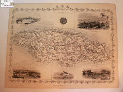
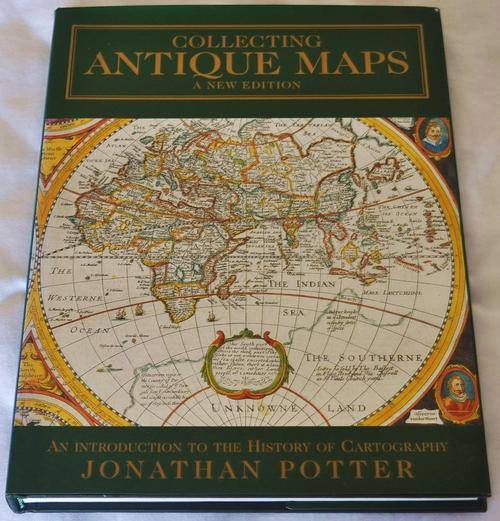
Jonathan Potter, London, 1999. Cloth. Book Condition: Very Good. Dust Jacket Condition: Very Good. Book in excellent condition.

Collecting Antique Maps by Jonathan Potter is an attractive book. It is packed with colour illustrations and virtually every page is illustrated, giving it a nice overall appearance. An introduction to the history of cartography. A thorough introduction to the history of antique maps and how to collect and enjoy them. Written by one of the world's leading antique map dealers, this new edition is extra illustrated with a new chapter on 19th century maps, and an additional chapter of up dated detail for collectors. 207 pages.

Three sections: Looking at Maps; Mapping the World and its Countries; Globes, Curiosities and Miniatures. Describes maps from the 15th to late 19th centuries covering all areas of the world.

Recently viewed

See more
PRIMORTALS ORIGINS - Issue # 1 Jan 1995
R35.00
Zimbabwe * $20 * issued 1997 * au note not unc
R59.00
ANDRE SNYMAN - RUGBY 1997 COLLECTION by PANINI - `BASE` TRADING CARD 16
R6.00
Pica Fine Dry Marker
R395.59

Customer ratings: 1 ratings

great seller will do business again
04 Nov 2010