This item has closed 1 buyer bought 1 item

Similar products

30% OFF
Brilliant Maps in the Wild
New
R280.00 R400.00
The Oval World - Tony Collins
New
R480.00
Picture Atlas of The World for South African Children (Hardcover)
Secondhand
R35.00
Natural World. A fascinating insight for children of all ages (5 - 95).
Secondhand
R80.00
Collins Children's World Map (Sheet map, rolled, 2nd Revised Edition)
Sold

Collins Children's World Map (Sheet map, rolled, 2nd Revised Edition)

New 8 were available
Indicative market price: R125.00
R99.00
21% off
Shipping
R65.00 Standard shipping applies to orders under R100.00, in most areas in South Africa. R35.00 Standard shipping applies to orders over R100.00. Some areas may attract a surcharge surcharge. This will be calculated at checkout if applicable.
Check my rate
The seller has indicated that they will usually have this item ready to ship within 3 business days. Shipping time depends on your delivery address. The most accurate delivery time will be calculated at checkout, but in general, the following shipping times apply:
 
Standard Delivery
Main centres:  1-3 business days
Regional areas: 3-4 business days
Remote areas: 3-5 business days
Seller
Buyer protection
Get it now, pay later

Product details

Condition
New
Location
South Africa
Product code
NMZR-5615-G950
Bob Shop ID
461603257
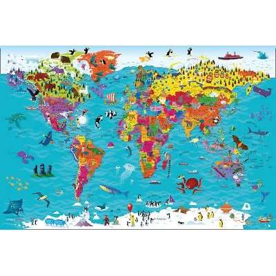
Collins Children's World Map (Sheet map, rolled, 2nd Revised Edition) picture

This item is sold brand new. It is ordered on demand from our supplier and is usually dispatched within 4 - 8 working days


Colourful Illustrated Map of the World

This bestselling, highly illustrated pictorial map is designed to take children on a journey of discovery around the countries of the world. The mapping is up-to-day, colourful and highly informative and shows countries and capital cities.

Stunning illustrations are used to depict themes such as national emblems, customs, food, birds, animals, buildings and sports to help younger readers gain an understanding of peoples around the world.

Dimensions 610 X 915 mm / 24 x 36 inches

Features

SummaryColourful Illustrated Map of the World
AuthorCollins Maps (Author), Steve Evans (Illustrator)
PublisherCollins
Release date20190815
ISBN0-00-831979-0
ISBN 13978-0-00-831979-3

Recently viewed

Flaring Tool Kit Pipe Expander
New
R499.65
34% OFF
Fixman 1/4' Dr.Bit Socket T30 -
New
R39.00 R59.00