This item has closed 1 buyer bought 1 item

Similar products

BOOKS - Disney`s Wonderful World of Knowledge , Holidays around the world
Secondhand
R65.00
The Wider World David Waugh
Secondhand
R75.00
30% OFF
Brilliant Maps in the Wild
New
R280.00 R400.00
Know Your World - Countries and Continents (Paperback)
Secondhand
R30.00
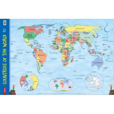
Countries of the World - Wall Map (Sheet map, rolled)
Sold

Countries of the World - Wall Map (Sheet map, rolled)

New 10 were available
Indicative market price: R258.00
R227.00
12% off
Shipping
R35.00 Standard shipping using one of our trusted couriers applies to most areas in South Africa. Some areas may attract a R30.00 surcharge. This will be calculated at checkout if applicable.
Check my rate
The seller has indicated that they will usually have this item ready to ship within 3 business days. Shipping time depends on your delivery address. The most accurate delivery time will be calculated at checkout, but in general, the following shipping times apply:
 
Standard Delivery
Main centres:  1-3 business days
Regional areas: 3-4 business days
Remote areas: 3-5 business days
Seller
Buyer protection
Get it now, pay later

Product details

Condition
New
Location
South Africa
Product code
MDLX-2637-G430
Bob Shop ID
273567534
Countries of the World - Wall Map (Sheet map, rolled) picture

This item is sold brand new. It is ordered on demand from our supplier and is usually dispatched within 7 - 15 working days


Every primary school needs this brightly coloured map of the world's countries. Uncluttered with unnecessary detail, this is a great visual aid for kids to learn geography and advance their understanding of the world. The map is clearly labelled with country names and oceans making it ideal for teaching the location of places. Alongside the large political map there are inset maps of the polar regions and the continents. This wall chart is laminated on one side and supplied rolled and shrink-wrapped. It is ideal for mounting on a classroom wall or for home study. Dimensions 610 X 915 mm. Makes learning fun. Published in association with the Geographical Association.

Features

SummaryEvery primary school needs this brightly coloured map of the world's countries. Uncluttered with unnecessary detail, this is a great visual aid for kids to learn geography and advance their understanding of the world...
AuthorCollins Maps
PublisherCollins
Release date20140213
ISBN0-00-753613-5
ISBN 13978-0-00-753613-9

Recently viewed

See more
i5 8th, 32GB RAM, 256GB SSD, 1TB HDD Gaming Computer
Secondhand
R6,800.00
20% OFF
Wine Decanter Carafe - Oblique Opening Design Wine Decanter Carafe
New
R399.00 R499.00
128GB Transcend MTE110S PCI-E M.2 2280 NVMe Solid State Drive
New
R521.00
InkPower Generic HP 130A for use with HP Color LaserJet Pro
New
R673.90