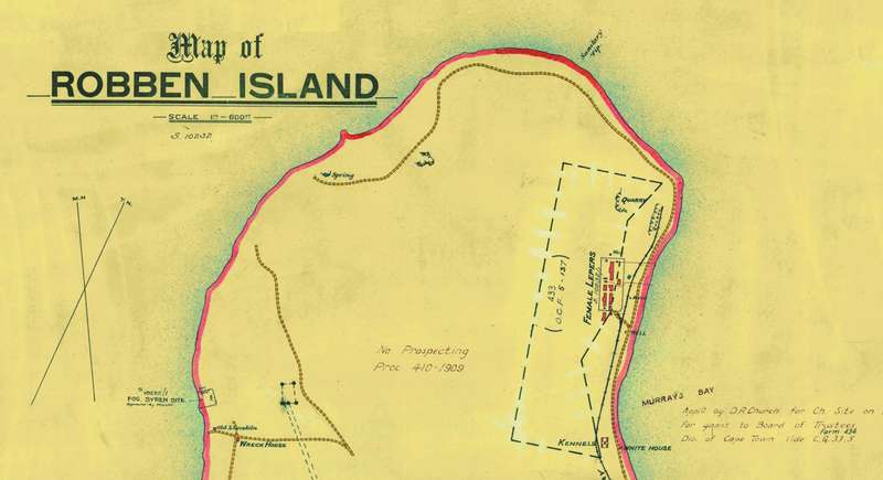
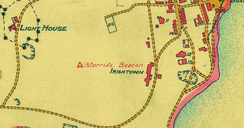

Digital Map of Robben Island from 1880's - 1894, Digital Download Digital Map of Robben Island from 1880's - 1894, Digital Download Digital Map of Robben Island from 1880's - 1894, Digital Download Digital Map of Robben Island from 1880's - 1894, Digital Download Digital Map of Robben Island from 1880's - 1894, Digital Download

Digital Map of Robben Island from 1880's - 1894, Digital Download

Digital product
1 available / new
Only 1 left – grab it before it’s gone!
R195.00
Shipping
This is a digital product (eg. voucher, product license, service, etc.) and does not require shipping. The seller will be in contact to deliver this product to you electronically.
The seller has indicated that they will usually have this item ready to ship within 3 business days. Shipping time depends on your delivery address. The most accurate delivery time will be calculated at checkout, but in general, the following shipping times apply:
 
Standard Delivery
Main centres:  1-3 business days
Regional areas: 3-4 business days
Remote areas: 3-5 business days
Seller
Buyer protection
Get it now, pay later

Product details

Condition
New
Location
South Africa
Area
Africa
Time Period
1800s
Type
Political Map
Product code
8326299
Bob Shop ID
630503336

Title: Digital Map of Robben Island from 1880's - 1894, Digital Download.
Publisher: Cape Survey Office.
Format: Vintage Printed Map that has been scanned and saved as a Tiff image.
Printed Size on a large format printer would be as follows:-
Height: 62cm.
Width: 51cm.
Scale: 1 Inch = 600 Feet.
Year: approx. late 1800's and updated in  July 1894.
File Size: Total of 19MB TIFF Image.
Total Number of Files: One.
Historical Map of Robben Island from circa 1880's when it was still a Leper Colony.
Buildings and Hospital Blocks as well as the Lighthouse which was constructed in 1865 are indicated.
Download: Digital files transferred via WeTransfer - A download Link will be forwarded on completion of order.
Price: R 195.00 Inc Vat.


Large image files require sufficient processing power and memory capabilities to render efficiently on the screen. 


Add to cart

Recently viewed

See more
Godox TR-S1 Wireless Timer Remote Control Sony
R995.00
Resistor 1w round c/f 5% 68e cf100-68e-j t/b
R0.53
ZK FOUR DOOR CONTROLLER USED WITH RFID READERS
R6,349.00
Amplifier multiwatt audio tda7396
R85.32

Similar products

Limpopo Provincial Map - Digital Download
R120.00
Gauteng Provincial Map - Digital Download
R120.00
Jeppe`s Transvaal 1899 6 x Maps Digital Download
R425.00
Mitchell`s Map Of North America 1860 Digital Download
R295.00