Early Map of 17th/18th Century Berlin. Framed (53x48cm). Early Map of 17th/18th Century Berlin. Framed (53x48cm). Early Map of 17th/18th Century Berlin. Framed (53x48cm). Early Map of 17th/18th Century Berlin. Framed (53x48cm). Early Map of 17th/18th Century Berlin. Framed (53x48cm). Early Map of 17th/18th Century Berlin. Framed (53x48cm). Early Map of 17th/18th Century Berlin. Framed (53x48cm). Early Map of 17th/18th Century Berlin. Framed (53x48cm). Early Map of 17th/18th Century Berlin. Framed (53x48cm). Early Map of 17th/18th Century Berlin. Framed (53x48cm). Early Map of 17th/18th Century Berlin. Framed (53x48cm). Early Map of 17th/18th Century Berlin. Framed (53x48cm).
Early Map of 17th/18th Century Berlin. Framed (53x48cm). Early Map of 17th/18th Century Berlin. Framed (53x48cm). Early Map of 17th/18th Century Berlin. Framed (53x48cm). Early Map of 17th/18th Century Berlin. Framed (53x48cm).
Early Map of 17th/18th Century Berlin. Framed (53x48cm).
+8

Early Map of 17th/18th Century Berlin. Framed (53x48cm).

Secondhand 1 available
R5.00 minimum increment
R450.00
Shipping
R35.00 Standard shipping using one of our trusted couriers applies to most areas in South Africa. Some areas may attract a R30.00 surcharge. This will be calculated at checkout if applicable.
Check my rate
The seller allows collection for this item. Buyers will receive the collection address and time once the order is ready.
The seller has indicated that they will usually have this item ready to ship within 7 business days. Shipping time depends on your delivery address. The most accurate delivery time will be calculated at checkout, but in general, the following shipping times apply:
 
Standard Delivery
Main centres:  1-3 business days
Regional areas: 3-4 business days
Remote areas: 3-5 business days
Seller
Buyer protection

Product details

Condition
Secondhand
Location
South Africa
Product code
AM472
Bob Shop ID
647938759

Early Map of 17th/18th Century Berlin. Framed (53x48cm).

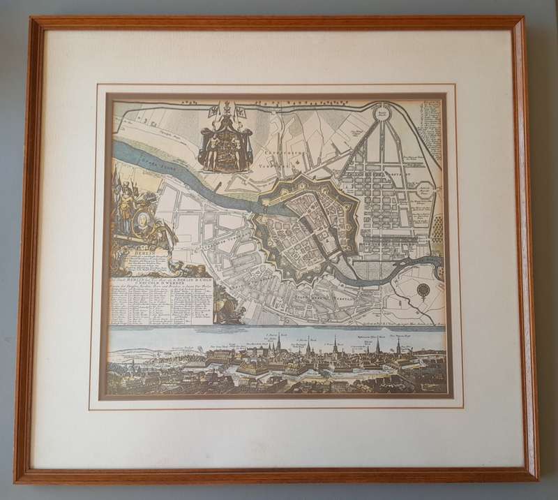
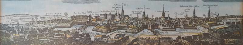
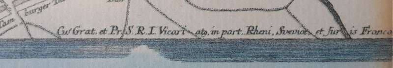
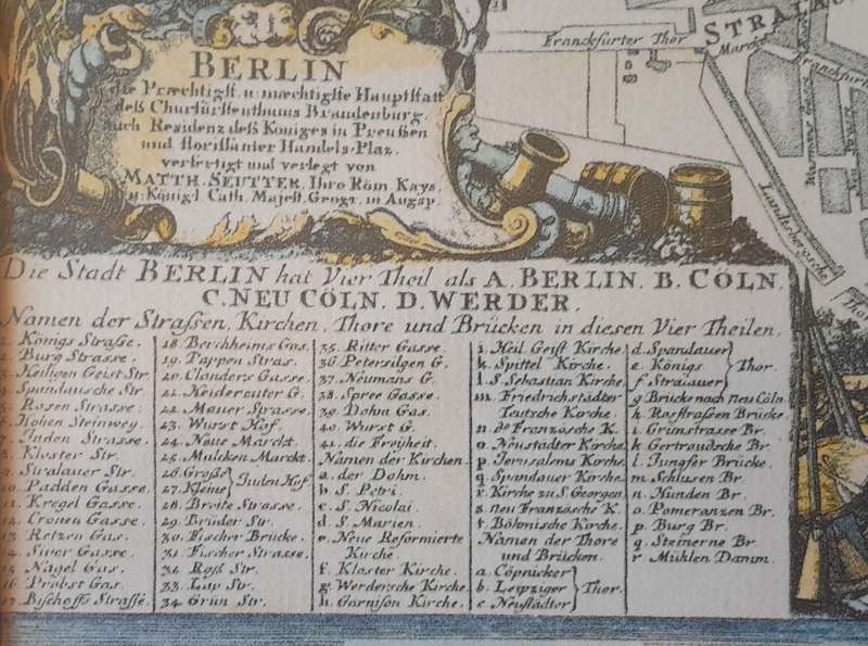
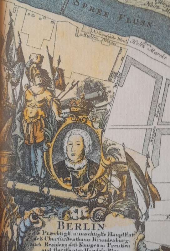
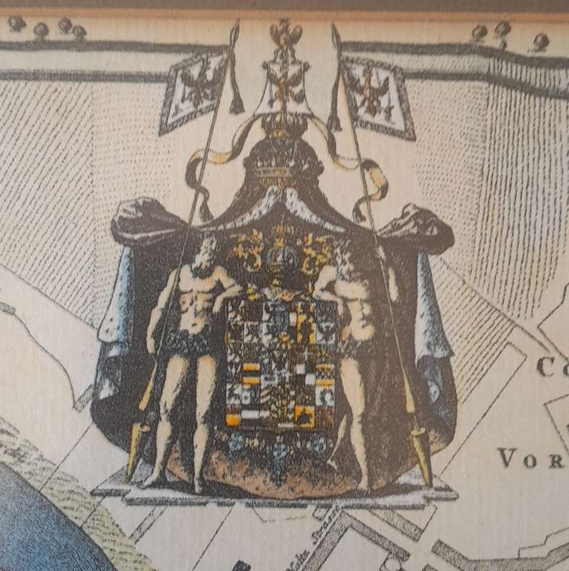
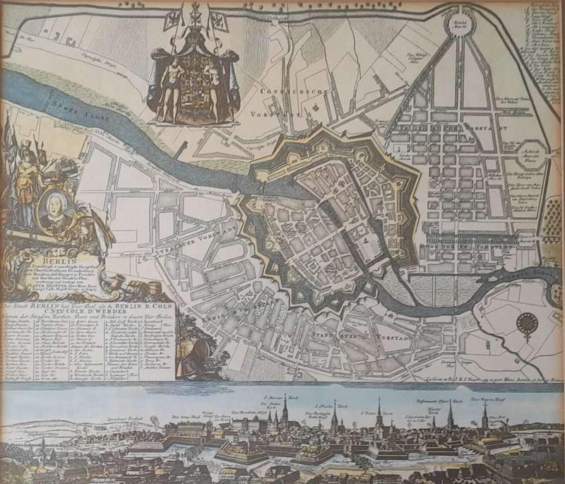
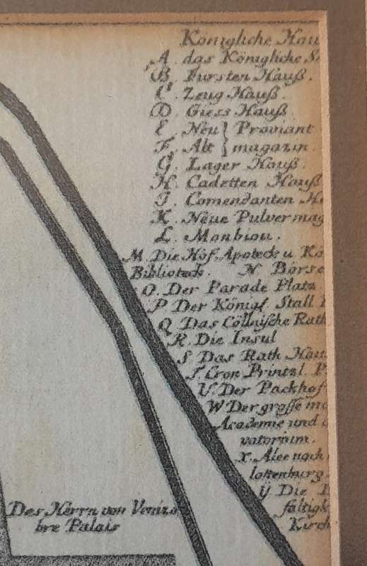
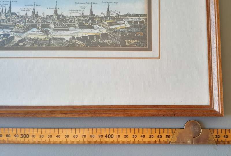
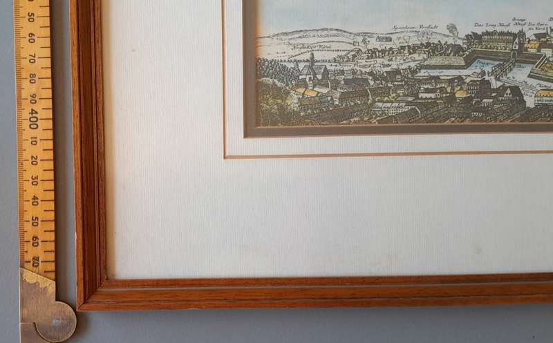
This framed historical map of Berlin showcases an intricate depiction of the city, likely dating back to the 17th or 18th century. It appears to be hand-coloured. The central portion highlights Berlin's old fortified core, surrounded by a star-shaped defensive wall characteristic of early modern European city planning. The map is adorned with artistic flourishes, including an ornate coat of arms at the top and a decorative cartouche featuring allegorical or historical figures. The streets, bridges, and waterways are meticulously drawn, illustrating Berlin's historical infrastructure. The star-shaped bastions encircling the city reflect the military architecture of the period. A striking skyline view at the bottom provides a perspective of Berlins churches, towers, and key landmarks. A numbered legend in the lower-left corner identifies important buildings and sites. The Spree River waterway prominently runs through the city, emphasizing it's significance in Berlin's development. The combination of cartographic precision and artistic embellishments makes this map not only an informative historical document but also a visually captivating piece. The wooden frame and elegant matting further enhance it's appeal. The map is behind non-reflective glass so is well-preserved.  Ready to hang. Please view images above for more detail.

Size (map) : 35.5 x 31.5cm

Size (frame) : 53 x 48cm

If you cannot make the end of the auction, feel free to place an auto bid.  Payment within 3 days please. 

You are welcome to combine items.

I have other items available on the auction. If you would like to view them, simply click on my username.

For International Shipping we use DHL. Before bidding, please contact us for a quote using the "Ask the Seller a Question" function. 

Please view the following pictures carefully as they form part of the description:

Add to cart

Recently viewed

67% OFF
1pc Mixed Color 2 For Samsung Galaxy A71 5G Phone Cases
New
R179.00 R536.00
1% OFF
Julie Tudor Is Not a Psychopath
New
R365.00 R370.00
SADF - School Cadets Cap Badges
Secondhand
R70.00 No bids
PS3 Prison Break The Conspiracy / As New
Secondhand
R1,699.00 No bids

Similar products

Antique Map of the Fort at Capo Corso, Corsica, 18th Century
Secondhand
R550.00
17% OFF
SAXTON'S MAP OF LANCHASHIRE 1577 PRINTED IN 1966 MAP FRAMED
Secondhand
R1,450.00 R1,750.00
Rhodesiana - copper pressed framed map (22,5 x 27cm)
Secondhand
R195.00
Berlin Stadtplan, Folded Map Feb 1997.
Secondhand
R195.00